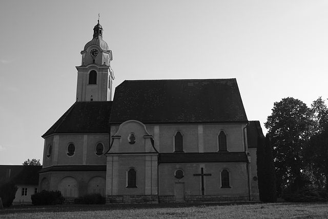
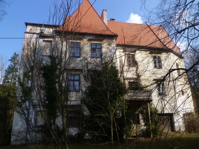
Sipbachzell (Sipbachzell)
- municipality in Austria
Sipbachzell is a lovely area in Austria that offers a range of hiking opportunities, showcasing the picturesque countryside and natural beauty of the region. Here are some key points to consider if you're planning a hike in and around Sipbachzell:
Trails:
- Diverse Terrain: The area features various trails, from easy walks suitable for families to more challenging routes for experienced hikers. You can find meandering paths through forests, alongside rivers, and fields with stunning views of the surrounding landscapes.
- Local Signage: Many trails are well-marked with signage indicating distances and difficulty levels. This makes it easier to navigate the paths and choose the right hike for your skill level.
Scenic Highlights:
- Nature Beauty: Expect to see rolling hills, lush forests, and maybe even some wildlife along the trails. The area is particularly beautiful in spring and autumn when the foliage changes color.
- Cultural Sites: Along some routes, you might come across small villages, traditional farms, or historical monuments, which can enrich your hiking experience.
Preparation:
- Weather Considerations: Always check the local weather conditions before setting out, as they can change rapidly in mountainous areas. Dress in layers and bring waterproof gear if necessary.
- Hydration and Snacks: Bring plenty of water and some snacks to keep your energy up. Some trails may lack facilities, so being self-sufficient is key.
- Footwear: Good hiking shoes are essential to navigate the trails safely and comfortably.
Local Advice:
- Community Insights: It’s a good idea to ask local hikers or check community resources for recommendations on the best trails, particularly if you’re looking for hidden gems or seasonal sights.
Safety Considerations:
- Always let someone know your hiking plan and expected return time.
- Be mindful of local wildlife and ensure you follow guidelines for safety.
Hiking in Sipbachzell can be an enjoyable and refreshing experience, combining physical activity with the beauty of nature and the charm of Austrian rural life. Be sure to take your time and appreciate the scenery along the way!
- Country:

- Postal Code: 4621
- Local Dialing Code: 07240
- Licence Plate Code: WL
- Coordinates: 48° 5' 53" N, 14° 6' 36" E


- GPS tracks (wikiloc): [Link]
- AboveSeaLevel: 366 м m
- Area: 25 sq km
- Population: 1975
- Web site: http://www.Sipbachzell.at/
- Wikipedia en: wiki(en)
- Wikipedia: wiki(de)
- Wikidata storage: Wikidata: Q677374
- Wikipedia Commons Category: [Link]
- Freebase ID: [/m/03gvh3h]
- GeoNames ID: Alt: [7873280]
- VIAF ID: Alt: [158446670]
- archINFORM location ID: [10493]
- Library of Congress authority ID: Alt: [n97060508]
- Austrian municipality key: [41819]
Shares border with regions:

Sattledt
- municipality in Austria
Sattledt is a picturesque village located in Austria, nestled in the region of Upper Austria. While it may not be as widely known as some other hiking destinations in the Alps, it offers access to beautiful landscapes and outdoor experiences....
- Country:

- Postal Code: 4642
- Local Dialing Code: 07244
- Licence Plate Code: WL
- Coordinates: 48° 4' 24" N, 14° 3' 27" E


- GPS tracks (wikiloc): [Link]
- AboveSeaLevel: 400 м m
- Area: 22 sq km
- Population: 2668
- Web site: [Link]

Thalheim bei Wels
- municipality in Austria
Thalheim bei Wels is a charming village in the Upper Austria region, known for its beautiful landscapes which are great for hiking enthusiasts. Here are some aspects you might find interesting about hiking in this area:...
- Country:

- Postal Code: 4600
- Local Dialing Code: 07242
- Licence Plate Code: WL
- Coordinates: 48° 9' 5" N, 14° 2' 18" E


- GPS tracks (wikiloc): [Link]
- AboveSeaLevel: 369 м m
- Area: 16 sq km
- Population: 5482
- Web site: [Link]

Steinhaus
- municipality in Austria
Steinhaus is a charming village located in the Tyrol region of Austria, surrounded by stunning alpine landscapes, making it a great destination for hiking enthusiasts. Here are some highlights and tips for hiking in the area:...
- Country:

- Postal Code: 4641
- Local Dialing Code: 0 72 42
- Licence Plate Code: WL
- Coordinates: 48° 6' 58" N, 14° 1' 14" E


- GPS tracks (wikiloc): [Link]
- AboveSeaLevel: 378 м m
- Area: 25 sq km
- Population: 2187
- Web site: [Link]

Schleißheim
- municipality in Austria
Schleißheim is a picturesque area located in Bavaria, Germany, not far from Munich. It offers a variety of hiking opportunities that cater to different skill levels....
- Country:

- Postal Code: 4600
- Local Dialing Code: 0 72 42
- Licence Plate Code: WL
- Coordinates: 48° 9' 39" N, 14° 5' 36" E


- GPS tracks (wikiloc): [Link]
- AboveSeaLevel: 317 м m
- Area: 7.55 sq km
- Population: 1389
- Web site: [Link]

Weißkirchen an der Traun
- municipality in Austria
 Hiking in Weißkirchen an der Traun
Weißkirchen an der Traun is a picturesque village located in Upper Austria, near the Traun River. The area is known for its beautiful natural scenery and offers various hiking opportunities suitable for different skill levels. Here are some highlights and tips for hiking in this region:...
- Country:

- Postal Code: 4616
- Local Dialing Code: 07243
- Licence Plate Code: WL
- Coordinates: 48° 9' 53" N, 14° 7' 42" E


- GPS tracks (wikiloc): [Link]
- AboveSeaLevel: 305 м m
- Area: 22 sq km
- Population: 3430
- Web site: [Link]

Eggendorf im Traunkreis
- municipality in Austria
 Hiking in Eggendorf im Traunkreis
Eggendorf im Traunkreis is a charming village located in the Traunviertel region of Austria, surrounded by beautiful landscapes that make it ideal for hiking enthusiasts. The area features a mix of gently rolling hills, lush forests, and scenic views of the surrounding mountains, providing a variety of trails suitable for different skill levels....
- Country:

- Postal Code: 4622
- Local Dialing Code: 07228
- Licence Plate Code: LL
- Coordinates: 48° 7' 54" N, 14° 8' 46" E


- GPS tracks (wikiloc): [Link]
- AboveSeaLevel: 364 м m
- Area: 9 sq km
- Population: 944
- Web site: [Link]

Kematen an der Krems
- municipality in Austria
 Hiking in Kematen an der Krems
Kematen an der Krems is a charming municipality located in Upper Austria, surrounded by beautiful landscapes that make it an excellent destination for hiking enthusiasts. The region features a variety of trails suited for different skill levels, including leisurely walks and more challenging hikes....
- Country:

- Postal Code: 4531
- Local Dialing Code: 07228
- Licence Plate Code: LL
- Coordinates: 48° 6' 41" N, 14° 11' 32" E


- GPS tracks (wikiloc): [Link]
- AboveSeaLevel: 327 м m
- Area: 21 sq km
- Population: 2790
- Web site: [Link]