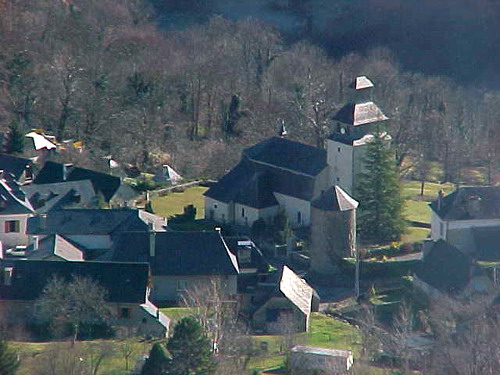
Sireix (Sireix)

- commune in Hautes-Pyrénées, France
- Country:

- Postal Code: 65400
- Coordinates: 42° 58' 31" N, 0° 8' 50" E


- GPS tracks (wikiloc): [Link]
- Area: 1.73 sq km
- Population: 65
- Wikipedia en: wiki(en)
- Wikipedia: wiki(fr)
- Wikidata storage: Wikidata: Q1323848
- Wikipedia Commons Category: [Link]
- Freebase ID: [/m/03nv78n]
- Freebase ID: [/m/03nv78n]
- GeoNames ID: Alt: [6440927]
- GeoNames ID: Alt: [6440927]
- SIREN number: [216504282]
- SIREN number: [216504282]
- BnF ID: [15270859h]
- BnF ID: [15270859h]
- INSEE municipality code: 65428
- INSEE municipality code: 65428
Shares border with regions:


Estaing
- commune in Hautes-Pyrénées, France
- Country:
- Postal Code: 65400
- Coordinates: 42° 56' 14" N, 0° 10' 45" E
- GPS tracks (wikiloc): [Link]
- Area: 71.53 sq km
- Population: 73

Arras-en-Lavedan
- commune in Hautes-Pyrénées, France
- Country:
- Postal Code: 65400
- Coordinates: 42° 59' 31" N, 0° 7' 37" E
- GPS tracks (wikiloc): [Link]
- Area: 24.66 sq km
- Population: 490


Bun
- commune in Hautes-Pyrénées, France
- Country:
- Postal Code: 65400
- Coordinates: 42° 58' 29" N, 0° 9' 25" E
- GPS tracks (wikiloc): [Link]
- Area: 2.8 sq km
- Population: 141