
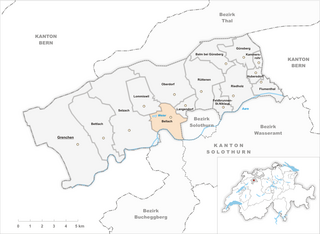
Solothurn (Solothurn)

- city in Switzerland, capital of its canton
 Hiking in Solothurn
Solothurn, located in the heart of Switzerland, offers a range of beautiful hiking trails that cater to various skill levels and interests. The region boasts stunning scenery, from picturesque villages to rolling hills and the majestic Jura Mountains. Here’s what you need to know about hiking in Solothurn:
Popular Hiking Trails
-
The Solothurner Höhenweg:
- This is a high-altitude hiking trail that runs along the slopes of the Jura Mountains. It offers breathtaking views of the surrounding landscape, including the Aare River and the Alps on clear days.
- The route is well-marked and suitable for experienced hikers, stretching over several stages.
-
Thal Nature Park:
- A beautiful area just outside Solothurn, the Thal Nature Park features various trails that take you through lush forests, open meadows, and along charming streams.
- Many trails are family-friendly and offer educational information about the local flora and fauna.
-
Ostring Path:
- Ideal for those looking for a more relaxed hike, the Ostring Path meanders along the Aare River and is suitable for all ages.
- It’s a perfect choice for a leisurely afternoon walk, with opportunities to enjoy picnics by the riverside.
-
Wangen an der Aare to Solothurn:
- This trail follows the Aare River and is relatively flat, making it accessible for almost everyone. It provides a scenic route connecting rural landscapes to the charming city of Solothurn.
Tips for Hiking in Solothurn
-
Weather Considerations: Check the weather forecast before heading out, as conditions can change quickly in the Alps. Dress in layers and bring waterproof gear if necessary.
-
Trail Maps: It’s helpful to obtain a map of the hiking trails in the region. Local tourist offices often provide maps and can give you information on trail conditions.
-
Safety: Always let someone know your hiking plans, carry enough water, and snacks, and take note of the time to ensure you're back before dark.
-
Wildlife and Nature: Be respectful of nature and wildlife during your hikes. Stick to marked trails and take your trash with you.
-
Transportation: Solothurn is well-connected by public transportation. You can easily reach hiking starting points by train or bus.
Conclusion
Hiking in Solothurn offers a remarkable chance to experience the natural beauty of Switzerland while enjoying well-maintained trails and stunning views. Whether you're a seasoned hiker or just looking for a leisurely walk, Solothurn has something to offer everyone. Enjoy your hike!
- Country:

- Postal Code: 4500
- Local Dialing Code: 032
- Licence Plate Code: SO
- Coordinates: 47° 12' 29" N, 7° 32' 15" E


- GPS tracks (wikiloc): [Link]
- AboveSeaLevel: 432 м m
- Area: 6.28 sq km
- Population: 16703
- Web site: http://www.stadt-solothurn.ch
- Wikipedia en: wiki(en)
- Wikipedia: wiki(de)
- Wikidata storage: Wikidata: Q68965
- Wikipedia Commons Gallery: [Link]
- Wikipedia Commons Category: [Link]
- Wikipedia Commons Maps Category: [Link]
- Freebase ID: [/m/0d341]
- GeoNames ID: Alt: [7287186]
- VIAF ID: Alt: [145418991]
- OSM relation ID: [1683577]
- GND ID: Alt: [4055458-2]
- archINFORM location ID: [1578]
- Library of Congress authority ID: Alt: [n80145218]
- MusicBrainz area ID: [942a57cb-6cb9-4b71-9c23-960aea254beb]
- Quora topic ID: [Solothurn]
- Encyclopædia Britannica Online ID: [place/Solothurn-Switzerland]
- HDS ID: [1174]
- EMLO location ID: [b6ece27b-aaa1-4359-acd0-1842174f5069]
- Great Russian Encyclopedia Online ID: [1995278]
- Swiss municipality code: [2601]
- Digital Atlas of the Roman Empire ID: [1807]
- ISNI: Alt: [0000 0001 1017 4328]
- Pleiades ID: [177624]
- Ringgold ID: [156367]
Shares border with regions:

Zuchwil
- municipality in the canton of Solothurn, Switzerland
Hiking in Zuchwil
Zuchwil is a charming area located near Basel in Switzerland, known for its beautiful landscapes and proximity to various hiking trails. While Zuchwil itself is more urban, it offers access to natural surroundings and nearby hiking opportunities....
- Country:
- Postal Code: 4528
- Local Dialing Code: 032
- Licence Plate Code: SO
- Coordinates: 47° 12' 21" N, 7° 33' 49" E
- GPS tracks (wikiloc): [Link]
- AboveSeaLevel: 431 м m
- Area: 4.67 sq km
- Population: 8875
- Web site: [Link]
Bellach
- municipality in Switzerland
Hiking in Bellach
Bellach is a charming municipality located in the canton of Solothurn, Switzerland, offering a variety of hiking opportunities for outdoor enthusiasts. The region around Bellach features beautiful landscapes, including rolling hills, forests, and stunning views of the surrounding mountains, making it a great base for hiking....
- Country:
- Postal Code: 4512
- Local Dialing Code: 032
- Licence Plate Code: SO
- Coordinates: 47° 12' 54" N, 7° 30' 0" E
- GPS tracks (wikiloc): [Link]
- AboveSeaLevel: 450 м m
- Area: 5.31 sq km
- Population: 5272
- Web site: [Link]

Biberist
- municipality in Switzerland
Hiking in Biberist
Biberist, located in the canton of Solothurn in Switzerland, offers a range of beautiful hiking opportunities that showcase the picturesque Swiss landscape. Although it is a relatively small area, it serves as a great starting point for various trails that meander through forests, fields, and scenic vistas....
- Country:
- Postal Code: 4562
- Local Dialing Code: 032
- Licence Plate Code: SO
- Coordinates: 47° 11' 6" N, 7° 32' 52" E
- GPS tracks (wikiloc): [Link]
- AboveSeaLevel: 493 м m
- Area: 12.24 sq km
- Population: 8455
- Web site: [Link]


Feldbrunnen-St. Niklaus
- municipality in Switzerland
Hiking in Feldbrunnen-St. Niklaus
Feldbrunnen-St. Niklaus is a picturesque area in Switzerland, known for its stunning natural landscapes and variety of hiking trails. It is situated near the city of Solothurn and offers access to beautiful views of the Jura Mountains and the surrounding countryside....
- Country:
- Postal Code: 4532
- Local Dialing Code: 032
- Licence Plate Code: SO
- Coordinates: 47° 13' 15" N, 7° 33' 20" E
- GPS tracks (wikiloc): [Link]
- AboveSeaLevel: 452 м m
- Area: 2.47 sq km
- Population: 975
- Web site: [Link]


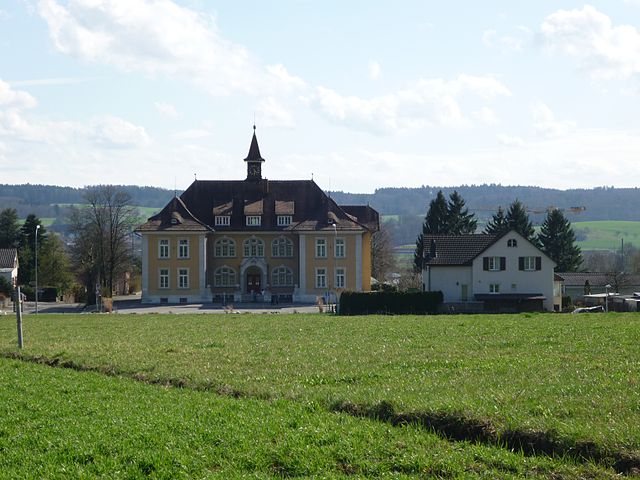
Langendorf
- municipality in the canton of Solothurn, Switzerland. located in the district of Lebern
Hiking in Langendorf
Langendorf, located in the Canton of Bern, Switzerland, is a charming village that serves as a great base for hiking enthusiasts looking to explore the surrounding natural beauty of the region. Here are some key highlights and tips for hiking in and around Langendorf:...
- Country:
- Postal Code: 4513
- Local Dialing Code: 032
- Licence Plate Code: SO
- Coordinates: 47° 13' 14" N, 7° 30' 52" E
- GPS tracks (wikiloc): [Link]
- AboveSeaLevel: 496 м m
- Area: 1.93 sq km
- Population: 3772
- Web site: [Link]
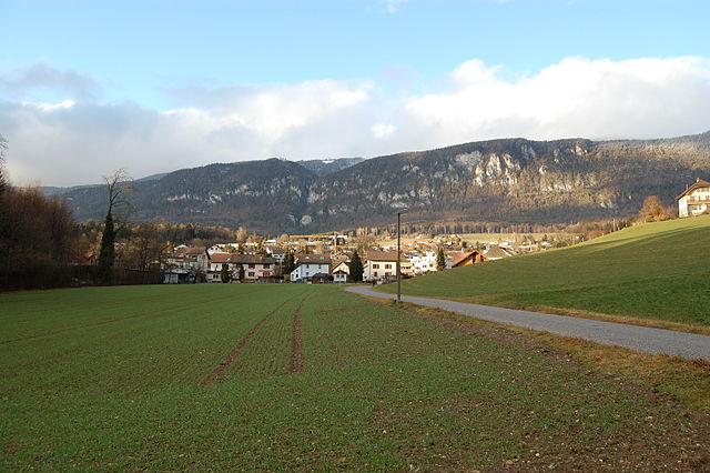

Rüttenen
- municipality in Switzerland
Hiking in Rüttenen
Rüttenen is a small municipality located in the canton of Solothurn in Switzerland, known for its beautiful landscapes and access to nature. Hiking in Rüttenen offers a variety of trails that cater to different skill levels, making it a great destination for both novice and experienced hikers....
- Country:
- Postal Code: 4522
- Local Dialing Code: 032
- Licence Plate Code: SO
- Coordinates: 47° 13' 49" N, 7° 31' 47" E
- GPS tracks (wikiloc): [Link]
- AboveSeaLevel: 516 м m
- Area: 8.80 sq km
- Population: 1495
- Web site: [Link]