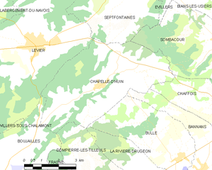
Sombacour (Sombacour)

- commune in Doubs, France
 Hiking in Sombacour
Sombacour, a picturesque village in the Jura region of France, offers a variety of hiking opportunities that showcase the area's natural beauty and diverse landscapes. Here are some highlights of hiking in Sombacour:
Trails and Terrain
-
Varied Landscapes: The region features a mix of rolling hills, forests, and valleys, offering varied terrain that caters to different skill levels—from leisurely walks to more challenging hikes.
-
Local Trails: There are several marked trails in and around Sombacour, allowing hikers to explore the stunning Jura mountains, woodlands, and stunning vistas. The trails typically range in length and difficulty.
-
Natural Parks: Nearby, you can access trails that lead into the Parc Naturel Régional du Haut-Jura, where you can experience the rich biodiversity, including unique flora and fauna.
Points of Interest
- Scenic Views: Many trails offer impressive viewpoints where you can enjoy panoramic views of the Jura Mountains and the Doubs Valley.
- Cultural Sites: Along the way, you may encounter traditional Jura architecture and historic sites, adding a cultural dimension to your hike.
- Lakes and Rivers: The area is also home to beautiful lakes and rivers, perfect for a rest stop or a refreshing swim.
Hiking Tips
- Plan Ahead: Make sure to check trail conditions and maps beforehand. Local visitor centers can provide valuable information and resources.
- Gear Up: Wear appropriate hiking footwear and clothing, and be prepared for changing weather conditions typical of mountainous areas.
- Stay Hydrated and Energized: Carry enough water and snacks to keep your energy levels up during your hike.
Best Time to Visit
The best time for hiking in Sombacour is typically from late spring to early autumn when the weather is mild and the trails are more accessible.
Whether you're an experienced hiker or just looking for a leisurely stroll in nature, Sombacour has something to offer. Enjoy exploring the beautiful Jura region!
- Country:

- Postal Code: 25520
- Coordinates: 46° 57' 12" N, 6° 15' 25" E


- GPS tracks (wikiloc): [Link]
- Area: 19.3 sq km
- Population: 624
- Wikipedia en: wiki(en)
- Wikipedia: wiki(fr)
- Wikidata storage: Wikidata: Q923289
- Wikipedia Commons Category: [Link]
- Freebase ID: [/m/03mhd2z]
- GeoNames ID: Alt: [6429999]
- SIREN number: [212505499]
- BnF ID: [15252775j]
- INSEE municipality code: 25549
Shares border with regions:


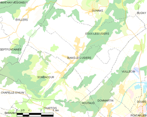
Septfontaines
- commune in Doubs, France
Hiking in Septfontaines
Septfontaines is a picturesque area in the Doubs department of the Bourgogne-Franche-Comté region in eastern France. The region is known for its beautiful landscapes, dense forests, and stunning geological formations, making it a fantastic destination for hiking enthusiasts....
- Country:
- Postal Code: 25270
- Coordinates: 46° 58' 55" N, 6° 11' 1" E
- GPS tracks (wikiloc): [Link]
- Area: 18.37 sq km
- Population: 359


Évillers
- commune in Doubs, France
Hiking in Évillers
Évillers is a charming commune located in the Doubs department of the Bourgogne-Franche-Comté region in eastern France. It is surrounded by beautiful natural landscapes, making it an ideal destination for hiking enthusiasts....
- Country:
- Postal Code: 25520
- Coordinates: 47° 0' 0" N, 6° 13' 33" E
- GPS tracks (wikiloc): [Link]
- Area: 13.02 sq km
- Population: 346

Chapelle-d'Huin
- commune in Doubs, France
Hiking in Chapelle-d'Huin
Chapelle-d'Huin is a small commune located in the Doubs department of the Bourgogne-Franche-Comté region in eastern France. While it may not be as well-known as other hiking destinations, it offers beautiful landscapes and opportunities for outdoor activities, including hiking....
- Country:
- Postal Code: 25270
- Coordinates: 46° 55' 57" N, 6° 10' 1" E
- GPS tracks (wikiloc): [Link]
- Area: 23.71 sq km
- Population: 511


Dommartin
- commune in Doubs, France
Hiking in Dommartin
Dommartin, located in the Doubs department of the Bourgogne-Franche-Comté region in France, offers beautiful landscapes and various hiking opportunities suitable for different experience levels. The area is characterized by rolling hills, dense forests, and scenic views, making it a great destination for nature lovers and outdoor enthusiasts....
- Country:
- Postal Code: 25300
- Coordinates: 46° 55' 29" N, 6° 18' 25" E
- GPS tracks (wikiloc): [Link]
- Area: 6.39 sq km
- Population: 677
- Web site: [Link]

Bians-les-Usiers
- commune in Doubs, France
Hiking in Bians-les-Usiers
Bians-les-Usiers is a picturesque village located in the Doubs department of France, in the region of Bourgogne-Franche-Comté. It's situated near the Jura Mountains, which provide a stunning backdrop for outdoor activities, including hiking. Here are some highlights and tips for hiking in and around Bians-les-Usiers:...
- Country:
- Postal Code: 25520
- Coordinates: 46° 57' 44" N, 6° 16' 3" E
- GPS tracks (wikiloc): [Link]
- Area: 14.01 sq km
- Population: 654


Chaffois
- commune in Doubs, France
Hiking in Chaffois
Chaffois is a charming village located in the Doubs department of the Bourgogne-Franche-Comté region in eastern France. It's known for its picturesque landscapes, which make it a great location for hiking enthusiasts. Here are some key points to consider if you're planning to hike in and around Chaffois:...
- Country:
- Postal Code: 25300
- Coordinates: 46° 54' 54" N, 6° 16' 12" E
- GPS tracks (wikiloc): [Link]
- Area: 16.25 sq km
- Population: 963
- Web site: [Link]


Houtaud
- commune in Doubs, France
Hiking in Houtaud
Houtaud, a quaint village in the Jura region of France, offers some beautiful hiking opportunities that showcase the area’s stunning landscapes, including rolling hills, dense forests, and expansive views of the surrounding countryside. Here are some key points about hiking in Houtaud:...
- Country:
- Postal Code: 25300
- Coordinates: 46° 54' 56" N, 6° 18' 43" E
- GPS tracks (wikiloc): [Link]
- Area: 7.89 sq km
- Population: 1055
- Web site: [Link]