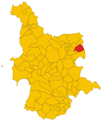
Sorradile (Sorradile)
%20-%202016.svg)
- Italian comune
 Hiking in Sorradile
Sorradile is a small town located in the province of Oristano in Sardinia, Italy. While it might not be as well-known as some other hiking destinations, the surrounding region offers beautiful landscapes, rich biodiversity, and opportunities for outdoor activities.
Hiking Opportunities
-
Natural Parks and Reserves: Sorradile is close to several natural parks and reserves that are great for hiking. The nearby Monte Ferru and Gennargentu National Park provide stunning views and diverse terrains. These parks feature varied trails, ranging from easy walks to more challenging hikes.
-
Scenic Trails: You can explore the traditional Sardinian countryside, characterized by rolling hills, olive groves, and vineyards. The trails often offer panoramic views of the surrounding landscape, including the distant mountains and the coast.
-
Cultural Hiking: Consider trails that take you through ancient Nuragic sites and small villages. This aspect of hiking in Sardinia can add a cultural layer to your experience, providing a glimpse into the island’s history and archaeological heritage.
Preparation Tips
-
Footwear: Wear sturdy hiking boots with good grip, as trails can vary in difficulty and terrain.
-
Map and Navigation: Carry a detailed map of the area or use a hiking app for navigation. Some trails may not be well-marked.
-
Weather: Check the weather before heading out, as conditions can change rapidly in mountainous areas. Late spring and early autumn are ideal times for hiking in the region.
-
Supplies: Bring plenty of water, snacks, and a basic first-aid kit. It’s important to stay hydrated and fueled during your hike.
Safety Guidelines
-
Hike with a buddy: If possible, hike with a friend, especially if you’re venturing into less-traveled areas.
-
Wildlife Awareness: Be aware of local wildlife and practice Leave No Trace principles to minimize your impact on nature.
-
Emergency Contacts: Familiarize yourself with local emergency contact numbers and inform someone of your hiking plans.
Conclusion
Hiking around Sorradile can be a rewarding way to experience the natural beauty and culture of Sardinia. With its diverse landscapes and rich history, you're likely to have an unforgettable adventure. Make sure to prepare accordingly and enjoy exploring this lesser-known jewel of Italy!
- Country:

- Postal Code: 09080
- Local Dialing Code: 0783
- Licence Plate Code: OR
- Coordinates: 40° 6' 20" N, 8° 55' 58" E


- GPS tracks (wikiloc): [Link]
- AboveSeaLevel: 350 м m
- Area: 26.34 sq km
- Population: 363
- Web site: http://www.comune.sorradile.or.it
- Wikipedia en: wiki(en)
- Wikipedia: wiki(it)
- Wikidata storage: Wikidata: Q388756
- Wikipedia Commons Category: [Link]
- Freebase ID: [/m/0gr16q]
- GeoNames ID: Alt: [6537981]
- VIAF ID: Alt: [246991383]
- OSM relation ID: [40277]
- WOEID: [724359]
- ISTAT ID: 095063
- Italian cadastre code: I861
Shares border with regions:


Bidonì
- Italian comune
Hiking in Bidonì
Bidonì is a small town located in the Sardinia region of Italy, which is known for its beautiful landscapes and rich natural heritage, making it a great destination for hiking enthusiasts. While Bidonì itself might not be prominently featured in hiking guides, its proximity to other natural attractions and trails in Sardinia offers plenty of opportunities for outdoor adventures....
- Country:
- Postal Code: 09080
- Local Dialing Code: 0783
- Licence Plate Code: OR
- Coordinates: 40° 6' 46" N, 8° 56' 11" E
- GPS tracks (wikiloc): [Link]
- AboveSeaLevel: 250 м m
- Area: 11.72 sq km
- Population: 143
- Web site: [Link]


Olzai
- Italian comune
Hiking in Olzai
Olzai is a charming town located in the province of Nuoro in Sardinia, Italy. The area is known for its picturesque landscapes, rugged mountains, and rich cultural heritage, making it an excellent destination for hiking enthusiasts....
- Country:
- Postal Code: 08020
- Local Dialing Code: 0784
- Licence Plate Code: NU
- Coordinates: 40° 10' 57" N, 9° 8' 52" E
- GPS tracks (wikiloc): [Link]
- AboveSeaLevel: 474 м m
- Area: 69.82 sq km
- Population: 873
- Web site: [Link]


Ardauli
- Italian comune
Hiking in Ardauli
Ardauli is a charming village located in the Oristano province of Sardinia, Italy. While it may not be as well-known as some larger hiking destinations, it offers unique opportunities for hiking enthusiasts who want to explore the natural beauty and cultural heritage of the region....
- Country:
- Postal Code: 09081
- Local Dialing Code: 0783
- Licence Plate Code: OR
- Coordinates: 40° 5' 5" N, 8° 54' 46" E
- GPS tracks (wikiloc): [Link]
- AboveSeaLevel: 421 м m
- Area: 20.53 sq km
- Population: 852
- Web site: [Link]


Boroneddu
- Italian comune
Hiking in Boroneddu
Boroneddu is a small village located in the province of Nuoro in Sardinia, Italy. Hiking in this area offers beautiful scenery, rich natural landscapes, and a glimpse into traditional Sardinian culture....
- Country:
- Postal Code: 09080
- Local Dialing Code: 0785
- Licence Plate Code: OR
- Coordinates: 40° 6' 45" N, 8° 52' 14" E
- GPS tracks (wikiloc): [Link]
- AboveSeaLevel: 216 м m
- Area: 4.59 sq km
- Population: 153
- Web site: [Link]


Ghilarza
- Italian comune
Hiking in Ghilarza
Ghilarza is a charming town located in the Oristano province of Sardinia, Italy, surrounded by beautiful landscapes that are perfect for hiking enthusiasts. The area offers a mix of natural beauty, historical sites, and varying terrain, making it an excellent destination for outdoor activities....
- Country:
- Postal Code: 09074
- Local Dialing Code: 0785
- Licence Plate Code: OR
- Coordinates: 40° 7' 12" N, 8° 50' 6" E
- GPS tracks (wikiloc): [Link]
- AboveSeaLevel: 290 м m
- Area: 55.46 sq km
- Population: 4452
- Web site: [Link]

Nughedu Santa Vittoria
- Italian comune
Hiking in Nughedu Santa Vittoria
Nughedu Santa Vittoria is a charming village located in the province of Nuoro, in the heart of Sardinia, Italy. It is a lesser-known destination, making it an excellent choice for hikers looking for serene landscapes, rich cultural history, and natural beauty away from the more crowded tourist spots....
- Country:
- Postal Code: 09080
- Local Dialing Code: 0783
- Licence Plate Code: OR
- Coordinates: 40° 6' 4" N, 8° 57' 5" E
- GPS tracks (wikiloc): [Link]
- AboveSeaLevel: 533 м m
- Area: 28.57 sq km
- Population: 475
- Web site: [Link]


Sedilo
- Italian comune
Hiking in Sedilo
Sedilo, located in the region of Sardinia, Italy, is not widely known as a primary hiking destination, but it offers beautiful countryside and opportunities for outdoor activities, including hiking. The area is characterized by its unique landscape, with hills, valleys, and a rich variety of flora and fauna....
- Country:
- Postal Code: 09076
- Local Dialing Code: 0785
- Licence Plate Code: OR
- Coordinates: 40° 10' 27" N, 8° 55' 9" E
- GPS tracks (wikiloc): [Link]
- AboveSeaLevel: 283 м m
- Area: 68.45 sq km
- Population: 2094
- Web site: [Link]


Tadasuni
- Italian comune
Hiking in Tadasuni
Tadasuni, situated in India, is a picturesque destination known for its natural beauty and hiking opportunities. While specific details about Tadasuni might not be well-documented, I can provide general advice about hiking in the region and what you might typically expect....
- Country:
- Postal Code: 09080
- Local Dialing Code: 0785
- Licence Plate Code: OR
- Coordinates: 40° 6' 37" N, 8° 53' 1" E
- GPS tracks (wikiloc): [Link]
- AboveSeaLevel: 180 м m
- Area: 5.09 sq km
- Population: 146
- Web site: [Link]