Sournia (Sournia)

- commune in Pyrénées-Orientales, France
- Country:

- Postal Code: 66730
- Coordinates: 42° 43' 40" N, 2° 26' 32" E


- GPS tracks (wikiloc): [Link]
- Area: 29.99 sq km
- Population: 498
- Web site: http://www.fenouilledes.com/perso/sournia/village/accueil.htm
- Wikipedia en: wiki(en)
- Wikipedia: wiki(fr)
- Wikidata storage: Wikidata: Q190346
- Wikipedia Commons Category: [Link]
- Freebase ID: [/m/03h3v2d]
- GeoNames ID: Alt: [2973941]
- SIREN number: [216601989]
- BnF ID: [15271107k]
- VIAF ID: Alt: [247861298]
- OSM relation ID: [2819131]
- WOEID: [622632]
- INSEE municipality code: 66198
Shares border with regions:

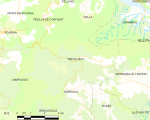
Trévillach
- commune in Pyrénées-Orientales, France
- Country:
- Postal Code: 66130
- Coordinates: 42° 42' 31" N, 2° 31' 49" E
- GPS tracks (wikiloc): [Link]
- Area: 17.24 sq km
- Population: 149
- Web site: [Link]

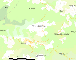
Prats-de-Sournia
- commune in Pyrénées-Orientales, France
- Country:
- Postal Code: 66730
- Coordinates: 42° 44' 39" N, 2° 27' 38" E
- GPS tracks (wikiloc): [Link]
- Area: 8.01 sq km
- Population: 76
- Web site: [Link]


Campoussy
- commune in Pyrénées-Orientales, France
- Country:
- Postal Code: 66730
- Coordinates: 42° 42' 37" N, 2° 27' 31" E
- GPS tracks (wikiloc): [Link]
- Area: 17.04 sq km
- Population: 39

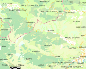
Mosset
- commune in Pyrénées-Orientales, France
- Country:
- Postal Code: 66500
- Coordinates: 42° 40' 5" N, 2° 20' 54" E
- GPS tracks (wikiloc): [Link]
- Area: 71.93 sq km
- Population: 300


Rabouillet
- commune in Pyrénées-Orientales, France
- Country:
- Postal Code: 66730
- Coordinates: 42° 43' 52" N, 2° 23' 23" E
- GPS tracks (wikiloc): [Link]
- Area: 19.21 sq km
- Population: 121


Molitg-les-Bains
- commune in Pyrénées-Orientales, France
- Country:
- Postal Code: 66500
- Coordinates: 42° 39' 9" N, 2° 23' 19" E
- GPS tracks (wikiloc): [Link]
- AboveSeaLevel: 610 м m
- Area: 12.96 sq km
- Population: 227


Eus
- commune in Pyrénées-Orientales, France
- Country:
- Postal Code: 66500
- Coordinates: 42° 38' 37" N, 2° 27' 26" E
- GPS tracks (wikiloc): [Link]
- AboveSeaLevel: 387 м m
- Area: 20.08 sq km
- Population: 388
- Web site: [Link]

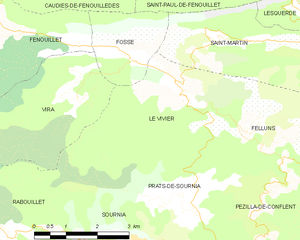
Le Vivier
- commune in Pyrénées-Orientales, France
- Country:
- Postal Code: 66730
- Coordinates: 42° 46' 18" N, 2° 27' 12" E
- GPS tracks (wikiloc): [Link]
- AboveSeaLevel: 426 м m
- Area: 12.9 sq km
- Population: 79