Souvigné (Souvigné)

- commune in Charente, France
- Country:

- Postal Code: 16240
- Coordinates: 45° 58' 16" N, 0° 3' 28" E


- GPS tracks (wikiloc): [Link]
- Area: 10.37 sq km
- Population: 216
- Wikipedia en: wiki(en)
- Wikipedia: wiki(fr)
- Wikidata storage: Wikidata: Q1438912
- Wikipedia Commons Category: [Link]
- Freebase ID: [/m/03mcdy4]
- GeoNames ID: Alt: [6614257]
- SIREN number: [211603733]
- BnF ID: [15248810g]
- INSEE municipality code: 16373
Shares border with regions:

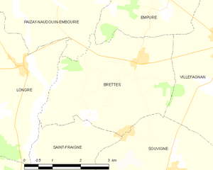
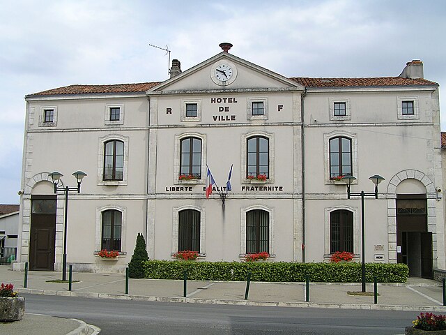
Brettes
- commune in Charente, France
- Country:
- Postal Code: 16240
- Coordinates: 46° 0' 19" N, 0° 2' 28" E
- GPS tracks (wikiloc): [Link]
- Area: 12.21 sq km
- Population: 183


Ébréon
- commune in Charente, France
- Country:
- Postal Code: 16140
- Coordinates: 45° 56' 15" N, 0° 1' 52" E
- GPS tracks (wikiloc): [Link]
- Area: 10.05 sq km
- Population: 154


Courcôme
- former commune in Charente, France
- Country:
- Postal Code: 16240
- Coordinates: 45° 59' 8" N, 0° 7' 54" E
- GPS tracks (wikiloc): [Link]
- Area: 19.44 sq km
- Population: 418


Bessé
- commune in Charente, France
- Country:
- Postal Code: 16140
- Coordinates: 45° 57' 19" N, 0° 4' 24" E
- GPS tracks (wikiloc): [Link]
- Area: 7.67 sq km
- Population: 139
- Web site: [Link]

Villefagnan
- commune in Charente, France
- Country:
- Postal Code: 16240
- Coordinates: 46° 0' 48" N, 0° 4' 47" E
- GPS tracks (wikiloc): [Link]
- Area: 23.65 sq km
- Population: 1012


Saint-Fraigne
- commune in Charente, France
- Country:
- Postal Code: 16140
- Coordinates: 45° 57' 10" N, 0° 0' 39" E
- GPS tracks (wikiloc): [Link]
- Area: 32.1 sq km
- Population: 451
- Web site: [Link]


Tusson
- commune in Charente, France
- Country:
- Postal Code: 16140
- Coordinates: 45° 56' 3" N, 0° 4' 6" E
- GPS tracks (wikiloc): [Link]
- Area: 13.97 sq km
- Population: 222
- Web site: [Link]