Studen (Studen)
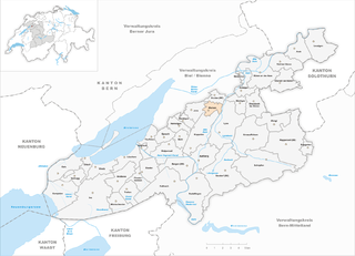
- municipality in the canton of Bern, Switzerland
Studen, located in the Bern district of Switzerland, offers a variety of natural landscapes and hiking opportunities. While Studen itself is a small municipality, it is well-positioned for accessing nearby hiking trails in the surrounding area.
Hiking Opportunities around Studen:
-
Aare River Trail: This scenic route follows the Aare River, allowing hikers to enjoy views of the water and the lush countryside. The trail is relatively flat, making it suitable for hikers of all skill levels.
-
Nature Reserves: The area around Studen has several nature reserves where you can hike while enjoying the local flora and fauna. These trails often provide opportunities for birdwatching and appreciating the diverse ecosystems.
-
Nearby Jura Mountains: A short drive from Studen leads to the Jura mountain range, where you can find more challenging hikes with panoramic views. Trails like the Creux du Van or Mont Tendre are popular among hikers looking for a more rugged experience.
-
Well-Marked Trails: Switzerland is known for its well-marked hiking trails. In and around Studen, you can find diverse routes ranging from easy walks to more rigorous hikes.
-
Local Guides and Tours: Consider hiring a local guide or joining a group for a more enriched experience. They can lead you through hidden gems that might not be found in standard hiking maps.
Tips for Hiking in Studen:
- Check the Weather: The weather in Switzerland can change rapidly, so check forecasts and dress in layers.
- Equipment: Make sure to wear comfortable hiking boots and bring essentials such as water, snacks, a map, and a first aid kit.
- Leave No Trace: As in any outdoor activity, it’s important to follow Leave No Trace principles to help preserve the natural beauty of the area.
Conclusion:
Hiking around Studen in Bern offers both serene walks and the thrill of mountain trails. With the combination of natural beauty and well-maintained paths, it can be a rewarding destination for hikers of all levels. Enjoy your time exploring the trails!
- Country:

- Postal Code: 2557
- Local Dialing Code: 032
- Licence Plate Code: BE
- Coordinates: 47° 6' 45" N, 7° 18' 10" E


- GPS tracks (wikiloc): [Link]
- AboveSeaLevel: 433 м m
- Area: 2.71 sq km
- Population: 3278
- Web site: http://www.studen.ch
- Wikipedia en: wiki(en)
- Wikipedia: wiki(de)
- Wikidata storage: Wikidata: Q69908
- Wikipedia Commons Category: [Link]
- Freebase ID: [/m/0ft9xl]
- GeoNames ID: Alt: [7287251]
- VIAF ID: Alt: [242321952]
- OSM relation ID: [1682676]
- PACTOLS thesaurus ID: [pcrtr3pXg6l5nz]
- HDS ID: [452]
- Swiss municipality code: [0749]
Shares border with regions:


Jens
- municipality in the canton of Bern, Switzerland
Jens, located in Switzerland, is a picturesque destination for hiking enthusiasts. The area's natural beauty, with its stunning mountain landscapes, deep valleys, and crystal-clear lakes, offers a variety of trails suitable for all skill levels....
- Country:

- Postal Code: 2565
- Local Dialing Code: 032
- Licence Plate Code: BE
- Coordinates: 47° 5' 53" N, 7° 16' 9" E


- GPS tracks (wikiloc): [Link]
- AboveSeaLevel: 436 м m
- Area: 4.58 sq km
- Population: 666
- Web site: [Link]


Worben
- municipality in Switzerland
Worben, located in the canton of Bern in Switzerland, offers beautiful landscapes ideal for hiking enthusiasts. The area is characterized by its lush greenery, serene lakes, and scenic views of the Swiss Alps. Here are some key points to consider when hiking in Worben:...
- Country:

- Postal Code: 3252
- Local Dialing Code: 032
- Licence Plate Code: BE
- Coordinates: 47° 6' 3" N, 7° 17' 47" E


- GPS tracks (wikiloc): [Link]
- AboveSeaLevel: 438 м m
- Area: 2.8 sq km
- Population: 2266
- Web site: [Link]


Büetigen
- municipality in Switzerland
Büetigen is a charming municipality located in the canton of Bern, Switzerland. It offers access to beautiful hiking trails that showcase the stunning natural landscapes of the region....
- Country:

- Postal Code: 3263
- Local Dialing Code: 032
- Licence Plate Code: BE
- Coordinates: 47° 6' 25" N, 7° 20' 40" E


- GPS tracks (wikiloc): [Link]
- AboveSeaLevel: 444 м m
- Area: 3.6 sq km
- Population: 860
- Web site: [Link]


Aegerten
- municipality in Switzerland
Aegerten is a charming municipality located in the Canton of Bern, Switzerland. While it may not be as well-known as some other hiking destinations in the region, it offers beautiful landscapes and opportunities for outdoor activities. Here’s what you can expect when hiking in and around Aegerten:...
- Country:

- Local Dialing Code: 032
- Licence Plate Code: BE
- Coordinates: 47° 6' 59" N, 7° 17' 0" E


- GPS tracks (wikiloc): [Link]
- AboveSeaLevel: 437 м m
- Area: 2.1 sq km
- Population: 2052
- Web site: [Link]


Lyss
- city and municipality in the canton of Bern, Switzerland
Lyss, located in the Canton of Bern, Switzerland, is a charming town that serves as a gateway to some fantastic hiking opportunities in the surrounding areas. Here are some highlights and tips for hiking in and around Lyss:...
- Country:

- Postal Code: 3250
- Local Dialing Code: 032
- Licence Plate Code: BE
- Coordinates: 47° 4' 36" N, 7° 19' 0" E


- GPS tracks (wikiloc): [Link]
- AboveSeaLevel: 473 м m
- Area: 14.82 sq km
- Population: 14887
- Web site: [Link]


Schwadernau
- municipality in Switzerland
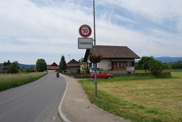
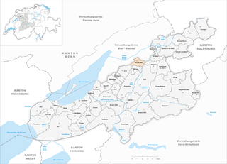
Schwadernau is a charming area located along the shores of Lake Biel in the Canton of Bern, Switzerland. It offers various hiking opportunities that allow you to enjoy the stunning landscapes of the region, characterized by rolling hills, vineyards, and beautiful lake views. Here are some highlights and tips for hiking in Schwadernau:...
- Country:

- Postal Code: 2556
- Local Dialing Code: 032
- Licence Plate Code: BE
- Coordinates: 47° 7' 26" N, 7° 19' 2" E


- GPS tracks (wikiloc): [Link]
- AboveSeaLevel: 431 м m
- Area: 4.1 sq km
- Population: 673
- Web site: [Link]

