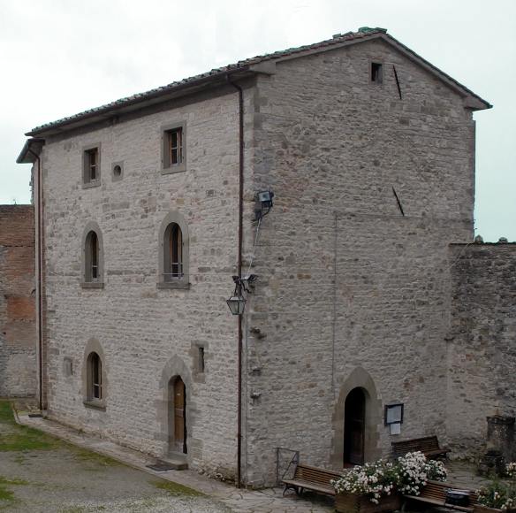
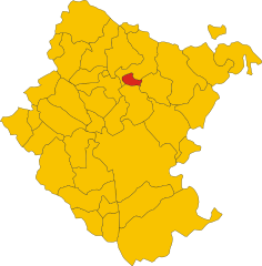
Subbiano (Subbiano)
.svg)
- Italian comune
 Hiking in Subbiano
Subbiano, located in the Tuscan region of Italy, is surrounded by beautiful landscapes, making it a great destination for hiking enthusiasts. The area offers a variety of trails that cater to different skill levels, from easy walks to more challenging hikes.
Key Features of Hiking in Subbiano:
-
Scenic Views: The trails in this area often provide stunning views of the surrounding countryside, including rolling hills, olive groves, and vineyards. You can also enjoy vistas of the Casentino Forests and the nearby Arno River.
-
Rich Flora and Fauna: The region is known for its biodiversity. Hikers can expect to see a variety of plant species, wildlife, and perhaps even a glimpse of local fauna like deer or a variety of birds.
-
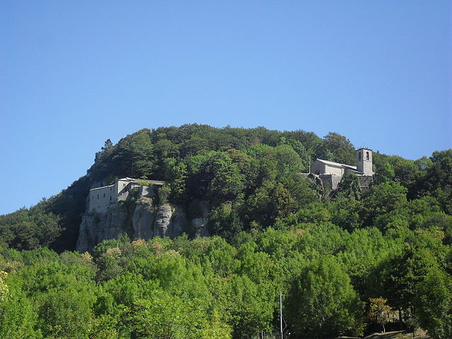
Cultural Landscape: Many trails connect not just to nature but also to historical sites, including ancient churches, castles, and ruins. This provides hikers with the chance to explore the rich culture and history of the area.
-
Trail Difficulty: There are trails suitable for all levels. Beginners can enjoy easier paths that are well-marked, while more experienced hikers may seek out challenging routes with steeper elevations and rugged terrain.
-
Seasonal Beauty: Each season offers a different hiking experience. Spring showcases blooming wildflowers, summer is perfect for warm-weather hikes, fall displays beautiful foliage, and winter offers a quiet, serene environment.
Popular Hiking Areas Nearby:
- Casentino Forests: Located a short distance from Subbiano, this area provides extensive hiking options with marked trails for various skill levels.
- Mount Falterona: A rewarding hike for those looking for a bit of elevation, with panoramic views at the top.
- Arezzo and Surrounding Areas: Other nearby towns and parks offer additional trails worth exploring.
Tips for Hiking in Subbiano:
- Plan Ahead: Always check trail conditions and forecasts before heading out. Local tourist information can provide valuable updates.
- Stay Hydrated: Carry enough water, especially during warmer months.
- Wear Appropriate Gear: Sturdy hiking boots and comfortable clothing can enhance your experience significantly.
- Respect Nature: Stay on marked trails, and remember to follow Leave No Trace principles to protect the environment.
Hiking in Subbiano is a perfect way to immerse yourself in the beautiful Tuscan landscape, enjoy the great outdoors, and appreciate the local culture and history.
- Country:

- Postal Code: 52010
- Local Dialing Code: 0575
- Licence Plate Code: AR
- Coordinates: 43° 34' 48" N, 11° 52' 20" E


- GPS tracks (wikiloc): [Link]
- AboveSeaLevel: 266 м m
- Area: 77.84 sq km
- Population: 6373
- Web site: http://www.comune.subbiano.ar.it/
- Wikipedia en: wiki(en)
- Wikipedia: wiki(it)
- Wikidata storage: Wikidata: Q52102
- Wikipedia Commons Category: [Link]
- Freebase ID: [/m/095n_d]
- GeoNames ID: Alt: [6540482]
- BnF ID: [12063565c]
- VIAF ID: Alt: [140816933]
- OSM relation ID: [42508]
- GND ID: Alt: [4727815-8]
- WOEID: [724625]
- UN/LOCODE: [ITZSY]
- ISTAT ID: 051037
- Italian cadastre code: I991
Shares border with regions:


Arezzo
- Italian comune
Hiking in Arezzo
Arezzo, located in Tuscany, Italy, offers a diverse range of hiking opportunities amidst its stunning landscapes, charming villages, and historical landmarks. Here are some highlights and tips for hiking in the Arezzo area:...
- Country:
- Postal Code: 52100
- Local Dialing Code: 0575
- Licence Plate Code: AR
- Coordinates: 43° 27' 47" N, 11° 52' 41" E
- GPS tracks (wikiloc): [Link]
- AboveSeaLevel: 296 м m
- Area: 384.7 sq km
- Population: 99541
- Web site: [Link]


Anghiari
- Italian comune
Hiking in Anghiari
Anghiari is a charming medieval town located in the Tuscany region of Italy, known for its stunning landscapes, rich history, and well-preserved architecture. Hiking in and around Anghiari offers a variety of trails that showcase the beautiful countryside, rolling hills, and picturesque views unique to this part of Tuscany....
- Country:
- Postal Code: 52031
- Local Dialing Code: 0575
- Licence Plate Code: AR
- Coordinates: 43° 32' 30" N, 12° 3' 18" E
- GPS tracks (wikiloc): [Link]
- AboveSeaLevel: 429 м m
- Area: 130.92 sq km
- Population: 5536
- Web site: [Link]


Capolona
- Italian comune
Hiking in Capolona
Capolona is a charming town located in Tuscany, Italy, surrounded by beautiful natural landscapes that make it an attractive destination for hiking enthusiasts. Here are some details about hiking in and around Capolona:...
- Country:
- Postal Code: 52010
- Local Dialing Code: 0575
- Licence Plate Code: AR
- Coordinates: 43° 34' 4" N, 11° 51' 53" E
- GPS tracks (wikiloc): [Link]
- AboveSeaLevel: 263 м m
- Area: 47.56 sq km
- Population: 5446
- Web site: [Link]

Caprese Michelangelo
- Italian comune
Hiking in Caprese Michelangelo
Caprese Michelangelo, a small town in Tuscany, Italy, is surrounded by beautiful landscapes, making it a great destination for hikers. Nestled in the Casentino Forests, the area is characterized by its rich natural beauty, historical sites, and diverse flora and fauna....
- Country:
- Postal Code: 52033
- Local Dialing Code: 0575
- Licence Plate Code: AR
- Coordinates: 43° 38' 27" N, 11° 59' 9" E
- GPS tracks (wikiloc): [Link]
- AboveSeaLevel: 653 м m
- Area: 66.53 sq km
- Population: 1406
- Web site: [Link]


Castel Focognano
- Italian comune
Hiking in Castel Focognano
Castel Focognano is a charming area located in the Tuscany region of Italy, known for its beautiful landscapes and hiking opportunities. Nestled in the Casentino Valley, this location is surrounded by nature, with trails that lead through picturesque forests, rolling hills, and offer stunning views of the surrounding countryside....
- Country:
- Postal Code: 52016
- Local Dialing Code: 0575
- Licence Plate Code: AR
- Coordinates: 43° 39' 12" N, 11° 47' 17" E
- GPS tracks (wikiloc): [Link]
- AboveSeaLevel: 310 м m
- Area: 56.63 sq km
- Population: 3093
- Web site: [Link]

Chitignano
- Italian comune
Hiking in Chitignano
Chitignano, a charming village in the province of Arezzo, Tuscany, offers beautiful landscapes and a variety of hiking opportunities for outdoor enthusiasts. Nestled in the Casentino area, the region is characterized by its rolling hills, lush forests, and picturesque views that are perfect for hiking and nature walks....
- Country:
- Postal Code: 52010
- Local Dialing Code: 0575
- Licence Plate Code: AR
- Coordinates: 43° 39' 48" N, 11° 52' 56" E
- GPS tracks (wikiloc): [Link]
- AboveSeaLevel: 582 м m
- Area: 14.89 sq km
- Population: 910
- Web site: [Link]

Chiusi della Verna
- Italian comune
Hiking in Chiusi della Verna
Chiusi della Verna, nestled in the Casentino Forests of Tuscany, Italy, is a fantastic destination for hikers. It offers a blend of natural beauty, historical significance, and a variety of trails catering to different skill levels. Here are some key points to consider when hiking in Chiusi della Verna:...
- Country:
- Postal Code: 52010
- Local Dialing Code: 0575
- Licence Plate Code: AR
- Coordinates: 43° 41' 54" N, 11° 56' 10" E
- GPS tracks (wikiloc): [Link]
- AboveSeaLevel: 960 м m
- Area: 102.33 sq km
- Population: 2000
- Web site: [Link]