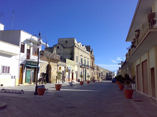
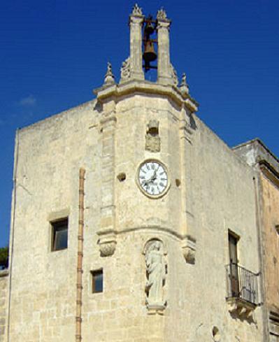
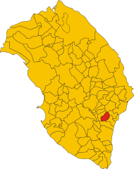
Surano (Surano)
.svg)
- Italian comune
 Hiking in Surano
Surano is a picturesque village located in the province of Lecce in the Apulia region of Italy. While it may not be as widely known for hiking as some other areas, it is surrounded by beautiful landscapes and offers routes that combine natural beauty with cultural experiences.
Hiking Opportunities:
-
Nature Trails: The area surrounding Surano features various paths that wind through olive groves, vineyards, and farmland. These trails are perfect for leisurely hikes, allowing you to take in the stunning scenery and enjoy the rural charm of the region.
-
Caving and Climbing: Near Surano, you may also find karst formations and limestone cliffs which provide opportunities for those interested in more challenging outdoor activities, including caving and rock climbing.
-
Coastal Hiking: If you venture a bit further, the coast of the Adriatic Sea is not too far away. The nearby coastal towns like Otranto and Santa Maria di Leuca offer beautiful coastal hikes with stunning sea views, cliffs, and beaches.
-
Historical Trails: Many hiking trails in the area are also rich in history, passing by ancient ruins, old churches, and traditional masserie (rural estates). Be sure to explore these sites, as they provide insight into the region's cultural heritage.
Tips for Hiking in Surano:
-
Weather Considerations: Check the weather conditions before heading out, as the summers can be hot. Spring and fall are generally the most pleasant times for hiking.
-
Footwear: Wear sturdy hiking shoes with good grip, especially if you choose to explore rocky or uneven terrain.
-
Hydration: Always carry water, especially on longer hikes, and consider packing some snacks.
-
Guided Tours: If you're unfamiliar with the area, consider joining a guided hiking tour. Local guides can offer insights into the flora, fauna, and history of the region.
-
Respect the Environment: Stay on marked trails, and be mindful of local wildlife and plants.
In summary, while Surano may not be a major hiking destination, it offers charming and rewarding experiences for those willing to explore its natural beauty and cultural richness.
- Country:

- Postal Code: 73030
- Local Dialing Code: 0836
- Licence Plate Code: LE
- Coordinates: 40° 2' 0" N, 18° 21' 0" E


- GPS tracks (wikiloc): [Link]
- AboveSeaLevel: 102 м m
- Area: 8.99 sq km
- Population: 1637
- Web site: http://www.comune.surano.le.it
- Wikipedia en: wiki(en)
- Wikipedia: wiki(it)
- Wikidata storage: Wikidata: Q52203
- Wikipedia Commons Category: [Link]
- Freebase ID: [/m/0f_9sh]
- GeoNames ID: Alt: [6541742]
- OSM relation ID: [40201]
- TGN ID: [7039331]
- UN/LOCODE: [ITIZZ]
- ISTAT ID: 075082
- Italian cadastre code: L010
Shares border with regions:


Andrano
- Italian comune
Hiking in Andrano
Andrano is a picturesque village located in the region of Puglia, Italy, known for its stunning landscapes, rich history, and cozy atmosphere. Hiking in Andrano allows you to explore both natural beauty and cultural heritage....
- Country:
- Postal Code: 73032
- Local Dialing Code: 0836
- Licence Plate Code: LE
- Coordinates: 39° 59' 0" N, 18° 23' 0" E
- GPS tracks (wikiloc): [Link]
- AboveSeaLevel: 111 м m
- Area: 15.71 sq km
- Population: 4750
- Web site: [Link]

Montesano Salentino
- Italian comune
Hiking in Montesano Salentino
Montesano Salentino is a picturesque town located in the Apulia region of southern Italy, and it offers beautiful hiking opportunities for outdoor enthusiasts. Nestled in the Salento area, the region is characterized by its stunning landscapes, rich history, and diverse flora and fauna. Here are some key points to consider when hiking in Montesano Salentino:...
- Country:
- Postal Code: 73030
- Local Dialing Code: 0833
- Licence Plate Code: LE
- Coordinates: 39° 58' 33" N, 18° 19' 21" E
- GPS tracks (wikiloc): [Link]
- AboveSeaLevel: 106 м m
- Area: 8.53 sq km
- Population: 2687
- Web site: [Link]


Nociglia
- Italian comune
Hiking in Nociglia
Nociglia, located in the Apulia region of southern Italy, offers a charming and scenic backdrop for hiking enthusiasts. While it may not be as well-known as some of the larger national parks, Nociglia and its surroundings provide a range of hiking opportunities, characterized by beautiful landscapes, traditional Apulian architecture, and rich local culture....
- Country:
- Postal Code: 73020
- Local Dialing Code: 0836
- Licence Plate Code: LE
- Coordinates: 40° 2' 0" N, 18° 20' 0" E
- GPS tracks (wikiloc): [Link]
- AboveSeaLevel: 102 м m
- Area: 11.13 sq km
- Population: 2289
- Web site: [Link]


Poggiardo
- Italian comune
Hiking in Poggiardo
Poggiardo is a charming town located in the Salento region of Puglia, Italy, and offers a variety of hiking opportunities that take you through its stunning landscapes, historical sites, and nearby coastal areas. Here are some highlights and recommendations for hiking in the Poggiardo area:...
- Country:
- Postal Code: 73037
- Local Dialing Code: 0836
- Licence Plate Code: LE
- Coordinates: 40° 3' 0" N, 18° 23' 0" E
- GPS tracks (wikiloc): [Link]
- AboveSeaLevel: 90 м m
- Area: 19.96 sq km
- Population: 5992
- Web site: [Link]
Spongano
- Italian comune
Hiking in Spongano
Spongano, a picturesque town in the Apulia region of Italy, offers a beautiful hiking experience for outdoor enthusiasts. Situated near the Adriatic coast, it features stunning landscapes, rich cultural heritage, and various trails that cater to different levels of hikers....
- Country:
- Postal Code: 73038
- Local Dialing Code: 0836
- Licence Plate Code: LE
- Coordinates: 40° 1' 0" N, 18° 22' 0" E
- GPS tracks (wikiloc): [Link]
- AboveSeaLevel: 96 м m
- Area: 12.42 sq km
- Population: 3673
- Web site: [Link]