Suzannecourt (Suzannecourt)

- commune in Haute-Marne, France
- Country:

- Postal Code: 52300
- Coordinates: 48° 26' 41" N, 5° 10' 11" E


- GPS tracks (wikiloc): [Link]
- Area: 4.6 sq km
- Population: 374
- Web site: http://www.suzannecourt.fr
- Wikipedia en: wiki(en)
- Wikipedia: wiki(fr)
- Wikidata storage: Wikidata: Q1325350
- Wikipedia Commons Category: [Link]
- Freebase ID: [/m/03ntrpn]
- Freebase ID: [/m/03ntrpn]
- GeoNames ID: Alt: [6436350]
- GeoNames ID: Alt: [6436350]
- SIREN number: [215203456]
- SIREN number: [215203456]
- BnF ID: [15263728g]
- BnF ID: [15263728g]
- INSEE municipality code: 52484
- INSEE municipality code: 52484
Shares border with regions:


Poissons
- commune in Haute-Marne, France
- Country:
- Postal Code: 52230
- Coordinates: 48° 25' 23" N, 5° 13' 11" E
- GPS tracks (wikiloc): [Link]
- Area: 15.48 sq km
- Population: 694
- Web site: [Link]


Montreuil-sur-Thonnance
- commune in Haute-Marne, France
- Country:
- Postal Code: 52230
- Coordinates: 48° 27' 33" N, 5° 14' 10" E
- GPS tracks (wikiloc): [Link]
- Area: 8.09 sq km
- Population: 64

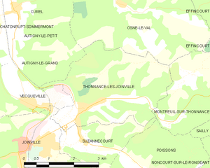
Thonnance-lès-Joinville
- commune in Haute-Marne, France
- Country:
- Postal Code: 52300
- Coordinates: 48° 27' 17" N, 5° 10' 20" E
- GPS tracks (wikiloc): [Link]
- Area: 11.33 sq km
- Population: 778


Joinville
- commune in Haute-Marne, France
- Country:
- Postal Code: 52300
- Coordinates: 48° 26' 33" N, 5° 8' 17" E
- GPS tracks (wikiloc): [Link]
- Area: 18.94 sq km
- Population: 3286
- Web site: [Link]


Saint-Urbain-Maconcourt
- commune in Haute-Marne, France
- Country:
- Postal Code: 52300
- Coordinates: 48° 24' 2" N, 5° 10' 56" E
- GPS tracks (wikiloc): [Link]
- Area: 25.85 sq km
- Population: 648