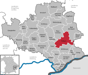
Tann (Tann)
- municipality of Germany
Hiking in Tann, Bavaria, offers a delightful experience with stunning landscapes, picturesque villages, and a range of trails for all levels of hikers. Nestled in the beautiful Bavarian region, Tann is surrounded by the rolling hills of the Bavarian Forest and offers a mix of well-marked trails, scenic views, and opportunities to immerse yourself in nature.
Trails and Routes
- Local Trails: Tann features numerous local hiking paths that range from easy walks suitable for families to more challenging routes for experienced hikers.
- Bavarian Forest National Park: Just a short drive away, this national park offers extensive trails through untouched nature, allowing hikers to experience diverse ecosystems and wildlife.
- Circular Routes: Many of the trails around Tann are circular routes, which means you can enjoy various landscapes and sights without retracing your steps.
Scenic Highlights
- Panoramic Views: Many hikes in the area reward you with breathtaking vistas of the Bavarian Alps, forests, and valleys.
- Historical Sites: Some trails lead to charming villages, historic churches, and local cultural sites that provide insight into the Bavarian way of life.
- Flora and Fauna: The region is rich in biodiversity, making it an excellent spot for nature enthusiasts and bird watchers.
Preparation and Tips
- Seasonal Considerations: The best time for hiking in Tann is in spring, summer, and early fall. Winter months can be harsh, and certain trails may be inaccessible due to snow.
- Gear: Wear comfortable hiking shoes, layered clothing, and carry a water bottle and snacks. A map or GPS device can be very useful for navigating the trails.
- Local Information: Visit the local tourist office for updated trail maps, guided tours, and any events happening in the area.
Conclusion
Whether you are seeking a leisurely walk through the countryside or an adventurous hike with challenging trails, Tann, Bavaria, offers a fantastic hiking experience amidst stunning scenery and rich cultural heritage. Don’t forget to enjoy some local Bavarian cuisine after your hike in one of the quaint local eateries!
- Country:

- Postal Code: 84367
- Local Dialing Code: 08572
- Licence Plate Code: PAN
- Coordinates: 48° 19' 0" N, 12° 54' 0" E


- GPS tracks (wikiloc): [Link]
- AboveSeaLevel: 476 м m
- Area: 37.55 sq km
- Population: 3289
- Web site: https://www.tann.de/
- Wikipedia en: wiki(en)
- Wikipedia: wiki(de)
- Wikidata storage: Wikidata: Q585601
- Wikipedia Commons Category: [Link]
- Freebase ID: [/m/02q83gb]
- GeoNames ID: Alt: [6558535]
- VIAF ID: Alt: [233871968]
- OSM relation ID: [957064]
- GND ID: Alt: [4358273-4]
- Bavarikon ID: [ODB_A00009235]
- German municipality key: 09277148
Shares border with regions:


Zeilarn
- municipality of Germany
Zeilarn, located in Bavaria, Germany, offers a range of beautiful hiking opportunities for outdoor enthusiasts. The region is characterized by its scenic landscapes, rolling hills, and charming villages....
- Country:

- Postal Code: 84367
- Local Dialing Code: 08572
- Licence Plate Code: PAN
- Coordinates: 48° 18' 0" N, 12° 50' 0" E


- GPS tracks (wikiloc): [Link]
- AboveSeaLevel: 450 м m
- Area: 28.9 sq km
- Population: 2053
- Web site: [Link]


Triftern
- municipality of Germany
Triftern is a small town located in the district of Rottal-Inn in Bavaria, Germany. While it may not be as well-known for hiking as some other regions, it offers access to the beautiful Bavarian countryside, where you can enjoy various nature trails and paths....
- Country:

- Postal Code: 84371
- Local Dialing Code: 08562
- Licence Plate Code: PAN
- Coordinates: 48° 24' 0" N, 13° 1' 0" E


- GPS tracks (wikiloc): [Link]
- AboveSeaLevel: 391 м m
- Area: 62.24 sq km
- Population: 5012
- Web site: [Link]


Hebertsfelden
- municipality of Germany
Hebertsfelden, located in Bavaria, Germany, is a charming village surrounded by picturesque landscapes that offer excellent hiking opportunities. The region is characterized by rolling hills, lush forests, and scenic views, making it perfect for both casual strolls and more challenging hikes....
- Country:

- Postal Code: 84332
- Local Dialing Code: 08721
- Licence Plate Code: PAN
- Coordinates: 48° 24' 0" N, 12° 49' 0" E


- GPS tracks (wikiloc): [Link]
- AboveSeaLevel: 446 м m
- Area: 49.89 sq km
- Population: 3547
- Web site: [Link]


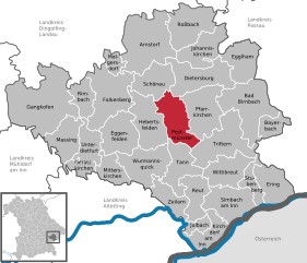
Postmünster
- municipality of Germany
Postmünster is a charming village located in Bavaria, Germany, surrounded by scenic landscapes that make it an excellent destination for hiking enthusiasts. Here are some highlights and tips for hiking in and around Postmünster:...
- Country:

- Postal Code: 84389
- Local Dialing Code: 08561
- Licence Plate Code: PAN
- Coordinates: 48° 25' 0" N, 12° 54' 0" E


- GPS tracks (wikiloc): [Link]
- AboveSeaLevel: 405 м m
- Area: 43.5 sq km
- Population: 2240
- Web site: [Link]


Wittibreut
- municipality in Rottal-Inn, Bavaria, Germany
Wittibreut, located in Bavaria, Germany, is a scenic area known for its beautiful landscapes and natural surroundings, making it a suitable location for hiking enthusiasts. Here are some key points to consider:...
- Country:

- Postal Code: 84384
- Local Dialing Code: 08574
- Licence Plate Code: PAN
- Coordinates: 48° 19' 45" N, 12° 59' 14" E


- GPS tracks (wikiloc): [Link]
- AboveSeaLevel: 480 м m
- Area: 38.32 sq km
- Population: 1872
- Web site: [Link]


Wurmannsquick
- municipality of Germany
Wurmannsquick is a small municipality in Bavaria, Germany, known for its picturesque countryside and forests, making it a lovely destination for hiking enthusiasts. The surrounding area offers a variety of trails suitable for different skill levels, from easy walks to more challenging hikes....
- Country:

- Postal Code: 84329
- Local Dialing Code: 08725
- Licence Plate Code: PAN
- Coordinates: 48° 21' 0" N, 12° 47' 0" E


- GPS tracks (wikiloc): [Link]
- AboveSeaLevel: 500 м m
- Area: 49.19 sq km
- Population: 3239
- Web site: [Link]


Reut
- municipality of Germany
Reut, located in central Israel near the city of Tel Aviv, is not typically known as a hiking destination compared to other regions in the country like the Galilee, the Golan Heights, or the Negev Desert. However, there are some opportunities for nature walks and outdoor activities in the surrounding areas....
- Country:

- Postal Code: 84367
- Local Dialing Code: 08572
- Licence Plate Code: PAN
- Coordinates: 48° 18' 40" N, 12° 56' 34" E


- GPS tracks (wikiloc): [Link]
- AboveSeaLevel: 460 м m
- Area: 30.75 sq km
- Population: 1599
- Web site: [Link]

