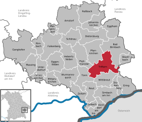
Triftern (Triftern)
- municipality of Germany
Triftern is a small town located in the district of Rottal-Inn in Bavaria, Germany. While it may not be as well-known for hiking as some other regions, it offers access to the beautiful Bavarian countryside, where you can enjoy various nature trails and paths.
Hiking Opportunities:
-
Local Trails: The area around Triftern features several local trails that can provide a peaceful hiking experience amidst fields, forests, and pastures. You can often find well-marked paths that are suitable for all skill levels.
-
Scenic Views: While hiking in the Bavarian countryside, you may encounter stunning views of rolling hills, farmland, and traditional Bavarian architecture.
-
Nearby Nature Reserves: A short drive from Triftern, you may find nature reserves and parks that offer more extended hiking trails, such as the Haidland Nature Reserve or areas along the Inn River.
-
Cultural Hiking: If you're interested in combining hiking with local culture, consider hiking to nearby towns or villages where you can experience local cuisine and Bavarian hospitality.
-
Lake Hiking: Depending on the season and your willingness to travel a bit further, consider areas around the many lakes in Bavaria, such as Lake Chiemsee, which offers picturesque trails and stunning scenery.
Preparation Tips:
- Check Weather: Bavaria's weather can change quickly, so it’s essential to check the forecast before heading out.
- Proper Gear: Wear suitable hiking boots and comfortable clothing. A small backpack with water, snacks, and a first-aid kit is always recommended.
- Maps and Guides: Carry a map or a GPS device, as not all trails may be well-marked. Be aware of your route before you set out.
- Respect Nature: Follow the Leave No Trace principles to help preserve the beautiful landscape.
Conclusion
While Triftern itself may not be a major hiking destination, the surrounding Bavarian countryside offers plenty of opportunities for those looking to experience nature and enjoy some peaceful outdoor time. Enjoy your hikes and the natural beauty of this lovely region!
- Country:

- Postal Code: 84371
- Local Dialing Code: 08562
- Licence Plate Code: PAN
- Coordinates: 48° 24' 0" N, 13° 1' 0" E


- GPS tracks (wikiloc): [Link]
- AboveSeaLevel: 391 м m
- Area: 62.24 sq km
- Population: 5012
- Web site: http://www.triftern.de
- Wikipedia en: wiki(en)
- Wikipedia: wiki(de)
- Wikidata storage: Wikidata: Q550561
- Wikipedia Commons Category: [Link]
- Freebase ID: [/m/02rg91v]
- GeoNames ID: Alt: [2821143]
- VIAF ID: Alt: [244127240]
- OSM relation ID: [957043]
- GND ID: Alt: [4119711-2]
- archINFORM location ID: [13356]
- Bavarikon ID: [ODB_A00001636]
- German municipality key: 09277149
Shares border with regions:
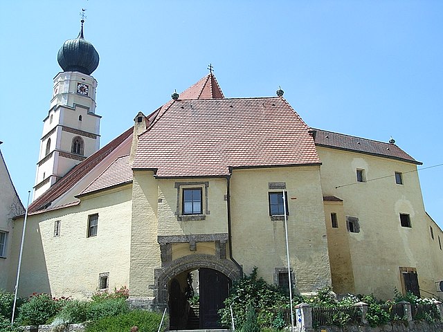

Kößlarn
- municipality of Germany
Kößlarn is a village located in Bavaria, Germany, known for its picturesque landscapes and outdoor activities, including hiking. The region surrounding Kößlarn offers various trails suitable for different skill levels, making it an appealing destination for both novice and experienced hikers....
- Country:

- Postal Code: 94149
- Local Dialing Code: 08536
- Licence Plate Code: PA
- Coordinates: 48° 22' 25" N, 13° 7' 26" E


- GPS tracks (wikiloc): [Link]
- AboveSeaLevel: 425 м m
- Area: 25.48 sq km
- Population: 1696
- Web site: [Link]
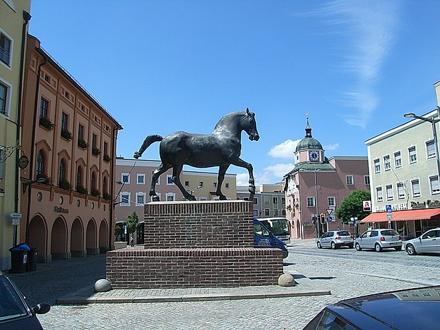
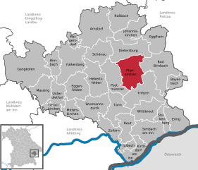
Pfarrkirchen
- the capital of the district Rottal-Inn, Bavaria.
Pfarrkirchen is a charming town located in Bavaria, Germany, surrounded by beautiful countryside that offers several hiking opportunities. The region is characterized by its rolling hills, lush forests, and tranquil rivers, making it an excellent destination for outdoor enthusiasts....
- Country:

- Postal Code: 84347
- Local Dialing Code: 08561
- Licence Plate Code: PAN
- Coordinates: 48° 26' 31" N, 12° 56' 39" E


- GPS tracks (wikiloc): [Link]
- AboveSeaLevel: 469 м m
- Area: 52.35 sq km
- Population: 10275
- Web site: [Link]

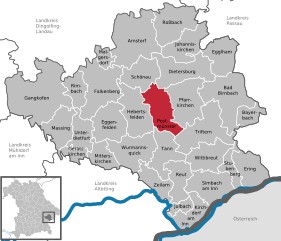
Postmünster
- municipality of Germany
Postmünster is a charming village located in Bavaria, Germany, surrounded by scenic landscapes that make it an excellent destination for hiking enthusiasts. Here are some highlights and tips for hiking in and around Postmünster:...
- Country:

- Postal Code: 84389
- Local Dialing Code: 08561
- Licence Plate Code: PAN
- Coordinates: 48° 25' 0" N, 12° 54' 0" E


- GPS tracks (wikiloc): [Link]
- AboveSeaLevel: 405 м m
- Area: 43.5 sq km
- Population: 2240
- Web site: [Link]


Wittibreut
- municipality in Rottal-Inn, Bavaria, Germany
Wittibreut, located in Bavaria, Germany, is a scenic area known for its beautiful landscapes and natural surroundings, making it a suitable location for hiking enthusiasts. Here are some key points to consider:...
- Country:

- Postal Code: 84384
- Local Dialing Code: 08574
- Licence Plate Code: PAN
- Coordinates: 48° 19' 45" N, 12° 59' 14" E


- GPS tracks (wikiloc): [Link]
- AboveSeaLevel: 480 м m
- Area: 38.32 sq km
- Population: 1872
- Web site: [Link]


Tann
- municipality of Germany
Hiking in Tann, Bavaria, offers a delightful experience with stunning landscapes, picturesque villages, and a range of trails for all levels of hikers. Nestled in the beautiful Bavarian region, Tann is surrounded by the rolling hills of the Bavarian Forest and offers a mix of well-marked trails, scenic views, and opportunities to immerse yourself in nature....
- Country:

- Postal Code: 84367
- Local Dialing Code: 08572
- Licence Plate Code: PAN
- Coordinates: 48° 19' 0" N, 12° 54' 0" E


- GPS tracks (wikiloc): [Link]
- AboveSeaLevel: 476 м m
- Area: 37.55 sq km
- Population: 3289
- Web site: [Link]

Bad Birnbach
- municipality in the district of Rottal-Inn in Bavaria
Bad Birnbach, located in the Lower Bavaria region of Germany, is known for its scenic landscapes, natural hot springs, and wellness facilities. The area is a great choice for hiking enthusiasts of all levels, offering a variety of trails that showcase the beautiful Bavarian countryside....
- Country:

- Postal Code: 84364
- Local Dialing Code: 08563
- Licence Plate Code: PAN
- Coordinates: 48° 27' 0" N, 13° 5' 0" E


- GPS tracks (wikiloc): [Link]
- AboveSeaLevel: 376 м m
- Area: 68.83 sq km
- Population: 5743
- Web site: [Link]


Stubenberg
- municipality of Germany
Stubenberg, located in Bavaria, Germany, is a charming area that offers numerous opportunities for hiking enthusiasts. While it may not be as widely known as some of the larger Bavarian hiking destinations, it boasts beautiful landscapes and trails that can cater to various skill levels....
- Country:

- Postal Code: 94166
- Local Dialing Code: 08571
- Licence Plate Code: PAN
- Coordinates: 48° 19' 0" N, 13° 5' 0" E


- GPS tracks (wikiloc): [Link]
- AboveSeaLevel: 425 м m
- Area: 18.19 sq km
- Population: 1307
- Web site: [Link]
