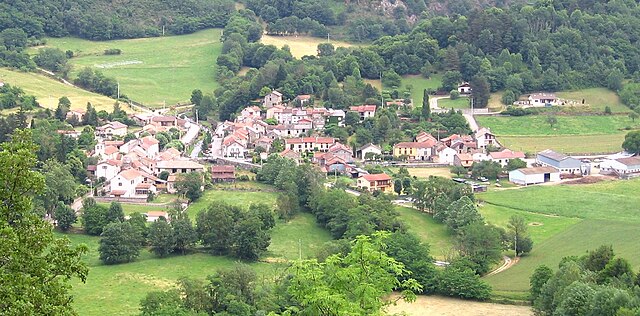
Tarascon-sur-Ariège (Tarascon-sur-Ariège)
- commune in Ariège, France
- Country:

- Postal Code: 09400
- Coordinates: 42° 50' 51" N, 1° 36' 22" E


- GPS tracks (wikiloc): [Link]
- Area: 8.65 sq km
- Population: 3231
- Web site: http://mairie-tarascon.com/
- Wikipedia en: wiki(en)
- Wikipedia: wiki(fr)
- Wikidata storage: Wikidata: Q670048
- Wikipedia Commons Category: [Link]
- Freebase ID: [/m/02vm_p4]
- GeoNames ID: Alt: [6426331]
- SIREN number: [210903068]
- BnF ID: [13121960r]
- VIAF ID: Alt: [248276173]
- OSM relation ID: [1806623]
- GND ID: Alt: [4560847-7]
- PACTOLS thesaurus ID: [pcrtFjYtLReFOp]
- WOEID: [12671524]
- Digital Atlas of the Roman Empire ID: [17884]
- INSEE municipality code: 09306
Shares border with regions:
Arnave
- commune in Ariège, France
- Country:
- Postal Code: 09400
- Coordinates: 42° 51' 12" N, 1° 38' 51" E
- GPS tracks (wikiloc): [Link]
- Area: 8.38 sq km
- Population: 202
Arignac
- commune in Ariège, France
- Country:
- Postal Code: 09400
- Coordinates: 42° 52' 15" N, 1° 36' 2" E
- GPS tracks (wikiloc): [Link]
- Area: 8.84 sq km
- Population: 717

Ussat
- commune in Ariège, France
- Country:
- Postal Code: 09400
- Coordinates: 42° 49' 51" N, 1° 37' 13" E
- GPS tracks (wikiloc): [Link]
- Area: 4.4 sq km
- Population: 338

Quié
- commune in Ariège, France
- Country:
- Postal Code: 09400
- Coordinates: 42° 50' 45" N, 1° 35' 39" E
- GPS tracks (wikiloc): [Link]
- Area: 2.51 sq km
- Population: 302
Bompas
- commune in Ariège, France
- Country:
- Postal Code: 09400
- Coordinates: 42° 51' 53" N, 1° 37' 2" E
- GPS tracks (wikiloc): [Link]
- Area: 2.75 sq km
- Population: 201
Génat
- commune in Ariège, France
- Country:
- Postal Code: 09400
- Coordinates: 42° 49' 24" N, 1° 34' 24" E
- GPS tracks (wikiloc): [Link]
- Area: 8.21 sq km
- Population: 21

Niaux
- commune in Ariège, France
- Country:
- Postal Code: 09400
- Coordinates: 42° 48' 48" N, 1° 35' 28" E
- GPS tracks (wikiloc): [Link]
- Area: 3.99 sq km
- Population: 182

Rabat-les-Trois-Seigneurs
- commune in Ariège, France
- Country:
- Postal Code: 09400
- Coordinates: 42° 51' 21" N, 1° 33' 10" E
- GPS tracks (wikiloc): [Link]
- Area: 26.96 sq km
- Population: 352
- Web site: [Link]

Alliat
- commune in Ariège, France
- Country:
- Postal Code: 09400
- Coordinates: 42° 49' 1" N, 1° 35' 11" E
- GPS tracks (wikiloc): [Link]
- Area: 3.46 sq km
- Population: 54
Surba
- commune in Ariège, France
- Country:
- Postal Code: 09400
- Coordinates: 42° 51' 32" N, 1° 34' 30" E
- GPS tracks (wikiloc): [Link]
- Area: 2.22 sq km
- Population: 343