
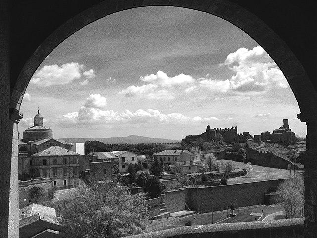
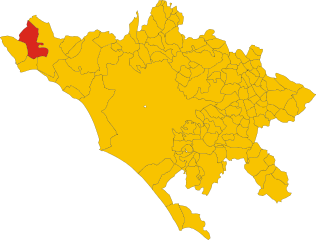
Tarquinia (Tarquinia)
.svg)
- Italian comune
 Hiking in Tarquinia
Tarquinia, located in the Lazio region of Italy, is a charming town that is not only known for its Etruscan history and archaeological sites but also offers some delightful hiking opportunities. The surrounding area features a mix of coastal and inland trails, rich in natural beauty and cultural heritage.
Hiking Opportunities near Tarquinia:
-
Tarquinia's Archaeological Park: While not a typical hiking trail, the park offers a great opportunity for a casual walk while exploring Etruscan tombs and learning about ancient civilization. The experience combines hiking with historical exploration.
-
The Coast of the Tyrrhenian Sea: The coastal area near Tarquinia has beautiful beaches and scenic trails that run along the shore. The pathways provide stunning views of the Mediterranean Sea and opportunities to enjoy the wildlife in the nearby protected areas.
-
The Etruscan Mountains: Towards the inland region, you can find trails that explore the hilly areas leading to the Etruscan Mountains. These hikes can be more challenging, offering panoramic views of the surrounding countryside and vineyards.
-
Cascate di Monte Gelato: A bit further from Tarquinia, but still worth mentioning, are the beautiful waterfalls that can be reached through a hike in the surrounding woods. The serene environment is perfect for a peaceful retreat.
-
Natural Reserves and Parks: Nearby natural reserves, such as the Tarquinia Saline Nature Reserve, provide additional trails and opportunities for birdwatching and enjoying the local flora and fauna.
Tips for Hiking in Tarquinia:
-
Best Time to Hike: Spring and fall typically provide the best weather for hiking, with pleasant temperatures and blooming nature.
-
Equipment: Good hiking shoes are essential, as many trails may be uneven. Bring plenty of water, snacks, and sun protection.
-
Map and Guidance: It’s advisable to have a map or download trail information beforehand, as some trails may not be clearly marked.
-
Respect Nature: Always practice Leave No Trace principles. Stay on marked paths, and take any waste with you to preserve the natural beauty of the area.
Hiking in and around Tarquinia can be a lovely way to combine physical activity with cultural enrichment, making it a rewarding experience for outdoor enthusiasts and history buffs alike.
- Country:

- Postal Code: 01016
- Local Dialing Code: 0766
- Licence Plate Code: VT
- Coordinates: 42° 14' 57" N, 11° 45' 22" E


- GPS tracks (wikiloc): [Link]
- AboveSeaLevel: 132 м m
- Area: 279.34 sq km
- Population: 16269
- Web site: http://www.tarquinia.net/
- Wikipedia en: wiki(en)
- Wikipedia: wiki(it)
- Wikidata storage: Wikidata: Q179999
- Wikipedia Commons Gallery: [Link]
- Wikipedia Commons Category: [Link]
- Freebase ID: [/m/05bqp2]
- GeoNames ID: Alt: [6536909]
- VIAF ID: Alt: [129634868]
- OSM relation ID: [41828]
- archINFORM location ID: [938]
- PACTOLS thesaurus ID: [pcrt6jXtv4Y9R3]
- MusicBrainz area ID: [5d5a7a63-773f-43cc-8739-dde5e35b2cf2]
- UN/LOCODE: [ITTRQ]
- Encyclopædia Britannica Online ID: [place/Tarquinia]
- Digital Atlas of the Roman Empire ID: [16705]
- DMOZ ID: Alt: [Regional/Europe/Italy/Lazio/Localities/Tarquinia/]
- Pleiades ID: [413332]
- Treccani ID: [l-italia-preromana-i-siti-etruschi-tarquinia_(Il-Mondo-dell'Archeologia)]
- ISTAT ID: 056050
- Italian cadastre code: D024
Shares border with regions:


Montalto di Castro
- Italian comune
Hiking in Montalto di Castro
Montalto di Castro, located in the Lazio region of Italy, offers wonderful hiking opportunities combined with stunning landscapes and rich historical context. Here are some key aspects to consider when hiking in this area:...
- Country:
- Postal Code: 01014
- Local Dialing Code: 0766
- Licence Plate Code: VT
- Coordinates: 42° 21' 5" N, 11° 36' 28" E
- GPS tracks (wikiloc): [Link]
- AboveSeaLevel: 42 м m
- Area: 189.63 sq km
- Population: 8978
- Web site: [Link]


Monte Romano
- Italian comune
Hiking in Monte Romano
Monte Romano is a beautiful area for hiking, located in the Lazio region of Italy. It is characterized by its scenic landscapes, rich biodiversity, and a mix of historical and natural attractions. Here are some key points to consider if you're planning to hike in the Monte Romano area:...
- Country:
- Postal Code: 01010
- Local Dialing Code: 0766
- Licence Plate Code: VT
- Coordinates: 42° 16' 5" N, 11° 53' 55" E
- GPS tracks (wikiloc): [Link]
- AboveSeaLevel: 230 м m
- Area: 86.14 sq km
- Population: 1962
- Web site: [Link]

Tuscania
- Italian comune
Hiking in Tuscania
Tuscania, a charming town in the Lazio region of Italy, offers a beautiful backdrop for hiking enthusiasts. Nestled in a landscape of rolling hills, ancient ruins, and lush greenery, it provides a variety of hiking opportunities suited for different skill levels. Here are some key points about hiking in and around Tuscania:...
- Country:
- Postal Code: 01017
- Local Dialing Code: 0761
- Licence Plate Code: VT
- Coordinates: 42° 25' 17" N, 11° 52' 19" E
- GPS tracks (wikiloc): [Link]
- AboveSeaLevel: 165 м m
- Area: 208.69 sq km
- Population: 8369
- Web site: [Link]

Allumiere
- Italian comune
Hiking in Allumiere
Allumiere, a charming town located in the Lazio region of Italy, is surrounded by stunning natural landscapes, making it a great destination for hiking enthusiasts. The area is part of the larger Monti della Tolfa mountain range, characterized by rolling hills, lush forests, and scenic vistas....
- Country:
- Postal Code: 00051
- Local Dialing Code: 0766
- Licence Plate Code: RM
- Coordinates: 42° 9' 25" N, 11° 54' 17" E
- GPS tracks (wikiloc): [Link]
- AboveSeaLevel: 522 м m
- Area: 92.17 sq km
- Population: 4059
- Web site: [Link]
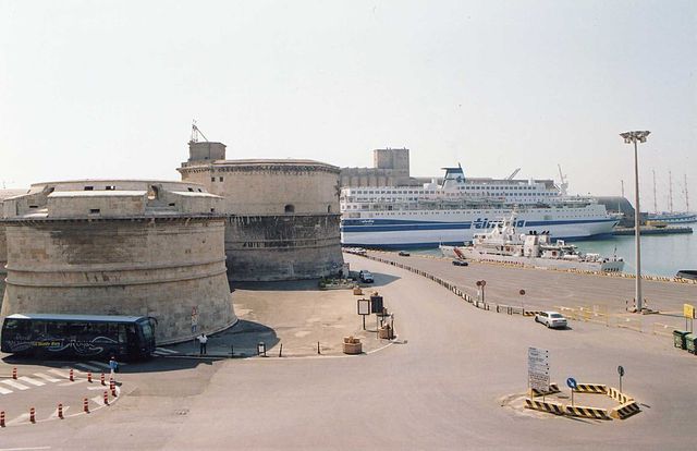

Civitavecchia
- Italian comune
Hiking in Civitavecchia
Civitavecchia, located along the western coast of Italy in the Lazio region, is known primarily as a port city serving as a gateway to Rome. While it may not be traditionally recognized as a hiking destination, there are several beautiful natural areas and trails nearby that can offer a pleasant experience for hikers....
- Country:
- Postal Code: 00053
- Local Dialing Code: 0766
- Licence Plate Code: ROMA
- Coordinates: 42° 6' 0" N, 11° 48' 0" E
- GPS tracks (wikiloc): [Link]
- AboveSeaLevel: 4 м m
- Area: 73.74 sq km
- Population: 52957
- Web site: [Link]


Tolfa
- Italian comune
Hiking in Tolfa
Hiking in Tolfa, located in the Lazio region of Italy, offers an excellent opportunity to explore both natural beauty and historical sites. The area is characterized by its rolling hills, lush vegetation, and panoramic views overlooking the nearby coastline, particularly the Tyrrhenian Sea....
- Country:
- Postal Code: 00059
- Local Dialing Code: 0766
- Licence Plate Code: RM
- Coordinates: 42° 9' 0" N, 11° 56' 0" E
- GPS tracks (wikiloc): [Link]
- AboveSeaLevel: 484 м m
- Area: 168.27 sq km
- Population: 5006
- Web site: [Link]