Teggiano (Teggiano)

- Italian comune
 Hiking in Teggiano
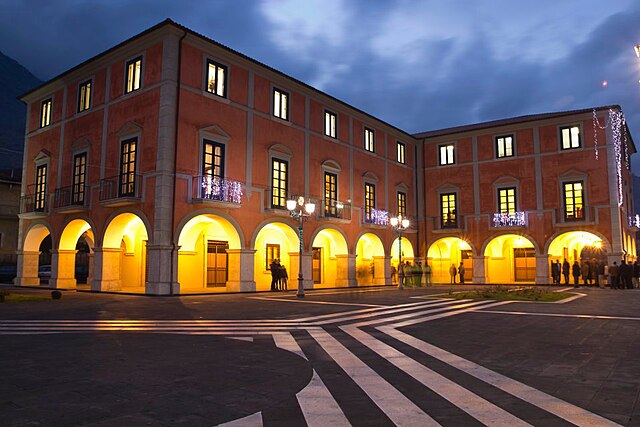
Teggiano, located in the province of Salerno in the Campania region of Italy, is a charming medieval town that offers stunning landscapes and various hiking opportunities. Here are some highlights for hiking in the Teggiano area:
Trails and Routes
-
Sentiero degli Dei (Path of the Gods):
- While not directly in Teggiano, this famous hike is relatively nearby and offers breathtaking views of the Amalfi Coast. The trail is about 7.8 km long and is known for its stunning panoramas and rich vegetation.
-
Local Nature Trails:
- Various local trails wind through the mountains surrounding Teggiano, often leading through olive groves, vineyards, and scenic landscapes. The trails vary in difficulty, catering to both novice hikers and experienced trekkers.
-
Monte Cervati:
- This is the highest peak in the Campania Apennines and is located near Teggiano. The hiking path to the summit can be challenging but rewards hikers with incredible views. The area is also rich in flora and fauna, making it a great spot for nature enthusiasts.
Scenic Views and Attractions
- Historical Sites: While hiking, you may come across historical sites including ancient churches, ruins, and medieval architecture, which offer a glimpse into the rich history of the region.
- Panoramic Views: The hikes around Teggiano provide stunning views of both the surrounding mountains and valleys, as well as the distant coastline.
Best Time to Hike
- Spring (March to May) and Fall (September to November): These seasons are ideal for hiking in Teggiano when the weather is mild and the landscapes are vibrant with flowers or autumn colors.
- Summer can be hot, so early morning or late afternoon hikes are recommended to avoid the heat.
Preparation Tips
- Carry plenty of water and snacks, especially on longer hikes.
- Wear appropriate footwear—sturdy hiking shoes or boots are best for uneven terrain.
- Check local weather conditions before you set out, as mountain weather can change quickly.
- Consider hiring a local guide if you're unfamiliar with the area or seeking to explore lesser-known trails.
Conclusion
Teggiano offers a unique blend of natural beauty, historical treasures, and a chance to immerse yourself in the stunning landscapes of southern Italy. Whether you're looking for a leisurely walk or a more rigorous hike, you'll find plenty of options to choose from in this picturesque setting.
- Country:

- Postal Code: 84039
- Local Dialing Code: 0975
- Licence Plate Code: SA
- Coordinates: 40° 23' 0" N, 15° 32' 0" E


- GPS tracks (wikiloc): [Link]
- AboveSeaLevel: 637 м m
- Area: 61.87 sq km
- Population: 7794
- Web site: http://www.comune.teggiano.sa.it
- Wikipedia en: wiki(en)
- Wikipedia: wiki(it)
- Wikidata storage: Wikidata: Q81728
- Wikipedia Commons Category: [Link]
- Freebase ID: [/m/0bd36q]
- GeoNames ID: Alt: [6537421]
- VIAF ID: Alt: [247756110]
- OSM relation ID: [40469]
- UN/LOCODE: [ITTG9]
- Digital Atlas of the Roman Empire ID: [24885]
- ISTAT ID: 065146
- Italian cadastre code: D292
Shares border with regions:


Atena Lucana
- Italian comune
Hiking in Atena Lucana
Atena Lucana is a charming town located in the province of Salerno, in the Campania region of southern Italy. It is surrounded by the beautiful natural landscape of the Lucanian Apennines and is near the breathtaking Cilento and Vallo di Diano National Park, making it an excellent destination for hiking enthusiasts....
- Country:
- Postal Code: 84030
- Local Dialing Code: 0975
- Licence Plate Code: SA
- Coordinates: 40° 27' 0" N, 15° 33' 0" E
- GPS tracks (wikiloc): [Link]
- AboveSeaLevel: 642 м m
- Area: 26.01 sq km
- Population: 2402
- Web site: [Link]


Corleto Monforte
- Italian comune
Hiking in Corleto Monforte
Corleto Monforte is a charming small town located in the region of Basilicata in southern Italy. This area is characterized by its stunning natural beauty, with a mix of rolling hills, rugged mountains, and beautiful landscapes, making it an excellent destination for hiking enthusiasts....
- Country:
- Postal Code: 84020
- Local Dialing Code: 0828
- Licence Plate Code: SA
- Coordinates: 40° 26' 0" N, 15° 23' 0" E
- GPS tracks (wikiloc): [Link]
- AboveSeaLevel: 683 м m
- Area: 58.97 sq km
- Population: 567
- Web site: [Link]
Monte San Giacomo
- Italian comune
Hiking in Monte San Giacomo
Monte San Giacomo, located in the Campania region of Italy, is a stunning hiking destination known for its beautiful landscapes, biodiversity, and panoramic views. Here are some key points to consider if you're planning to hike in this area:...
- Country:
- Postal Code: 84030
- Local Dialing Code: 0975
- Licence Plate Code: SA
- Coordinates: 40° 21' 0" N, 15° 32' 0" E
- GPS tracks (wikiloc): [Link]
- AboveSeaLevel: 700 м m
- Area: 51.69 sq km
- Population: 1550
- Web site: [Link]


Piaggine
- Italian comune
Hiking in Piaggine
Piaggine is a charming town located in the Campania region of southern Italy, nestled in the heart of the Cilento and Vallo di Diano National Park. This area is known for its stunning natural beauty, rich biodiversity, and a variety of hiking trails suitable for different skill levels. Here are some key highlights and tips for hiking in and around Piaggine:...
- Country:
- Postal Code: 84065
- Local Dialing Code: 0974
- Licence Plate Code: SA
- Coordinates: 40° 21' 0" N, 15° 23' 0" E
- GPS tracks (wikiloc): [Link]
- AboveSeaLevel: 630 м m
- Area: 62.77 sq km
- Population: 1773
- Web site: [Link]


Sacco
- Italian comune
Hiking in Sacco
Hiking in Sacco, a town in the province of Bergamo, Italy, offers stunning views and comes with a variety of trails suitable for different skill levels. The region is known for its beautiful landscapes, rolling hills, and proximity to the Orobie Alps, providing a great backdrop for outdoor activities....
- Country:
- Postal Code: 84070
- Local Dialing Code: 0974
- Licence Plate Code: SA
- Coordinates: 40° 22' 36" N, 15° 22' 40" E
- GPS tracks (wikiloc): [Link]
- AboveSeaLevel: 500 м m
- Area: 23.66 sq km
- Population: 480
- Web site: [Link]


Sala Consilina
- Italian comune
Hiking in Sala Consilina
Sala Consilina, located in the Campania region of southern Italy, offers a range of hiking opportunities amid its beautiful landscapes. Nestled in the heart of the Vallo di Diano National Park, this area is characterized by lush forests, rolling hills, and stunning views of the surrounding mountains....
- Country:
- Postal Code: 84036
- Local Dialing Code: 0975
- Licence Plate Code: SA
- Coordinates: 40° 24' 0" N, 15° 36' 0" E
- GPS tracks (wikiloc): [Link]
- AboveSeaLevel: 614 м m
- Area: 59.7 sq km
- Population: 12636
- Web site: [Link]

San Pietro al Tanagro
- Italian comune
Hiking in San Pietro al Tanagro
San Pietro al Tanagro is a charming village located in the Campania region of southern Italy, nestled within the natural beauty of the Cilento and Vallo di Diano National Park. This area is known for its stunning landscapes, rich biodiversity, and numerous hiking trails suited for various skill levels....
- Country:
- Postal Code: 84030
- Local Dialing Code: 0975
- Licence Plate Code: SA
- Coordinates: 40° 27' 23" N, 15° 28' 59" E
- GPS tracks (wikiloc): [Link]
- AboveSeaLevel: 465 м m
- Area: 15.51 sq km
- Population: 1707
- Web site: [Link]


San Rufo
- Italian comune
Hiking in San Rufo
San Rufo is a charming village located in the Campania region of Italy, known for its beautiful landscapes and rich cultural history. While it may not be as widely recognized as some other hiking destinations in Italy, it offers some lovely trails and opportunities for outdoor activities....
- Country:
- Postal Code: 84030
- Local Dialing Code: 0975
- Licence Plate Code: SA
- Coordinates: 40° 26' 0" N, 15° 28' 0" E
- GPS tracks (wikiloc): [Link]
- AboveSeaLevel: 640 м m
- Area: 31.96 sq km
- Population: 1702
- Web site: [Link]
Sant'Arsenio
- Italian comune
Hiking in Sant'Arsenio
Sant'Arsenio, located in the Campania region of Italy, is surrounded by stunning natural landscapes, making it an excellent destination for hiking enthusiasts. The area features the scenic backdrop of the Appennine Mountains, offering varied terrain and a range of trails for hikers of all levels....
- Country:
- Postal Code: 84037
- Local Dialing Code: 0975
- Licence Plate Code: SA
- Coordinates: 40° 28' 0" N, 15° 29' 0" E
- GPS tracks (wikiloc): [Link]
- AboveSeaLevel: 448 м m
- Area: 20.14 sq km
- Population: 2815
- Web site: [Link]
Sassano
- Italian comune
Hiking in Sassano
Sassano, located in the heart of the Cilento and Vallo di Diano National Park in southern Italy, offers a plethora of hiking opportunities. This picturesque area is characterized by its stunning landscapes, diverse flora and fauna, and historical significance. Here are some highlights about hiking in Sassano:...
- Country:
- Postal Code: 84038
- Local Dialing Code: 0975
- Licence Plate Code: SA
- Coordinates: 40° 20' 25" N, 15° 33' 56" E
- GPS tracks (wikiloc): [Link]
- AboveSeaLevel: 491 м m
- Area: 47.76 sq km
- Population: 4935
- Web site: [Link]