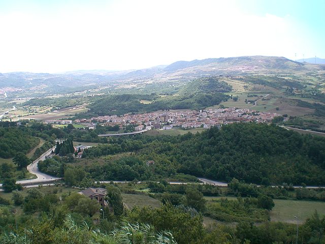
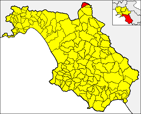
Teora (Teora)
- Italian comune
 Hiking in Teora
Teora, located in the specific region you're referring to, isn’t overly recognized in the wider context of hiking trails compared to more prominent national parks or established hiking areas. However, if you are referring to a local area or community that may have hiking opportunities, I can provide general guidance on what to expect when hiking in a lesser-known region.
-
Trail Types: In lesser-known areas, you might find a variety of trails ranging from easy walks to more challenging hikes. Look for local trail maps or resources to understand the routes and their difficulties.
-
Nature and Wildlife: Often, less-traveled regions can offer unique flora and fauna. As you hike, keep an eye out for local wildlife and plants, and consider bringing a camera to capture the beauty.
-
Preparation: Since these areas may not have as many amenities as popular hiking destinations, make sure to prepare adequately. Bring plenty of water, snacks, a first aid kit, and any necessary gear depending on the season.
-
Navigation: It’s crucial to have a reliable map, GPS, or smartphone app since trail markers may not be as clearly posted as in more developed parks. Download offline maps if you expect limited cell service.
-
Leave No Trace: This principle is vital in preserving nature. Always pack out what you pack in and respect wildlife and plant life.
-
Local Regulations: Check for any local guidelines, permits, or rules regarding the area. Some trails might have specific regulations aimed at protecting the environment.
If you’re looking for specific trails or insights about Teora, I'd recommend checking local hiking clubs, community boards, or social media groups where local hikers share information. Happy hiking!
- Country:

- Postal Code: 83056
- Local Dialing Code: 0827
- Licence Plate Code: AV
- Coordinates: 40° 51' 10" N, 15° 15' 12" E


- GPS tracks (wikiloc): [Link]
- AboveSeaLevel: 660 м m
- Area: 23.21 sq km
- Population: 1494
- Web site: http://www.comune.teora.av.it/
- Wikipedia en: wiki(en)
- Wikipedia: wiki(it)
- Wikidata storage: Wikidata: Q55127
- Wikipedia Commons Category: [Link]
- Freebase ID: [/m/0ffzl6]
- GeoNames ID: Alt: [6539999]
- OSM relation ID: [40823]
- ISTAT ID: 064108
- Italian cadastre code: L102
Shares border with regions:
Caposele
- Italian comune
Hiking in Caposele
Caposele is a charming town located in the Campania region of Italy, nestled in the heart of the scenic National Park of Cilento, Vallo di Diano, and Alburni Mountains. This area offers a variety of hiking opportunities thanks to its diverse landscapes, rich flora and fauna, and numerous trails that cater to different skill levels....
- Country:
- Postal Code: 83040
- Local Dialing Code: 0827
- Licence Plate Code: AV
- Coordinates: 40° 48' 55" N, 15° 13' 27" E
- GPS tracks (wikiloc): [Link]
- AboveSeaLevel: 415 м m
- Area: 41.28 sq km
- Population: 3430
- Web site: [Link]
Conza della Campania
- Italian comune
Hiking in Conza della Campania
Conza della Campania is a charming town located in the heart of the Campania region of Italy, surrounded by beautiful natural landscapes that offer excellent hiking opportunities. Nestled in the foothills of the Appennino Campano mountain range, this area provides various trails and paths suitable for different skill levels, making it a great destination for hikers....
- Country:
- Postal Code: 83040
- Local Dialing Code: 0827
- Licence Plate Code: AV
- Coordinates: 40° 51' 31" N, 15° 20' 11" E
- GPS tracks (wikiloc): [Link]
- AboveSeaLevel: 594 м m
- Area: 51.64 sq km
- Population: 1329
- Web site: [Link]

Lioni
- Italian comune
Hiking in Lioni
Hiking in Lioni, a town located in the province of Avellino in the Campania region of Italy, offers a variety of scenic routes set against the backdrop of the Apennine Mountains. The area is known for its lush landscapes, rich biodiversity, and traditional Italian culture, making it a great destination for outdoor enthusiasts....
- Country:
- Postal Code: 83047
- Local Dialing Code: 0827
- Licence Plate Code: AV
- Coordinates: 40° 52' 39" N, 15° 11' 19" E
- GPS tracks (wikiloc): [Link]
- AboveSeaLevel: 550 м m
- Area: 46.51 sq km
- Population: 6153
- Web site: [Link]
Morra De Sanctis
- Italian comune
Hiking in Morra De Sanctis
Morra De Sanctis is a picturesque village located in the province of Avellino, Campania, Italy. It's known for its stunning natural landscapes and the surrounding region offers a variety of hiking opportunities for outdoor enthusiasts. Here's some information to help you plan a hiking trip in the area:...
- Country:
- Postal Code: 83040
- Local Dialing Code: 0827
- Licence Plate Code: AV
- Coordinates: 40° 55' 48" N, 15° 14' 37" E
- GPS tracks (wikiloc): [Link]
- AboveSeaLevel: 863 м m
- Area: 30.41 sq km
- Population: 1231
- Web site: [Link]

Castelnuovo di Conza
- Italian comune
Hiking in Castelnuovo di Conza
Castelnuovo di Conza, located in the Campania region of Italy, offers a unique hiking experience thanks to its picturesque landscapes, historical significance, and varied terrain. Here are some key points to consider if you're planning to hike in this area:...
- Country:
- Postal Code: 84020
- Local Dialing Code: 0828
- Licence Plate Code: SA
- Coordinates: 40° 49' 0" N, 15° 19' 0" E
- GPS tracks (wikiloc): [Link]
- AboveSeaLevel: 650 м m
- Area: 14.06 sq km
- Population: 598
- Web site: [Link]