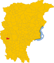
Terno d'Isola (Terno d'Isola)
.svg)
- Italian comune
 Hiking in Terno d'Isola
Terno d'Isola is a charming town located in the province of Bergamo, Lombardy, Italy. While it’s not typically recognized as a primary hiking destination, the surrounding region offers some lovely trails and opportunities for outdoor activities. Here are some insights about hiking in and around Terno d'Isola:
Local Trails
-
Nature Trails: The area has various nature trails that wind through picturesque landscapes, including lush meadows, forests, and agricultural fields. These trails are generally well-marked and suitable for all skill levels.
-
Sentiero dei Mulini: A popular route near Terno d'Isola, this trail leads you along old watermills, providing not only a scenic hike but also a glimpse into the region’s history.
-
Borghi and Villages: Hiking in the surrounding hills can lead you to charming nearby villages such as Ambivere and Capizzaglio, where you can enjoy local culture, cuisine, and stunning views of the countryside.
Nearby Hiking Areas
-
Bergamo Alps: A short drive will take you to the Bergamo Alps, where you can find more challenging hikes with breathtaking views of the surrounding mountains and valleys.
-
Parco dei Colli di Bergamo: This park features numerous trails through diverse terrains, from woodlands to panoramic viewpoints. It’s an excellent place for hiking enthusiasts looking for a more rugged experience.
Tips for Hiking in Terno d'Isola
- Weather Considerations: Always check the weather conditions before heading out, especially if you're venturing into higher altitudes.
- Footwear: Wear sturdy hiking shoes for better support and traction, especially if the trails are uneven or steep.
- Local Guidance: Consider hiring a local guide if you’re unfamiliar with the area or want to explore more off-the-beaten-path trails.
- Stay Hydrated and Prepared: Bring enough water and snacks, along with a basic first-aid kit, especially for longer hikes.
Conclusion
While Terno d'Isola itself may not have extensive hiking routes, its proximity to the Bergamo region opens up a wealth of hiking opportunities set against a backdrop of stunning Italian scenery. Make sure to carve out time to enjoy the natural beauty and local culture during your hikes!
- Country:

- Postal Code: 24030
- Local Dialing Code: 035
- Licence Plate Code: BG
- Coordinates: 45° 41' 0" N, 9° 32' 0" E


- GPS tracks (wikiloc): [Link]
- AboveSeaLevel: 299 м m
- Area: 4.13 sq km
- Population: 8106
- Web site: http://www.comune.ternodisola.bg.it
- Wikipedia en: wiki(en)
- Wikipedia: wiki(it)
- Wikidata storage: Wikidata: Q101651
- Wikipedia Commons Gallery: [Link]
- Wikipedia Commons Category: [Link]
- Freebase ID: [/m/0gjf82]
- GeoNames ID: Alt: [6543169]
- VIAF ID: Alt: [304911442]
- OSM relation ID: [45737]
- UN/LOCODE: [ITTDO]
- Trismegistos Geo ID: [31531]
- ISTAT ID: 016213
- Italian cadastre code: L118
Shares border with regions:


Calusco d'Adda
- Italian comune
Hiking in Calusco d'Adda
Calusco d'Adda, located in the Lombardy region of Italy, offers a charming setting for hiking enthusiasts. The area is characterized by picturesque landscapes, rolling hills, and the meandering Adda River. Here are some key points to consider when hiking in and around Calusco d'Adda:...
- Country:
- Postal Code: 24033
- Local Dialing Code: 035
- Licence Plate Code: BG
- Coordinates: 45° 41' 0" N, 9° 29' 0" E
- GPS tracks (wikiloc): [Link]
- AboveSeaLevel: 273 м m
- Area: 8.33 sq km
- Population: 8378
- Web site: [Link]


Carvico
- Italian comune
Hiking in Carvico
Carvico, located in the Lombardy region of Italy, is a charming destination for hikers and nature enthusiasts. Situated near the stunning Orobie Alps and not far from the picturesque Lake Como, Carvico offers a variety of trails that cater to different skill levels, from leisurely walks to more challenging hikes....
- Country:
- Postal Code: 24030
- Local Dialing Code: 035
- Licence Plate Code: BG
- Coordinates: 45° 42' 0" N, 9° 29' 0" E
- GPS tracks (wikiloc): [Link]
- AboveSeaLevel: 287 м m
- Area: 4.59 sq km
- Population: 4659
- Web site: [Link]


Chignolo d'Isola
- Italian comune
Hiking in Chignolo d'Isola
Chignolo d'Isola is a small village located in the Lombardy region of Italy, not far from the larger city of Bergamo. The area surrounding Chignolo d'Isola typically features beautiful landscapes, agricultural fields, and gentle hills, making it suitable for a variety of outdoor activities, including hiking....
- Country:
- Postal Code: 24040
- Local Dialing Code: 035
- Licence Plate Code: BG
- Coordinates: 45° 39' 59" N, 9° 31' 39" E
- GPS tracks (wikiloc): [Link]
- AboveSeaLevel: 229 м m
- Area: 5.55 sq km
- Population: 3417
- Web site: [Link]


Mapello
- Italian comune
Hiking in Mapello
Mapello, located in the Lombardy region of Italy, is a charming area that offers various opportunities for hiking enthusiasts. The landscape surrounding Mapello features rolling hills, woodlands, and scenic views of the surrounding mountains and countryside, making it a great destination for outdoor activities....
- Country:
- Postal Code: 24030
- Local Dialing Code: 035
- Licence Plate Code: BG
- Coordinates: 45° 42' 32" N, 9° 32' 52" E
- GPS tracks (wikiloc): [Link]
- AboveSeaLevel: 255 м m
- Area: 8.66 sq km
- Population: 6840
- Web site: [Link]


Medolago
- Italian comune
Hiking in Medolago
Medolago is a small town located in the Lombardy region of Italy, close to the city of Bergamo. While it may not be as widely known for hiking as some of the more mountainous areas in Italy, there are still opportunities for nature walks and hiking in the surrounding areas....
- Country:
- Postal Code: 24030
- Local Dialing Code: 035
- Licence Plate Code: BG
- Coordinates: 45° 40' 0" N, 9° 30' 0" E
- GPS tracks (wikiloc): [Link]
- AboveSeaLevel: 246 м m
- Area: 3.8 sq km
- Population: 2398
- Web site: [Link]


Sotto il Monte Giovanni XXIII
- Italian comune
Hiking in Sotto il Monte Giovanni XXIII
Sotto il Monte Giovanni XXIII is a picturesque area located in the Lombardy region of Italy, known for its natural beauty, rolling hills, and historical significance, particularly as the birthplace of Pope John XXIII. Hiking in this area offers a blend of serene landscapes, cultural landmarks, and opportunities for various outdoor activities....
- Country:
- Postal Code: 24039
- Local Dialing Code: 035
- Licence Plate Code: BG
- Coordinates: 45° 42' 26" N, 9° 29' 57" E
- GPS tracks (wikiloc): [Link]
- AboveSeaLevel: 305 м m
- Area: 5.02 sq km
- Population: 3864
- Web site: [Link]

Bonate Sopra
- Italian comune
Hiking in Bonate Sopra
Bonate Sopra, located in the Lombardy region of Italy, offers a variety of picturesque landscapes and opportunities for hiking enthusiasts. Nestled close to the hills of Bergamo, this area is ideal for those who enjoy nature and scenic views....
- Country:
- Postal Code: 24040
- Local Dialing Code: 035
- Licence Plate Code: BG
- Coordinates: 45° 40' 55" N, 9° 33' 31" E
- GPS tracks (wikiloc): [Link]
- AboveSeaLevel: 320 м m
- Area: 6.15 sq km
- Population: 10020
- Web site: [Link]