Thenissey (Thenissey)

- commune in Côte-d'Or, France
- Country:

- Postal Code: 21150
- Coordinates: 47° 29' 45" N, 4° 37' 26" E


- GPS tracks (wikiloc): [Link]
- Area: 10.25 sq km
- Population: 121
- Wikipedia en: wiki(en)
- Wikipedia: wiki(fr)
- Wikidata storage: Wikidata: Q636558
- Wikipedia Commons Category: [Link]
- Freebase ID: [/m/03mfw_r]
- GeoNames ID: Alt: [6428910]
- SIREN number: [212106272]
- BnF ID: [15250914d]
- VIAF ID: Alt: [307295061]
- INSEE municipality code: 21627
Shares border with regions:
Gissey-sous-Flavigny
- commune in Côte-d'Or, France
- Country:
- Postal Code: 21150
- Coordinates: 47° 30' 46" N, 4° 35' 26" E
- GPS tracks (wikiloc): [Link]
- Area: 10.29 sq km
- Population: 89
- Web site: [Link]
Hauteroche
- commune in Côte-d'Or, France
- Country:
- Postal Code: 21150
- Coordinates: 47° 30' 2" N, 4° 34' 52" E
- GPS tracks (wikiloc): [Link]
- Area: 13.28 sq km
- Population: 76
- Web site: [Link]

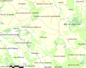
Frôlois
- commune in Côte-d'Or, France
- Country:
- Postal Code: 21150
- Coordinates: 47° 31' 47" N, 4° 37' 52" E
- GPS tracks (wikiloc): [Link]
- Area: 34.77 sq km
- Population: 176


Boux-sous-Salmaise
- commune in Côte-d'Or, France
- Country:
- Postal Code: 21690
- Coordinates: 47° 28' 25" N, 4° 38' 19" E
- GPS tracks (wikiloc): [Link]
- AboveSeaLevel: 310 м m
- Area: 14.64 sq km
- Population: 128