Thiébouhans (Thiébouhans)

- commune in Doubs, France
 Hiking in Thiébouhans
Thiébouhans is a charming village located in the Doubs department of the Bourgogne-Franche-Comté region in eastern France. While it may not be as widely known as some other hiking destinations, it offers picturesque landscapes and opportunities for outdoor activities.
Hiking Opportunities
-
Scenic Trails: The region around Thiébouhans features lush forests, rolling hills, and scenic views of the surrounding countryside. There are various walking and hiking trails that cater to different skill levels, from easy strolls to more challenging routes.
-
Nature and Wildlife: As you hike in and around Thiébouhans, you might encounter diverse flora and fauna. The area is known for its natural beauty, making it a perfect spot for nature enthusiasts and photographers.
-
Nearby Natural Attractions: Consider exploring nearby natural sites, such as the Doubs River, which offers opportunities for additional outdoor activities such as kayaking or fishing.
Preparation Tips
- Trail Maps: It's advisable to obtain relevant trail maps or information from local resources, as some trails may not be well-marked.
- Weather Considerations: Check the weather conditions before heading out, as they can change rapidly in mountainous regions.
- Gear: Wear sturdy hiking boots and dress in layers to adapt to changing temperatures. Carry enough water and snacks for your hike.
Local Culture
While hiking, take time to enjoy the local culture. You might find small farms, artisanal shops, and local cuisine that reflect the rich traditions of the region.
Conclusion
Hiking in Thiébouhans is a delightful way to experience the natural beauty and rural charm of the Bourgogne-Franche-Comté region. Whether you're looking for a tranquil day hike or a more challenging adventure, you’ll find plenty of options to explore the serene landscapes surrounding this quaint village.
- Country:

- Postal Code: 25470
- Coordinates: 47° 16' 51" N, 6° 50' 47" E


- GPS tracks (wikiloc): [Link]
- Area: 5.81 sq km
- Population: 253
- Wikipedia en: wiki(en)
- Wikipedia: wiki(fr)
- Wikidata storage: Wikidata: Q906681
- Wikipedia Commons Category: [Link]
- Freebase ID: [/m/03mhd94]
- GeoNames ID: Alt: [6430008]
- SIREN number: [212505598]
- BnF ID: [15252785v]
- INSEE municipality code: 25559
Shares border with regions:


Cernay-l'Église
- commune in Doubs, France
Hiking in Cernay-l'Église
Cernay-l'Église, located in the northeastern part of France, is surrounded by beautiful natural landscapes that offer various hiking opportunities for enthusiasts. While it may not be as well-known as some other hiking destinations in the country, its rural charm and proximity to nature make it a lovely spot for outdoor activities....
- Country:
- Postal Code: 25120
- Coordinates: 47° 15' 26" N, 6° 49' 51" E
- GPS tracks (wikiloc): [Link]
- Area: 5.95 sq km
- Population: 304


Maîche
- commune in Doubs, France
Hiking in Maîche
Maîche is a charming town located in the Doubs department of France, nestled in the Jura Mountains. This region is known for its stunning landscapes, rich biodiversity, and various outdoor activities, including hiking. Here are some highlights about hiking in and around Maîche:...
- Country:
- Postal Code: 25120
- Coordinates: 47° 15' 4" N, 6° 48' 13" E
- GPS tracks (wikiloc): [Link]
- Area: 17.42 sq km
- Population: 4273
- Web site: [Link]

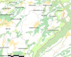
Damprichard
- commune in Doubs, France
Hiking in Damprichard
Damprichard is a charming commune located in the Doubs department of the Bourgogne-Franche-Comté region in eastern France. It offers a picturesque setting for outdoor enthusiasts, especially hikers. Here are some highlights about hiking in and around Damprichard:...
- Country:
- Postal Code: 25450
- Coordinates: 47° 14' 40" N, 6° 52' 53" E
- GPS tracks (wikiloc): [Link]
- Area: 21.9 sq km
- Population: 1872
- Web site: [Link]


Les Bréseux
- commune in Doubs, France
Hiking in Les Bréseux
Les Bréseux, a picturesque area located in the Jura Mountains of France near the Swiss border, offers a variety of hiking trails that cater to different skill levels and preferences. Here are some highlights about hiking in Les Bréseux:...
- Country:
- Postal Code: 25120
- Coordinates: 47° 16' 21" N, 6° 48' 37" E
- GPS tracks (wikiloc): [Link]
- Area: 7.37 sq km
- Population: 489

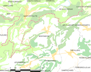
Montandon
- commune in Doubs, France
Hiking in Montandon
Montandon, located in Pennsylvania, offers a range of hiking opportunities that are suitable for various skill levels. While it may not be as widely known as some of the larger national parks or mountainous regions, the surrounding landscapes and natural beauty make it a great spot for outdoor enthusiasts....
- Country:
- Postal Code: 25190
- Coordinates: 47° 18' 14" N, 6° 50' 23" E
- GPS tracks (wikiloc): [Link]
- Area: 12.71 sq km
- Population: 408


Trévillers
- commune in Doubs, France
Hiking in Trévillers
Trévillers is a charming village located in the Jura region of France, which offers stunning landscapes and a variety of hiking opportunities. The area's natural beauty features dense forests, rolling hills, and breathtaking views, making it a great destination for outdoor enthusiasts....
- Country:
- Postal Code: 25470
- Coordinates: 47° 16' 56" N, 6° 52' 10" E
- GPS tracks (wikiloc): [Link]
- Area: 10.74 sq km
- Population: 481