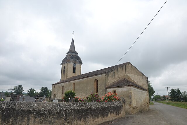
Tieste-Uragnoux (Tieste-Uragnoux)

- commune in Gers, France
- Country:

- Postal Code: 32160
- Coordinates: 43° 32' 58" N, 0° 2' 16" E


- GPS tracks (wikiloc): [Link]
- Area: 6.1 sq km
- Population: 173
- Wikipedia en: wiki(en)
- Wikipedia: wiki(fr)
- Wikidata storage: Wikidata: Q735195
- Wikipedia Commons Category: [Link]
- Freebase ID: [/m/03nrvh0]
- Freebase ID: [/m/03nrvh0]
- GeoNames ID: Alt: [6432152]
- GeoNames ID: Alt: [6432152]
- SIREN number: [213204456]
- SIREN number: [213204456]
- BnF ID: [15256031z]
- BnF ID: [15256031z]
- INSEE municipality code: 32445
- INSEE municipality code: 32445
Shares border with regions:


Hères
- commune in Hautes-Pyrénées, France
- Country:
- Postal Code: 65700
- Coordinates: 43° 33' 11" N, 0° 0' 0" E
- GPS tracks (wikiloc): [Link]
- AboveSeaLevel: 148 м m
- Area: 5.89 sq km
- Population: 131


Labatut-Rivière
- commune in Hautes-Pyrénées, France
- Country:
- Postal Code: 65700
- Coordinates: 43° 31' 36" N, 0° 2' 0" E
- GPS tracks (wikiloc): [Link]
- Area: 12.71 sq km
- Population: 425
- Web site: [Link]
Saint-Aunix-Lengros
- commune in Gers, France
- Country:
- Postal Code: 32160
- Coordinates: 43° 34' 40" N, 0° 3' 6" E
- GPS tracks (wikiloc): [Link]
- Area: 5.36 sq km
- Population: 143


Ladevèze-Ville
- commune in Gers, France
- Country:
- Postal Code: 32230
- Coordinates: 43° 32' 10" N, 0° 3' 29" E
- GPS tracks (wikiloc): [Link]
- Area: 9.09 sq km
- Population: 262

Jû-Belloc
- commune in Gers, France
- Country:
- Postal Code: 32160
- Coordinates: 43° 34' 58" N, 0° 0' 18" E
- GPS tracks (wikiloc): [Link]
- AboveSeaLevel: 139 м m
- Area: 10.01 sq km
- Population: 302