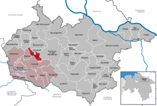
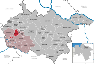
Tostedt (Samtgemeinde Tostedt)

- Samtgemeinde in Lower Saxony
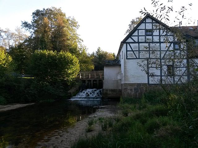
 Hiking in Tostedt
Tostedt, located in the Samtgemeinde area of Lower Saxony, Germany, offers a serene backdrop for hiking enthusiasts. The region features a mix of scenic countryside, forests, and charming villages, making it an ideal destination for both casual walkers and more serious hikers.
Key Highlights for Hiking in Tostedt:
-
Nature Trails: There are several well-marked hiking trails that take you through beautiful landscapes, including meadows, woodlands, and along rivers. Many trails cater to different skill levels, from easy strolls for families to more challenging routes for seasoned hikers.
-
Forests: The surrounding woodlands, such as those found in nearby Lüneburg Heath, provide shaded paths and the chance to encounter local wildlife. Bring your binoculars for birdwatching or simply enjoy the tranquility of the forest.
-
Cultural Sightseeing: While hiking, you may come across historical sites like old farms and traditional architecture unique to the region. This offers an opportunity to merge outdoor activity with cultural exploration.
-
Local Amenities: Tostedt itself has various facilities, including eateries and places to stay, where you can sample local cuisine or rest after a long hike. Ensure you plan your route to include stops for refreshments.
-
Accessibility: The region is accessible by public transport, making it easy to reach starting points for different hiking routes. It’s suggested to check local bus or train schedules ahead of your visit.
-
Seasonal Recommendations: The best time to hike in Tostedt is during spring and autumn when the weather is mild, and nature is particularly beautiful. However, summer is also a popular time for hiking, though it may be more crowded.
Tips for Hikers:
- Preparation: Always bring adequate water, snacks, and a first-aid kit. Wear appropriate footwear and clothing for varying weather conditions.
- Navigation: Use a reliable map or a GPS app to navigate the trails effectively. While many paths are well-marked, it's helpful to be aware of your surroundings.
- Respect Nature: Stay on marked trails to minimize impact on the environment. Dispose of waste responsibly and follow local guidelines for wildlife interactions.
Overall, Tostedt offers a peaceful and scenic hiking experience, making it a wonderful choice for those looking to escape into nature in Lower Saxony. Enjoy your hiking adventure!
- Country:

- Coordinates: 53° 17' 0" N, 9° 43' 0" E


- GPS tracks (wikiloc): [Link]
- Area: 221.29 sq km
- Population: 26497
- Web site: https://www.tostedt.de/
- Wikipedia en: wiki(en)
- Wikipedia: wiki(de)
- Wikidata storage: Wikidata: Q460518
- Wikipedia Commons Category: [Link]
- Freebase ID: [/m/02v_vx_]
- Freebase ID: [/m/02v_vx_]
- VIAF ID: Alt: [247835471]
- VIAF ID: Alt: [247835471]
- GND ID: Alt: [4600657-6]
- GND ID: Alt: [4600657-6]
- German regional key: 033535406
- German regional key: 033535406
Includes regions:
Heidenau
- municipality in Lower Saxony, Germany
Hiking in Heidenau
Heidenau, located in Lower Saxony, is surrounded by beautiful landscapes that offer a variety of hiking opportunities. The area is characterized by rolling hills, forests, and scenic views, making it a great destination for both casual walkers and more experienced hikers....
- Country:
- Postal Code: 21258
- Local Dialing Code: 04182
- Licence Plate Code: WL
- Coordinates: 53° 19' 0" N, 9° 40' 0" E
- GPS tracks (wikiloc): [Link]
- AboveSeaLevel: 48 м m
- Area: 38.9 sq km
- Population: 2222
- Web site: [Link]
Königsmoor
- municipality in the district of Harburg, Lower Saxony, Germany
Hiking in Königsmoor
Königsmoor, located in the northern part of Germany, is a beautiful nature reserve that offers a unique hiking experience through its moorland landscapes. Here are some features and tips for hiking in Königsmoor:...
- Country:
- Postal Code: 21255
- Local Dialing Code: 04180
- Licence Plate Code: WL
- Coordinates: 53° 13' 59" N, 9° 39' 0" E
- GPS tracks (wikiloc): [Link]
- AboveSeaLevel: 39 м m
- Area: 10.01 sq km
- Population: 611
- Web site: [Link]
Kakenstorf
- municipality of Germany
Hiking in Kakenstorf
Kakenstorf is a small village in Lower Saxony, Germany, located near the larger city of Hamburg. While it may not be a prominent hiking destination, there are several opportunities for nature walks and hikes in the surrounding areas, particularly in the Lüneburg Heath (Lüneburger Heide) region, which is accessible from Kakenstorf....
- Country:
- Postal Code: 21255
- Local Dialing Code: 04186
- Licence Plate Code: WL
- Coordinates: 53° 19' 0" N, 9° 46' 0" E
- GPS tracks (wikiloc): [Link]
- AboveSeaLevel: 46 м m
- Area: 38.71 sq km
- Population: 1393
- Web site: [Link]


Tostedt
- municipality of Germany
Hiking in Tostedt
Tostedt is a small town located in Lower Saxony, Germany, and while it might not be as well-known for hiking as some of the larger parks or regions, it offers some lovely opportunities for outdoor enthusiasts. Here are some details about hiking in and around Tostedt:...
- Country:
- Postal Code: 21255
- Local Dialing Code: 04182
- Licence Plate Code: WL
- Coordinates: 53° 17' 0" N, 9° 43' 0" E
- GPS tracks (wikiloc): [Link]
- AboveSeaLevel: 61 м m
- Area: 48.24 sq km
- Population: 13895
- Web site: [Link]


Wistedt
- municipality of Germany
Hiking in Wistedt
Wistedt is a small village located in Lower Saxony, Germany. While it may not be widely known for extensive hiking trails compared to larger national parks or mountainous areas, the surrounding region does offer some opportunities for outdoor activities, including hiking. Here are some points to consider when hiking in and around Wistedt:...
- Country:
- Postal Code: 21255
- Local Dialing Code: 04182
- Licence Plate Code: WL
- Coordinates: 53° 16' 0" N, 9° 41' 0" E
- GPS tracks (wikiloc): [Link]
- AboveSeaLevel: 45 м m
- Area: 18.49 sq km
- Population: 1754
- Web site: [Link]


Welle
- municipality of Germany
Hiking in Welle
Welle, Germany, is a small village located in the picturesque region of Lower Saxony, surrounded by beautiful landscapes that are perfect for hiking. The area offers a variety of trails, ranging from easy walks to more challenging hikes, making it suitable for hikers of all skill levels....
- Country:
- Postal Code: 21261
- Local Dialing Code: 04188
- Licence Plate Code: WL
- Coordinates: 53° 13' 0" N, 9° 48' 0" E
- GPS tracks (wikiloc): [Link]
- AboveSeaLevel: 49 м m
- Area: 19.93 sq km
- Population: 1177
- Web site: [Link]


Otter
- municipality of Germany
Hiking in Otter
Otter, Germany, is a small village located in the northern part of the country, close to the town of Salzwedel in the state of Saxony-Anhalt. While it may not be a well-known hiking destination, the surrounding areas offer numerous opportunities for outdoor activities amidst picturesque landscapes....
- Country:
- Postal Code: 21259
- Local Dialing Code: 04182
- Licence Plate Code: WL
- Coordinates: 53° 14' 0" N, 9° 44' 0" E
- GPS tracks (wikiloc): [Link]
- AboveSeaLevel: 47 м m
- Area: 34.13 sq km
- Population: 1706
- Web site: [Link]


Handeloh
- municipality of Germany
Hiking in Handeloh
Handeloh is a charming village located in Lower Saxony, Germany, and it offers a variety of hiking opportunities for outdoor enthusiasts. While not as widely known as some larger hiking destinations, the area is characterized by its beautiful landscapes, woodlands, and serene countryside, making it an appealing spot for local hikes....
- Country:
- Postal Code: 21256
- Local Dialing Code: 04188
- Licence Plate Code: WL
- Coordinates: 53° 14' 44" N, 9° 50' 21" E
- GPS tracks (wikiloc): [Link]
- AboveSeaLevel: 56 м m
- Area: 26.91 sq km
- Population: 2488
- Web site: [Link]

Dohren
- municipality in the district of Harburg, in Lower Saxony, Germany
Hiking in Dohren
Dohren is a small town in Lower Saxony, Germany, known for its picturesque countryside and access to various outdoor activities, including hiking. While it may not have an extensive network of marked trails like some larger national parks, there are still opportunities for enjoyable hikes in the surrounding area....
- Country:
- Postal Code: 21255
- Local Dialing Code: 04182
- Licence Plate Code: WL
- Coordinates: 53° 18' 18" N, 9° 42' 9" E
- GPS tracks (wikiloc): [Link]
- AboveSeaLevel: 54 м m
- Area: 11.25 sq km
- Population: 1196
- Web site: [Link]