Trémouille-Saint-Loup (Trémouille-Saint-Loup)

- commune in Puy-de-Dôme, France
- Country:

- Postal Code: 63810
- Coordinates: 45° 29' 26" N, 2° 33' 39" E


- GPS tracks (wikiloc): [Link]
- Area: 12.23 sq km
- Population: 139
- Wikipedia en: wiki(en)
- Wikipedia: wiki(fr)
- Wikidata storage: Wikidata: Q629041
- Wikipedia Commons Category: [Link]
- Freebase ID: [/m/03ql3lw]
- GeoNames ID: Alt: [6440258]
- SIREN number: [216304378]
- BnF ID: [15269787f]
- INSEE municipality code: 63437
Shares border with regions:


Labessette
- commune in Puy-de-Dôme, France
- Country:
- Postal Code: 63690
- Coordinates: 45° 29' 21" N, 2° 32' 15" E
- GPS tracks (wikiloc): [Link]
- Area: 10.45 sq km
- Population: 61

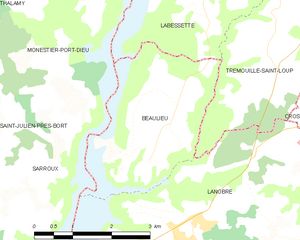
Beaulieu
- commune in Cantal, France
- Country:
- Postal Code: 15270
- Coordinates: 45° 27' 24" N, 2° 30' 43" E
- GPS tracks (wikiloc): [Link]
- AboveSeaLevel: 620 м m
- Area: 7.64 sq km
- Population: 90

Cros
- commune in Puy-de-Dôme, France
- Country:
- Postal Code: 63810
- Coordinates: 45° 28' 26" N, 2° 36' 6" E
- GPS tracks (wikiloc): [Link]
- AboveSeaLevel: 798 м m
- Area: 19.62 sq km
- Population: 178
- Web site: [Link]

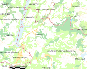
Lanobre
- commune in Cantal, France
- Country:
- Postal Code: 15270
- Coordinates: 45° 26' 19" N, 2° 32' 4" E
- GPS tracks (wikiloc): [Link]
- Area: 40.99 sq km
- Population: 1432
- Web site: [Link]


Larodde
- commune in Puy-de-Dôme, France
- Country:
- Postal Code: 63690
- Coordinates: 45° 31' 33" N, 2° 33' 0" E
- GPS tracks (wikiloc): [Link]
- Area: 23.04 sq km
- Population: 267


Bagnols
- commune in Puy-de-Dôme, France
- Country:
- Postal Code: 63810
- Coordinates: 45° 30' 1" N, 2° 37' 56" E
- GPS tracks (wikiloc): [Link]
- Area: 42.46 sq km
- Population: 440