Trades (Trades)

- commune in Rhône, France
- Country:

- Postal Code: 69860
- Coordinates: 46° 16' 41" N, 4° 33' 42" E


- GPS tracks (wikiloc): [Link]
- Area: 7.93 sq km
- Population: 115
- Wikipedia en: wiki(en)
- Wikipedia: wiki(fr)
- Wikidata storage: Wikidata: Q634009
- Wikipedia Commons Category: [Link]
- Freebase ID: [/m/03qljhr]
- GeoNames ID: Alt: [6441803]
- SIREN number: [216902510]
- BnF ID: [152723379]
- INSEE municipality code: 69251
Shares border with regions:


Saint-Mamert
- commune in Rhône, France
- Country:
- Postal Code: 69860
- Coordinates: 46° 15' 2" N, 4° 34' 57" E
- GPS tracks (wikiloc): [Link]
- Area: 3.21 sq km
- Population: 67


Saint-Christophe
- commune in Rhône, France
- Country:
- Postal Code: 69860
- Coordinates: 46° 15' 43" N, 4° 32' 31" E
- GPS tracks (wikiloc): [Link]
- AboveSeaLevel: 512 м m
- Area: 14.62 sq km
- Population: 240


Saint-Jacques-des-Arrêts
- commune in Rhône, France
- Country:
- Postal Code: 69860
- Coordinates: 46° 15' 21" N, 4° 35' 51" E
- GPS tracks (wikiloc): [Link]
- Area: 7.47 sq km
- Population: 101


Germolles-sur-Grosne
- commune in Saône-et-Loire, France
- Country:
- Postal Code: 71520
- Coordinates: 46° 16' 46" N, 4° 35' 24" E
- GPS tracks (wikiloc): [Link]
- AboveSeaLevel: 250 м m
- Area: 7.23 sq km
- Population: 128

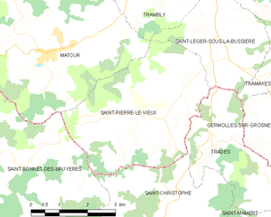
Saint-Pierre-le-Vieux
- commune in Saône-et-Loire, France
- Country:
- Postal Code: 71520
- Coordinates: 46° 17' 7" N, 4° 32' 10" E
- GPS tracks (wikiloc): [Link]
- Area: 15.79 sq km
- Population: 350
- Web site: [Link]


Saint-Léger-sous-la-Bussière
- commune in Saône-et-Loire, France
- Country:
- Postal Code: 71520
- Coordinates: 46° 18' 39" N, 4° 33' 42" E
- GPS tracks (wikiloc): [Link]
- AboveSeaLevel: 312 м m
- Area: 8.64 sq km
- Population: 251