Tribano (Tribano)
.svg)
- Italian comune
 Hiking in Tribano
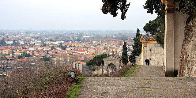
Tribano is a small town located in the Veneto region of Italy, near Padua. While it may not be a widely known hiking destination, the surrounding areas offer beautiful scenery and opportunities for outdoor activities. Here are some options and tips for hiking around Tribano:
Nearby Hiking Areas:
-
Colli Euganei Regional Park:
- Just a short drive from Tribano, this park features rolling hills, vineyards, and quaint villages. There are numerous trails of varying difficulty levels, making it perfect for both novice and experienced hikers.
- Trails: Look for routes like the trail to Monte Venda or the paths around the charming village of Arquà Petrarca, where you can enjoy beautiful views and local history.
-
The Brenta River:
- Hiking along the Brenta River, especially in the stretches near Padua, offers a unique landscape with lush greenery, river views, and the chance to spot local wildlife.
-
Parco Regionale dei Colli Euganei:
- This park offers well-marked trails, historical sites, and a chance to explore the natural beauty of the Euganean Hills. It also includes thermal springs and various lookout points.
Hiking Tips:
- Seasonal Considerations: Spring and early autumn are ideal for hiking in the Veneto region due to mild weather. Summer can be hot, so early morning hikes are preferable.
- Trail Conditions: Always check current trail conditions before heading out and ensure you have a map or a reliable GPS device.
- Gear: Wear sturdy hiking shoes, and bring plenty of water, snacks, and a first aid kit.
- Respect Nature: Follow Leave No Trace principles, making sure to pack out what you pack in.
Local Culture:
Engaging with locals can enhance your hiking experience. Consider stopping by local farms or vineyards for tastings or to learn about local agricultural practices. Also, be sure to visit historic areas for a glimpse into the region’s rich culture and history.
While Tribano itself may not have extensive hiking trails, its proximity to beautiful natural parks and areas makes it a good base for outdoor exploration in the Veneto region. Always check local information sources for any guided hikes or tours available. Happy hiking!
- Country:

- Postal Code: 35020
- Local Dialing Code: 049
- Licence Plate Code: PD
- Coordinates: 45° 13' 0" N, 11° 50' 0" E


- GPS tracks (wikiloc): [Link]
- AboveSeaLevel: 7 м m
- Area: 19.23 sq km
- Population: 4376
- Web site: http://www.comuneditribano.com
- Wikipedia en: wiki(en)
- Wikipedia: wiki(it)
- Wikidata storage: Wikidata: Q34702
- Wikipedia Commons Category: [Link]
- Freebase ID: [/m/0gk5wp]
- GeoNames ID: Alt: [6536675]
- OSM relation ID: [44366]
- UN/LOCODE: [ITBOD]
- ISTAT ID: 028094
- Italian cadastre code: L414
Shares border with regions:

Pozzonovo
- Italian comune
Hiking in Pozzonovo
Pozzonovo is a small town located in the Veneto region of Italy, surrounded by beautiful landscapes and a rich natural environment. While it may not be a prominent hiking destination like the nearby Dolomites, there are still some pleasant walking and hiking opportunities in and around Pozzonovo....
- Country:
- Postal Code: 35020
- Local Dialing Code: 0429
- Licence Plate Code: PD
- Coordinates: 45° 12' 0" N, 11° 47' 0" E
- GPS tracks (wikiloc): [Link]
- AboveSeaLevel: 6 м m
- Area: 24.48 sq km
- Population: 3571
- Web site: [Link]
San Pietro Viminario
- Italian comune
Hiking in San Pietro Viminario
San Pietro Viminario, located in the province of Padua in Italy, offers a unique blend of natural beauty and historical charm for hiking enthusiasts. While it is not as widely known as some of the surrounding areas, it provides opportunities for exploration and appreciation of the local landscape....
- Country:
- Postal Code: 35020
- Local Dialing Code: 0429
- Licence Plate Code: PD
- Coordinates: 45° 15' 0" N, 11° 49' 0" E
- GPS tracks (wikiloc): [Link]
- AboveSeaLevel: 7 м m
- Area: 13.31 sq km
- Population: 3032
- Web site: [Link]
Conselve
- Italian comune
Hiking in Conselve
Conselve is a small town located in the Province of Padua in the Veneto region of Italy. While it's not widely known as a hiking destination, it can serve as a great base for exploring the beautiful surrounding landscapes, particularly the regional parks and natural areas in the vicinity....
- Country:
- Postal Code: 35026
- Local Dialing Code: 049
- Licence Plate Code: PD
- Coordinates: 45° 14' 0" N, 11° 52' 0" E
- GPS tracks (wikiloc): [Link]
- AboveSeaLevel: 7 м m
- Area: 24.29 sq km
- Population: 10224
- Web site: [Link]

Bagnoli di Sopra
- Italian comune
Hiking in Bagnoli di Sopra
Bagnoli di Sopra is a charming town in the Veneto region of Italy, located near the banks of the Adige River. While the town itself may not be widely known for extensive hiking trails, it offers access to the surrounding natural beauty, including wetlands, riversides, and picturesque countryside that can be explored on foot....
- Country:
- Postal Code: 35023
- Local Dialing Code: 049
- Licence Plate Code: PD
- Coordinates: 45° 11' 0" N, 11° 53' 0" E
- GPS tracks (wikiloc): [Link]
- AboveSeaLevel: 5 м m
- Area: 34.98 sq km
- Population: 3612
- Web site: [Link]
Monselice
- Italian comune
Hiking in Monselice
Monselice, located in the Veneto region of Italy, is a charming town that offers a variety of hiking opportunities, particularly in the surrounding Euganean Hills (Colli Euganei). The area is known for its beautiful landscapes, historical sites, and diverse flora and fauna....
- Country:
- Postal Code: 35043
- Local Dialing Code: 0429
- Licence Plate Code: PD
- Coordinates: 45° 14' 0" N, 11° 45' 0" E
- GPS tracks (wikiloc): [Link]
- AboveSeaLevel: 9 м m
- Area: 50.57 sq km
- Population: 17572
- Web site: [Link]

Anguillara Veneta
- Italian comune
Hiking in Anguillara Veneta
Anguillara Veneta is a charming town located in the province of Padua in the Veneto region of Italy. While it may not be as famous for hiking as some of the larger mountain ranges in Italy, it offers some delightful trails and scenic spots for those looking to enjoy nature and the surrounding countryside....
- Country:
- Postal Code: 35022
- Local Dialing Code: 049
- Licence Plate Code: PD
- Coordinates: 45° 9' 0" N, 11° 53' 0" E
- GPS tracks (wikiloc): [Link]
- AboveSeaLevel: 6 м m
- Area: 21.67 sq km
- Population: 4325
- Web site: [Link]