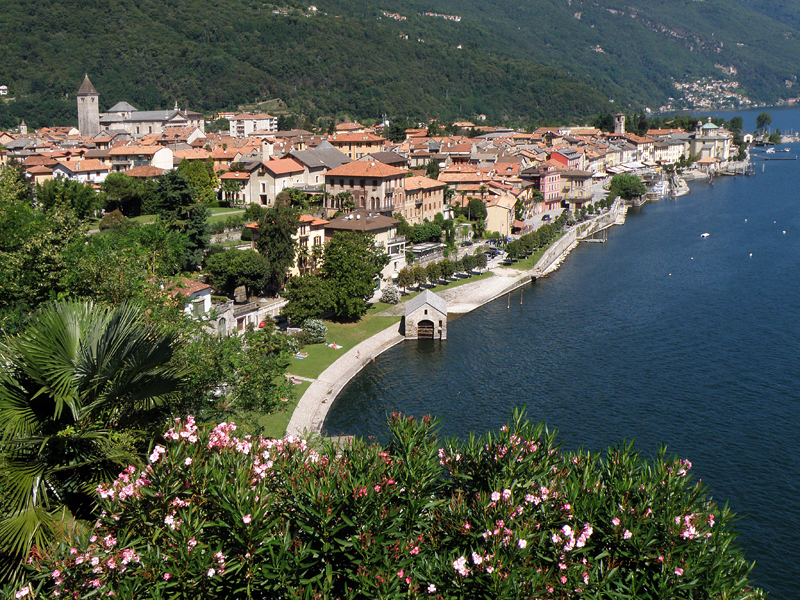
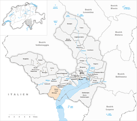
Tronzano Lago Maggiore (Tronzano Lago Maggiore)
- Italian comune
 Hiking in Tronzano Lago Maggiore
Tronzano Lago Maggiore, located in the picturesque region of Piedmont in Italy, offers breathtaking landscapes, serene lakeside views, and a variety of hiking opportunities suitable for different skill levels. The area is part of the larger Lago Maggiore region, renowned for its natural beauty, charming villages, and cultural heritage.
Hiking Trails
-
Sentiero Verde (Green Trail): This is a relatively easy trail that winds along the lakeshore, offering stunning views of Lago Maggiore. It’s suitable for families and those looking for a leisurely hike.
-
Monte Sasso del Ferro: For more experienced hikers, the trail leading to Monte Sasso del Ferro provides a moderate challenge. The summit offers panoramic views of the lake and surrounding mountains.
-
Sentiero della Poesia (Poetry Trail): A scenic trail that combines nature with art, featuring installations and poetry along the path. This trail is ideal for those looking to enjoy a relaxing hike while engaging with the arts.
-
Hikes to Nearby Villages: You can hike to nearby villages like Ghiffa or Oggebbio, which allow you to experience local culture, cuisine, and historical sites along the way.
Tips for Hiking in Tronzano Lago Maggiore
-
Weather: Always check the weather forecast before heading out. The region can experience sudden changes in weather, especially in the mountains.
-
Trail Maps: Obtain a detailed trail map or use a hiking app for navigation. Some trails may not be well-marked.
-
Safety: Carry enough water and snacks, wear appropriate footwear, and inform someone of your hiking plans.
-
Best Time to Hike: Spring (April to June) and early autumn (September to October) are the best times for hiking, with milder temperatures and vibrant landscapes.
-
Local Regulations: Respect local wildlife and natural surroundings. Follow any guidelines presented for each trail.
Nearby Attractions
After your hike, you can explore the area’s charming villages, enjoy local cuisine in the restaurants, or take a boat trip on the lake to appreciate the stunning scenery from a different perspective.
Overall, Tronzano Lago Maggiore offers a wonderful blend of outdoor adventure and cultural experiences for hikers of all levels. Happy hiking!
- Country:

- Postal Code: 21010
- Local Dialing Code: 0332
- Licence Plate Code: VA
- Coordinates: 46° 5' 0" N, 8° 44' 0" E


- GPS tracks (wikiloc): [Link]
- AboveSeaLevel: 342 м m
- Area: 11.06 sq km
- Population: 236
- Web site: http://www.comune.tronzanolagomaggiore.va.it
- Wikipedia en: wiki(en)
- Wikipedia: wiki(it)
- Wikidata storage: Wikidata: Q39819
- Wikipedia Commons Category: [Link]
- Freebase ID: [/m/0ghzws]
- GeoNames ID: Alt: [6536490]
- OSM relation ID: [46843]
- NKCR AUT ID: [ge919928]
- ISTAT ID: 012129
- Italian cadastre code: A705
Shares border with regions:
Maccagno con Pino e Veddasca
- Italian comune
 Hiking in Maccagno con Pino e Veddasca
Maccagno con Pino e Veddasca is a charming municipality located in the province of Varese, Lombardy, Italy. Nestled near Lake Maggiore, it offers a diverse range of hiking opportunities, showcasing stunning views, natural beauty, and cultural heritage....
- Country:

- Postal Code: 21061
- Local Dialing Code: 0332
- Licence Plate Code: VA
- Coordinates: 46° 3' 0" N, 8° 44' 0" E


- GPS tracks (wikiloc): [Link]
- AboveSeaLevel: 210 м m
- Area: 41.96 sq km
- Population: 2585
- Web site: [Link]

Cannobio
- Italian comune
Cannobio is a picturesque town located on the shores of Lake Maggiore in the Piedmont region of Italy. It's known for its stunning landscapes, charming old town, and access to various hiking trails that offer breathtaking views of the lake and surrounding mountains. Here are some highlights for hiking in and around Cannobio:...
- Country:

- Postal Code: 28822
- Local Dialing Code: 0323
- Licence Plate Code: VB
- Coordinates: 46° 4' 0" N, 8° 42' 0" E


- GPS tracks (wikiloc): [Link]
- AboveSeaLevel: 214 м m
- Area: 52.53 sq km
- Population: 5162
- Web site: [Link]


Brissago
- municipality in the canton of Ticino, Switzerland
Brissago, located in the southern part of Switzerland in the canton of Ticino, is a beautiful destination for hiking enthusiasts. Nestled along the shores of Lake Maggiore, it features stunning landscapes, Mediterranean vegetation, and breathtaking views....
- Country:

- Postal Code: 6614
- Local Dialing Code: 091
- Licence Plate Code: TI
- Coordinates: 46° 7' 0" N, 8° 42' 0" E


- GPS tracks (wikiloc): [Link]
- AboveSeaLevel: 197 м m
- Area: 17.8 sq km
- Population: 1773
- Web site: [Link]
