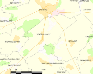
Troussencourt (Troussencourt)

- commune in Oise, France
- Country:

- Postal Code: 60120
- Coordinates: 49° 36' 25" N, 2° 15' 15" E


- GPS tracks (wikiloc): [Link]
- Area: 5.33 sq km
- Population: 347
- Web site: http://www.troussencourt.fr
- Wikipedia en: wiki(en)
- Wikipedia: wiki(fr)
- Wikidata storage: Wikidata: Q1334299
- Wikipedia Commons Category: [Link]
- Freebase ID: [/m/03qg7mt]
- GeoNames ID: Alt: [6439009]
- SIREN number: [216006395]
- BnF ID: [152678815]
- PACTOLS thesaurus ID: [pcrt04V70r78qo]
- INSEE municipality code: 60648
Shares border with regions:


Sainte-Eusoye
- commune in Oise, France
- Country:
- Postal Code: 60480
- Coordinates: 49° 34' 37" N, 2° 14' 43" E
- GPS tracks (wikiloc): [Link]
- Area: 8.48 sq km
- Population: 306
- Web site: [Link]


Breteuil
- commune in Oise, France
- Country:
- Postal Code: 60120
- Coordinates: 49° 37' 57" N, 2° 17' 36" E
- GPS tracks (wikiloc): [Link]
- Area: 17.27 sq km
- Population: 4534
- Web site: [Link]
Maisoncelle-Tuilerie
- commune in Oise, France
- Country:
- Postal Code: 60480
- Coordinates: 49° 35' 21" N, 2° 13' 12" E
- GPS tracks (wikiloc): [Link]
- Area: 7.72 sq km
- Population: 301


Hardivillers
- commune in Oise, France
- Country:
- Postal Code: 60120
- Coordinates: 49° 36' 59" N, 2° 13' 21" E
- GPS tracks (wikiloc): [Link]
- Area: 9.63 sq km
- Population: 558

Vendeuil-Caply
- commune in Oise, France
- Country:
- Postal Code: 60120
- Coordinates: 49° 36' 27" N, 2° 17' 21" E
- GPS tracks (wikiloc): [Link]
- Area: 10.84 sq km
- Population: 476
- Web site: [Link]