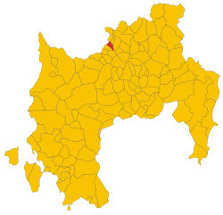
Tuili (Tuili)
%20-%202016.svg)
- Italian comune
 Hiking in Tuili
Tuili, located in the region of Tuili in the Italian countryside, is an emerging destination for hikers looking for beautiful landscapes, diverse trails, and a serene environment. The surrounding hills, forests, and valleys offer numerous hiking opportunities for different skill levels.
Key Features of Hiking in Tuili:
-
Scenic Trails: There are various trails ranging from easy walks to more challenging hikes, allowing hikers to experience the stunning natural beauty of the area. The routes often feature picturesque views of the countryside, native flora, and fauna.
-
Trail Markings: Most hiking trails in Tuili are well-marked, making it easier for hikers to navigate. However, a map or a GPS device is always recommended, especially for less trafficked routes.
-
Seasonal Considerations: The best time to hike in Tuili is usually in spring (April to June) and fall (September to October) when temperatures are milder and the scenery is vibrant. Summer can be hot, and winter conditions may make some trails inaccessible.
-
Wildlife Watching: The area is rich in biodiversity. Hikers might spot various species of birds, deer, and even local wildflowers, enhancing the experience of being in nature.
-
Cultural Experience: While hiking, you may also encounter local vineyards and olive groves, offering opportunities for wine tasting and experiencing the region's culinary delights in local trattorias.
-
Safety Considerations: Always check the weather forecast beforehand and wear appropriate gear. Hiking in pairs or groups is recommended, and carrying plenty of water and snacks is essential, especially on longer hikes.
-
Local Guides: Consider hiring a local guide if you're unfamiliar with the area. They can provide insights into the best trails, local history, and safety tips.
If you plan to hike in Tuili, enjoy the beautiful landscapes and immerse yourself in the tranquility of nature. Don’t forget your camera to capture the unforgettable views!
- Country:

- Postal Code: 09029
- Local Dialing Code: 070
- Licence Plate Code: SU
- Coordinates: 39° 42' 53" N, 8° 57' 35" E


- GPS tracks (wikiloc): [Link]
- AboveSeaLevel: 208 м m
- Area: 24.59 sq km
- Population: 1001
- Web site: http://www.comune.tuili.vs.it/
- Wikipedia en: wiki(en)
- Wikipedia: wiki(it)
- Wikidata storage: Wikidata: Q278730
- Wikipedia Commons Category: [Link]
- Freebase ID: [/m/0gqyh9]
- Freebase ID: [/m/0gqyh9]
- GeoNames ID: Alt: [6539312]
- GeoNames ID: Alt: [6539312]
- VIAF ID: Alt: [245439572]
- VIAF ID: Alt: [245439572]
- OSM relation ID: [40038]
- OSM relation ID: [40038]
- TGN ID: [7037454]
- TGN ID: [7037454]
- ISTAT ID: 111091
- ISTAT ID: 111091
- Italian cadastre code: L463
- Italian cadastre code: L463
Shares border with regions:


Barumini
- Italian comune
Hiking in Barumini
Barumini, located in the south of Sardinia, Italy, is not only famous for its archaeological site, Su Nuraxi, which is recognized as a UNESCO World Heritage Site, but it also offers some beautiful hiking opportunities in the surrounding area. Here are some aspects to consider if you're looking to hike in and around Barumini:...
- Country:
- Postal Code: 09021
- Local Dialing Code: 070
- Licence Plate Code: SU
- Coordinates: 39° 42' 14" N, 9° 0' 13" E
- GPS tracks (wikiloc): [Link]
- AboveSeaLevel: 202 м m
- Area: 26.4 sq km
- Population: 1273
- Web site: [Link]


Gesturi
- Italian comune
Hiking in Gesturi
Gesturi is a charming village located in the heart of Sardinia, Italy, known for its stunning natural landscapes and rich cultural heritage. Hiking in this area can offer a wonderful mix of scenic views, historical sites, and the chance to explore Sardinian flora and fauna. Here are some details to consider when hiking in Gesturi:...
- Country:
- Postal Code: 09020
- Local Dialing Code: 070
- Licence Plate Code: SU
- Coordinates: 39° 43' 59" N, 9° 1' 13" E
- GPS tracks (wikiloc): [Link]
- AboveSeaLevel: 310 м m
- Area: 46.83 sq km
- Population: 1224
- Web site: [Link]


Las Plassas
- Italian comune
Hiking in Las Plassas
Las Plassas is a charming area located in Sardinia, Italy, known for its picturesque landscapes, unique geological formations, and rich flora and fauna, making it an excellent destination for hiking enthusiasts. Here are some key points to consider when hiking in Las Plassas:...
- Country:
- Postal Code: 09020
- Local Dialing Code: 070
- Licence Plate Code: SU
- Coordinates: 39° 40' 48" N, 8° 59' 6" E
- GPS tracks (wikiloc): [Link]
- AboveSeaLevel: 148 м m
- Area: 11.04 sq km
- Population: 231
- Web site: [Link]


Pauli Arbarei
- Italian comune
Hiking in Pauli Arbarei
Pauli Arbarei, located in Sardinia, Italy, is a fantastic destination for hikers looking to experience stunning natural landscapes and diverse terrains. Here are some key points about hiking in this area:...
- Country:
- Postal Code: 09020
- Local Dialing Code: 070
- Licence Plate Code: SU
- Coordinates: 39° 39' 40" N, 8° 55' 19" E
- GPS tracks (wikiloc): [Link]
- AboveSeaLevel: 136 м m
- Area: 15.14 sq km
- Population: 603
- Web site: [Link]
Setzu
- Italian comune
Hiking in Setzu
Setzu is a beautiful destination for hiking enthusiasts, offering a variety of trails that cater to different skill levels. The area is characterized by its stunning natural landscapes, including forests, mountains, and unique geological formations. Here are some key points to consider when hiking in Setzu:...
- Country:
- Postal Code: 09029
- Local Dialing Code: 070
- Licence Plate Code: SU
- Coordinates: 39° 43' 21" N, 8° 56' 18" E
- GPS tracks (wikiloc): [Link]
- AboveSeaLevel: 206 м m
- Area: 7.77 sq km
- Population: 145
- Web site: [Link]

Turri
- Italian comune
Hiking in Turri
Turri, located in the beautiful region of Italy, offers a scenic and diverse landscape perfect for hiking enthusiasts. Here are some key points about hiking in Turri:...
- Country:
- Postal Code: 09020
- Local Dialing Code: 0783
- Licence Plate Code: SU
- Coordinates: 39° 42' 17" N, 8° 54' 59" E
- GPS tracks (wikiloc): [Link]
- AboveSeaLevel: 164 м m
- Area: 9.6 sq km
- Population: 424
- Web site: [Link]