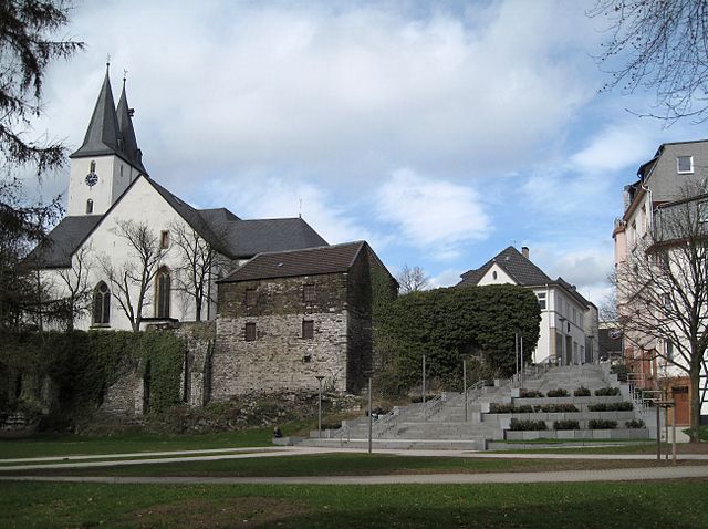
Urnäsch (Urnäsch)
- municipality in Switzerland
Urnäsch is a picturesque village located in the Appenzellerland region of Switzerland, providing a stunning backdrop for hiking enthusiasts. The area is characterized by rolling hills, lush meadows, and stunning views of the surrounding Swiss Alps. Here are some highlights and tips for hiking in Urnäsch:
Trails and Routes
- Appenzeller Trail: This is part of a longer scenic route that takes you through the Appenzell region, offering panoramic views, charming farms, and traditional Swiss chalets.
- Urnäsch to Kronberg: This hike offers an ascent to Kronberg, which rewards you with breathtaking views over the Appenzell Valley and beyond. It’s a moderately challenging hike, suitable for those with some hiking experience.
- Ursula's Trail: A smaller, family-friendly trail that weaves through beautiful landscapes, ideal for shorter excursions or easy strolls with kids.
Key Features
- Scenic Beauty: Expect beautiful alpine meadows, traditional Swiss farms, and breathtaking mountain views. The area is particularly stunning in spring and summer when wildflowers bloom.
- Wildlife: Keep an eye out for local wildlife, including deer, various bird species, and unique flora that thrive in this region.
- Cultural Experience: Hiking around Urnäsch can provide insight into the local culture, including traditional Swiss customs and the unique Appenzeller heritage.
Practical Tips
- Weather Considerations: The weather can change rapidly in the Swiss Alps. Always check forecasts before heading out and bring layers.
- Trail Markings: Trails are well-marked with the Swiss hiking signs, but it’s a good practice to carry a map or a GPS device.
- Start Early: To avoid crowds and enjoy the tranquility of nature, start your hikes early in the morning.
- Safety: Make sure to carry enough water, snacks, and a first aid kit, especially if you plan on longer hikes.
Accessibility
Urnäsch is accessible by public transport, making it easy to reach for day hikes from nearby cities or towns.
Conclusion
Hiking in Urnäsch is a wonderful way to explore the beauty of Swiss nature while enjoying some cultural elements specific to the region. Whether you’re an experienced hiker or a casual walker, there are plenty of trails to suit your preferences. Enjoy your adventure!
- Country:

- Postal Code: 9107
- Local Dialing Code: 071
- Licence Plate Code: AR
- Coordinates: 47° 17' 48" N, 9° 16' 3" E


- GPS tracks (wikiloc): [Link]
- AboveSeaLevel: 866 м m
- Area: 48.3 sq km
- Population: 2315
- Web site: http://www.urnaesch.ch
- Wikipedia en: wiki(en)
- Wikipedia: wiki(de)
- Wikidata storage: Wikidata: Q67168
- Wikipedia Commons Category: [Link]
- Freebase ID: [/m/01v5xz]
- GeoNames ID: Alt: [7287392]
- VIAF ID: Alt: [139608733]
- OSM relation ID: [1683952]
- MusicBrainz area ID: [81d194ce-eba6-47c1-969c-56c89997df68]
- HDS ID: [1298]
- Swiss municipality code: [3006]
Shares border with regions:


Schönengrund
- municipality in Switzerland
Schönengrund is a picturesque village located in the Appenzell Innerrhoden region of Switzerland, surrounded by stunning landscapes and natural beauty. Hiking in and around Schönengrund offers a variety of trails that cater to different skill levels, making it a fantastic destination for both novice and experienced hikers....
- Country:

- Postal Code: 9105
- Local Dialing Code: 071
- Licence Plate Code: AR
- Coordinates: 47° 19' 15" N, 9° 13' 54" E


- GPS tracks (wikiloc): [Link]
- AboveSeaLevel: 970 м m
- Area: 5.21 sq km
- Population: 518
- Web site: [Link]


Schwellbrunn
- municipality in Appenzell Ausserrhoden, Switzerland
Schwellbrunn is a picturesque village located in the Appenzell region of Switzerland, nestled amidst stunning landscapes that are perfect for hiking enthusiasts. The area is known for its rolling hills, lush forests, and striking mountain views, making it an ideal destination for both casual walkers and experienced hikers....
- Country:

- Postal Code: 9103
- Local Dialing Code: 071
- Licence Plate Code: AR
- Coordinates: 47° 21' 8" N, 9° 14' 56" E


- GPS tracks (wikiloc): [Link]
- AboveSeaLevel: 914 м m
- Area: 17.31 sq km
- Population: 1579
- Web site: [Link]


Hemberg
- municipality in the canton of St. Gallen, Switzerland
Hemberg, located in the St. Gallen region of Switzerland, is a charming area known for its scenic landscapes and a variety of hiking trails suitable for different skill levels. The region features rolling hills, forests, and panoramic views of the surrounding mountains, making it a great destination for nature enthusiasts and hikers....
- Country:

- Postal Code: 9633
- Local Dialing Code: 071
- Licence Plate Code: SG
- Coordinates: 47° 18' 2" N, 9° 10' 31" E


- GPS tracks (wikiloc): [Link]
- AboveSeaLevel: 786 м m
- Area: 20.15 sq km
- Population: 920
- Web site: [Link]


Hundwil
- municipality in Switzerland
Hundwil is a charming village located in the Appenzell region of Switzerland, surrounded by picturesque landscapes and rolling hills, making it an excellent destination for hiking enthusiasts. The area offers a variety of well-marked trails suitable for different skill levels, from leisurely walks to more challenging hikes....
- Country:

- Postal Code: 9064
- Local Dialing Code: 071
- Licence Plate Code: AR
- Coordinates: 47° 21' 55" N, 9° 19' 10" E


- GPS tracks (wikiloc): [Link]
- AboveSeaLevel: 897 м m
- Area: 23.96 sq km
- Population: 957
- Web site: [Link]


Waldstatt
- municipality in Switzerland
Waldstatt, located in the picturesque region of Appenzell Innerrhoden in Switzerland, offers some delightful hiking opportunities with its stunning landscapes, rolling hills, and serene trails. Here are some highlights and tips for hiking in Waldstatt:...
- Country:

- Postal Code: 9104
- Local Dialing Code: 071
- Licence Plate Code: AR
- Coordinates: 47° 21' 25" N, 9° 17' 4" E


- GPS tracks (wikiloc): [Link]
- AboveSeaLevel: 821 м m
- Area: 6.74 sq km
- Population: 1846
- Web site: [Link]

