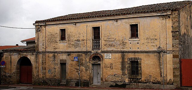
Usellus (Usellus)
%20-%202016.svg)
- Italian comune
 Hiking in Usellus
Usellus, a small town in the region of Sardinia, Italy, offers a unique hiking experience characterized by its picturesque landscapes, rich history, and serene environment. While it might not be as widely known as some other hiking destinations, it provides several trails that showcase the natural beauty of the island.
Hiking Experience in Usellus
-
Scenic Trails: The trails around Usellus often include rolling hills, valleys, and views of the surrounding countryside. You can expect to see a mix of native flora and fauna, making it a great spot for nature enthusiasts.
-
Historical Sites: The region is rich in history, with ancient nuraghe (megalithic structures) and other archaeological sites scattered throughout. Some hiking routes may offer opportunities to explore these historical landmarks, adding an educational aspect to your hike.
-
Moderate Climate: The Mediterranean climate in Sardinia means that hiking is enjoyable most of the year, but spring and fall are particularly pleasant for outdoor activities.
-
Local Culture: Engaging with local communities can enhance your hiking experience. Usellus and the nearby areas often celebrate traditional Sardinian culture, which you may encounter during your hikes.
-
Trail Recommendations: While specific trail maps may not be readily available, local tourism offices can provide information on recommended routes. Look for paths that lead to nearby natural attractions or charming villages.
Tips for Hiking in Usellus
- Preparation: Ensure you have adequate water, snacks, and a first-aid kit. The area may not always have facilities, so plan accordingly.
- Trail Conditions: Check with local guides or online resources for trail conditions, especially after rain, as some paths might become muddy or overgrown.
- Respect Nature: Follow the principles of Leave No Trace—stay on marked trails, and take your trash with you to preserve the natural beauty of the area.
In summary, Usellus offers a quaint yet enriching hiking experience perfect for those looking to explore a less-traveled path in Sardinia. Make sure to immerse yourself in the surroundings and take the time to appreciate the natural and historical wonders the region has to offer.
- Country:

- Postal Code: 09090
- Local Dialing Code: 0783
- Licence Plate Code: OR
- Coordinates: 39° 48' 27" N, 8° 51' 9" E


- GPS tracks (wikiloc): [Link]
- AboveSeaLevel: 289 м m
- Area: 35.07 sq km
- Population: 765
- Web site: http://www.comune.usellus.or.it/
- Wikipedia en: wiki(en)
- Wikipedia: wiki(it)
- Wikidata storage: Wikidata: Q389355
- Wikipedia Commons Category: [Link]
- Freebase ID: [/m/091jtk]
- GeoNames ID: Alt: [6539886]
- VIAF ID: Alt: [316388868]
- OSM relation ID: [40082]
- Digital Atlas of the Roman Empire ID: [41639]
- ISTAT ID: 095070
- Italian cadastre code: L508
Shares border with regions:
Albagiara
- Italian comune
Hiking in Albagiara
Albagiara, a small town located in the province of Nuoro in Sardinia, Italy, offers a stunning natural landscape that is perfect for hiking enthusiasts. The area is characterized by rolling hills, lush green valleys, and a rich diversity of flora and fauna, making it ideal for outdoor activities....
- Country:
- Postal Code: 09090
- Local Dialing Code: 0783
- Licence Plate Code: OR
- Coordinates: 39° 47' 14" N, 8° 51' 42" E
- GPS tracks (wikiloc): [Link]
- AboveSeaLevel: 215 м m
- Area: 8.87 sq km
- Population: 254
- Web site: [Link]


Ales, Sardinia
- comune of Italy
Hiking in Ales, Sardinia
Ales is a charming town located in the province of Oristano in Sardinia, Italy. Although Ales itself might not be a well-known hiking destination compared to other parts of Sardinia, it serves as a great base for exploring the surrounding landscapes, which offer a variety of hiking opportunities....
- Country:
- Postal Code: 09091
- Local Dialing Code: 0783
- Licence Plate Code: OR
- Coordinates: 39° 46' 0" N, 8° 49' 0" E
- GPS tracks (wikiloc): [Link]
- AboveSeaLevel: 194 м m
- Area: 22.45 sq km
- Population: 1410
- Web site: [Link]
Gonnosnò
- Italian comune
Hiking in Gonnosnò
Gonnosnò, a picturesque town located in the province of Nuoro in Sardinia, Italy, offers a unique experience for hikers. The region features a varied landscape, including hills, forests, and proximity to the beautiful Gennargentu mountains, making it an appealing destination for both novice and experienced trekkers....
- Country:
- Postal Code: 09090
- Local Dialing Code: 0783
- Licence Plate Code: OR
- Coordinates: 39° 45' 38" N, 8° 52' 21" E
- GPS tracks (wikiloc): [Link]
- AboveSeaLevel: 195 м m
- Area: 15.46 sq km
- Population: 759
- Web site: [Link]
Mogorella
- Italian comune
Hiking in Mogorella
Mogorella is a small municipality located in Sardinia, Italy, known for its beautiful landscapes and rich natural surroundings. Hiking in this region can be a delightful experience, as it offers a mix of agricultural land, rolling hills, and proximity to the scenic areas of the Sardinian countryside....
- Country:
- Postal Code: 09080
- Local Dialing Code: 0783
- Licence Plate Code: OR
- Coordinates: 39° 51' 53" N, 8° 51' 31" E
- GPS tracks (wikiloc): [Link]
- AboveSeaLevel: 265 м m
- Area: 17.06 sq km
- Population: 449
- Web site: [Link]
Villa Verde
- Italian comune
Hiking in Villa Verde
Villa Verde, located in the Azores archipelago of Portugal, is known for its stunning natural landscapes, lush greenery, and diverse hiking trails. The island offers a variety of hiking experiences, from easy walks to challenging treks that showcase its unique topography, volcanic features, and panoramic views....
- Country:
- Postal Code: 09090
- Local Dialing Code: 0783
- Licence Plate Code: OR
- Coordinates: 39° 47' 44" N, 8° 49' 13" E
- GPS tracks (wikiloc): [Link]
- AboveSeaLevel: 204 м m
- Area: 17.65 sq km
- Population: 308
- Web site: [Link]

Villaurbana
- Italian comune
Hiking in Villaurbana
Villaurbana, located in the province of Oristano in Sardinia, Italy, offers a unique hiking experience with its natural beauty, diverse landscapes, and rich cultural heritage. Here are some highlights to consider when hiking in Villaurbana:...
- Country:
- Postal Code: 09080
- Local Dialing Code: 0783
- Licence Plate Code: OR
- Coordinates: 39° 53' 7" N, 8° 46' 43" E
- GPS tracks (wikiloc): [Link]
- AboveSeaLevel: 80 м m
- Area: 58.7 sq km
- Population: 1631
- Web site: [Link]