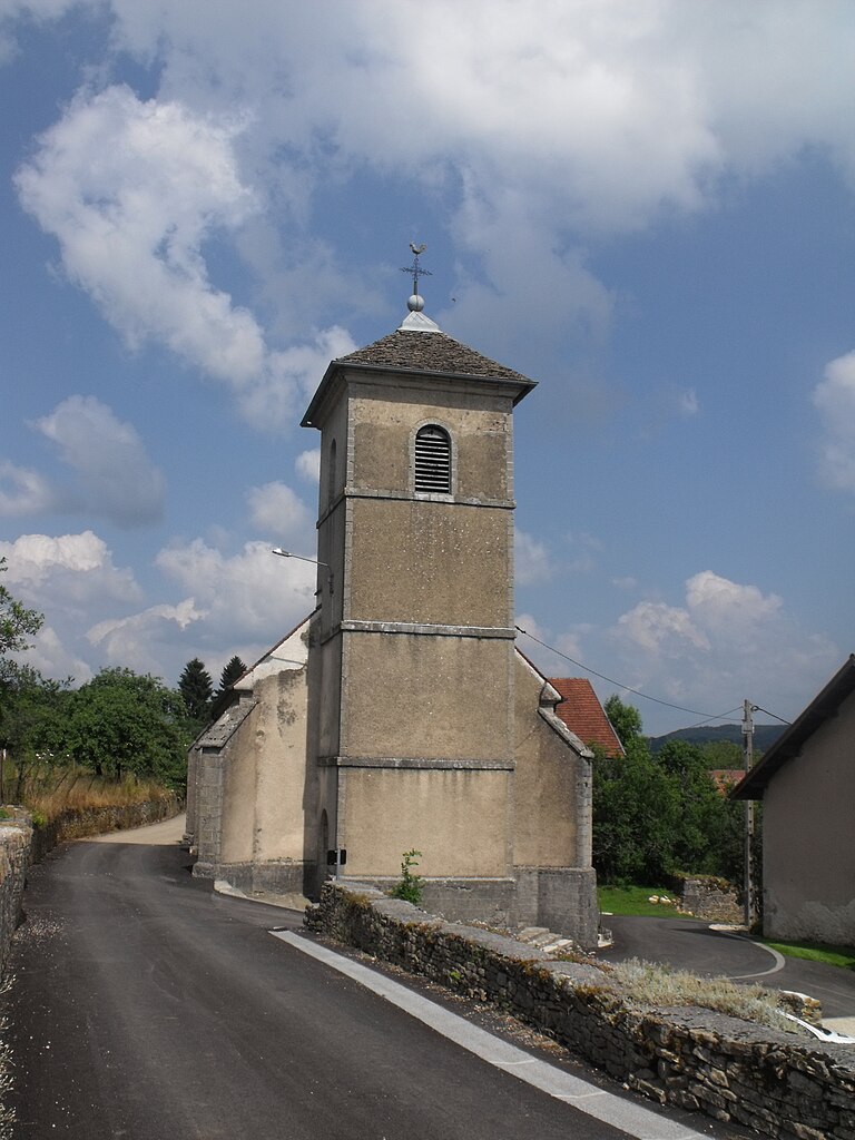
Valoreille (Valoreille)

- commune in Doubs, France
 Hiking in Valoreille
Valoreille is a picturesque area known for its beautiful landscapes and hiking opportunities. Located in the Jura region of France, it offers a mix of lush forests, rolling hills, and stunning viewpoints. Here’s an overview of what you can expect when hiking in Valoreille:
Hiking Trails
- Variety of Trails: There are various trails to suit different experience levels, from easy walks suitable for families to more challenging hikes for experienced trekkers.
- Marked Paths: The trails are generally well-marked, making it easy to navigate the area without getting lost.
- Scenic Routes: Many trails offer breathtaking views of the surrounding mountains and valleys, particularly during sunrise and sunset.
Wildlife and Nature
- Flora and Fauna: The region is rich in biodiversity, with many native plants and wildlife, including deer, various bird species, and maybe even the occasional fox. Hikers can enjoy the beauty of wildflowers and dense forests.
- Seasonal Changes: Each season offers a different experience, with vibrant colors in the fall, snow-covered trails in winter, and blooming flowers in spring.
Tips for Hiking in Valoreille
- Check Weather Conditions: The weather can change rapidly in mountainous areas, so it's essential to check forecasts and be prepared for various conditions.
- Proper Gear: Invest in good hiking boots, appropriate clothing layers, and a reliable backpack. Don't forget water and snacks!
- Stay on Trails: To preserve the natural environment and avoid getting lost, it’s best to stick to marked trails.
- Leave No Trace: Always practice Leave No Trace principles by packing out what you pack in, and being respectful of wildlife and other hikers.
Local Amenities
- Accommodations: There are often local inns, hostels, or camping options for those wishing to extend their stay.
- Guided Tours: If you're unfamiliar with the area or prefer companionship, consider joining a guided hiking tour.
Valoreille offers a fantastic blend of outdoor adventure and serene natural beauty, making it a great destination for both novice hikers and seasoned adventurers. Remember to plan ahead and enjoy the stunning landscapes!
- Country:

- Postal Code: 25190
- Coordinates: 47° 18' 1" N, 6° 44' 35" E


- GPS tracks (wikiloc): [Link]
- Area: 7.58 sq km
- Population: 132
- Wikipedia en: wiki(en)
- Wikipedia: wiki(fr)
- Wikidata storage: Wikidata: Q644703
- Wikipedia Commons Category: [Link]
- Freebase ID: [/m/03mhdwq]
- GeoNames ID: Alt: [6430026]
- SIREN number: [212505846]
- BnF ID: [152528107]
- INSEE municipality code: 25584
Shares border with regions:


Belleherbe
- commune in Doubs, France
Hiking in Belleherbe
Belleherbe is a charming village located in the Doubs department of the Bourgogne-Franche-Comté region in eastern France. It’s surrounded by beautiful landscapes, making it a great spot for hiking enthusiasts. Here are some key details about hiking in and around Belleherbe:...
- Country:
- Postal Code: 25380
- Coordinates: 47° 15' 43" N, 6° 39' 30" E
- GPS tracks (wikiloc): [Link]
- Area: 16.13 sq km
- Population: 604

Fleurey
- commune in Doubs, France
Hiking in Fleurey
Fleurey is likely a reference to Fleurey-sur-Ouche, a picturesque commune located in the Côte-d'Or department in the Bourgogne-Franche-Comté region of France. The region is known for its beautiful landscapes, rolling hills, and scenic trails that are perfect for hiking enthusiasts....
- Country:
- Postal Code: 25190
- Coordinates: 47° 18' 13" N, 6° 46' 45" E
- GPS tracks (wikiloc): [Link]
- Area: 8.04 sq km
- Population: 84

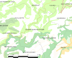
Orgeans-Blanchefontaine
- commune in Doubs, France
Hiking in Orgeans-Blanchefontaine
Orgeans-Blanchefontaine, located in the Vosges department in northeastern France, is an excellent destination for hiking enthusiasts. The region is known for its beautiful natural landscapes, dense forests, and numerous trails that cater to various skill levels. Here’s what you should know about hiking in this picturesque area:...
- Country:
- Postal Code: 25120
- Coordinates: 47° 15' 48" N, 6° 44' 37" E
- GPS tracks (wikiloc): [Link]
- AboveSeaLevel: 450 м m
- Area: 4.83 sq km
- Population: 49


Les Terres-de-Chaux
- commune in Doubs, France
Hiking in Les Terres-de-Chaux
Les Terres-de-Chaux is an appealing destination for hiking enthusiasts, located in the Jura region of France. This area is characterized by its stunning natural landscapes, rolling hills, lush forests, and unique geological features. Here are some aspects to consider when hiking in Les Terres-de-Chaux:...
- Country:
- Postal Code: 25190
- Coordinates: 47° 19' 7" N, 6° 44' 16" E
- GPS tracks (wikiloc): [Link]
- AboveSeaLevel: 700 м m
- Area: 14.49 sq km
- Population: 150
- Web site: [Link]


Vauclusotte
- commune in Doubs, France
Hiking in Vauclusotte
Vaucluse, located in the Provence-Alpes-Côte d'Azur region of southeastern France, is renowned for its stunning landscapes, picturesque villages, and diverse hiking trails that cater to various skill levels. Here are some key highlights for hiking in the Vaucluse region:...
- Country:
- Postal Code: 25380
- Coordinates: 47° 16' 45" N, 6° 44' 5" E
- GPS tracks (wikiloc): [Link]
- Area: 7.62 sq km
- Population: 94