Varennes-sous-Dun (Varennes-sous-Dun)
- commune in Saône-et-Loire, France
- Country:

- Postal Code: 71800
- Coordinates: 46° 17' 22" N, 4° 19' 59" E


- GPS tracks (wikiloc): [Link]
- Area: 17.76 sq km
- Population: 589
- Wikipedia en: wiki(en)
- Wikipedia: wiki(fr)
- Wikidata storage: Wikidata: Q641894
- Wikipedia Commons Category: [Link]
- Wikipedia Commons Maps Category: [Link]
- Freebase ID: [/m/03qh92z]
- GeoNames ID: Alt: [6442525]
- SIREN number: [217105592]
- BnF ID: [15273529g]
- INSEE municipality code: 71559
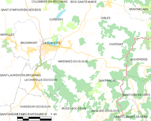
Shares border with regions:


La Clayette
- commune in Saône-et-Loire, France
- Country:

- Postal Code: 71800
- Coordinates: 46° 17' 23" N, 4° 18' 17" E


- GPS tracks (wikiloc): [Link]
- Area: 3.12 sq km
- Population: 1706
- Web site: [Link]


Gibles
- commune in Saône-et-Loire, France
- Country:

- Postal Code: 71800
- Coordinates: 46° 19' 28" N, 4° 22' 44" E


- GPS tracks (wikiloc): [Link]
- Area: 19.66 sq km
- Population: 601


Châtenay
- commune in Saône-et-Loire, France
- Country:

- Postal Code: 71800
- Coordinates: 46° 17' 28" N, 4° 22' 59" E


- GPS tracks (wikiloc): [Link]
- Area: 8.07 sq km
- Population: 160
- Web site: [Link]


Mussy-sous-Dun
- commune in Saône-et-Loire, France
- Country:

- Postal Code: 71170
- Coordinates: 46° 14' 3" N, 4° 19' 47" E


- GPS tracks (wikiloc): [Link]
- Area: 10 sq km
- Population: 348


La Chapelle-sous-Dun
- commune in Saône-et-Loire, France
- Country:

- Postal Code: 71800
- Coordinates: 46° 15' 36" N, 4° 17' 35" E


- GPS tracks (wikiloc): [Link]
- Area: 8.51 sq km
- Population: 430


Curbigny
- commune in Saône-et-Loire, France
- Country:

- Postal Code: 71800
- Coordinates: 46° 18' 27" N, 4° 18' 41" E


- GPS tracks (wikiloc): [Link]
- Area: 9.64 sq km
- Population: 315


Saint-Racho
- commune in Saône-et-Loire, France
- Country:

- Postal Code: 71800
- Coordinates: 46° 15' 54" N, 4° 22' 5" E


- GPS tracks (wikiloc): [Link]
- Area: 10.57 sq km
- Population: 181
