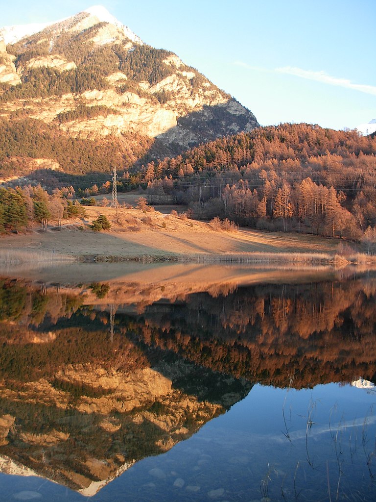
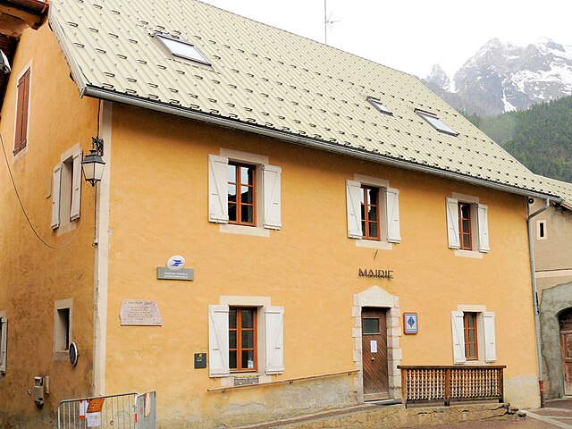
Vars (Vars)
- commune in Hautes-Alpes, France
 Hiking in Vars
Vars, located in the Hautes-Alpes region of southeastern France, is a fantastic destination for hiking enthusiasts. Known primarily for its winter sports, Vars also offers stunning landscapes and a variety of hiking trails during the warmer months. Here's an overview of what to expect when hiking in this area:
Trail Highlights
-
Scenic Views: The hiking trails in Vars often provide breathtaking views of the surrounding mountains, valleys, and lush landscapes. The landscapes are characterized by alpine meadows, rocky ridges, and forested areas, making each hike visually rewarding.
-
Variety of Trails: There are trails suitable for different skill levels, from easy walks to challenging hikes. You can find routes that cater to families and beginners, as well as more strenuous paths for experienced hikers.
-
Local Flora and Fauna: The region is rich in biodiversity. While hiking, you can spot a variety of herbs, wildflowers, and maybe even some local wildlife such as chamois, marmots, and various bird species.
Popular Hikes
- Le Col de la Bonette: This is one of the highest paved roads in Europe and offers several trails branching from it. Hikers can experience stunning panoramic views from the top.
- Les Clots: A beginner-friendly hike that takes you through beautiful meadows and offers great views of the surrounding peaks.
- Lac de l'Allos: A bit further afield, this hike leads to one of the largest natural lakes in the Alps, with options to extend the walk around the lake and connect to higher trails.
Preparing for Your Hike
-
Check Weather: The weather in the Alps can be unpredictable, so it’s essential to check the forecast before heading out.
-
Gear Up: Make sure to wear appropriate hiking boots, bring plenty of water, snacks, and sun protection. A first aid kit is also recommended.
-
Trail Maps: While trails are marked, bringing a map or using a hiking app can be beneficial, especially on less populated routes.
-
Local Regulations: Be aware of local wildlife and environmental protection rules, particularly regarding littering and staying on marked trails.
Activities Beyond Hiking
In addition to hiking, Vars offers other outdoor activities like mountain biking, paragliding, and rock climbing in the summer. Exploring the local culture, such as the architecture and cuisine, can also be a rewarding experience during your visit.
Overall, hiking in Vars, Hautes-Alpes, promises an adventure filled with natural beauty and opportunities to enjoy the great outdoors. Whether you're there for the challenging trails or the gentle walks, there’s something for everyone in this stunning alpine environment.
- Country:

- Postal Code: 05560
- Coordinates: 44° 35' 42" N, 6° 41' 23" E


- GPS tracks (wikiloc): [Link]
- Area: 92.2 sq km
- Population: 573
- Web site: http://www.vars.com
- Wikipedia en: wiki(en)
- Wikipedia: wiki(fr)
- Wikidata storage: Wikidata: Q1111000
- Wikipedia Commons Category: [Link]
- Freebase ID: [/m/03m826h]
- Freebase ID: [/m/03m826h]
- GeoNames ID: Alt: [6453565]
- GeoNames ID: Alt: [6453565]
- SIREN number: [210501771]
- SIREN number: [210501771]
- INSEE municipality code: 05177
- INSEE municipality code: 05177
Shares border with regions:
Saint-André-d'Embrun
- commune in Hautes-Alpes, France
Hiking in Saint-André-d'Embrun
Saint-André-d'Embrun is a charming village located in the southeastern part of France, nestled in the Hautes-Alpes region. It offers a variety of hiking opportunities that cater to different experience levels, making it a great destination for outdoor enthusiasts....
- Country:
- Postal Code: 05200
- Coordinates: 44° 35' 10" N, 6° 32' 2" E
- GPS tracks (wikiloc): [Link]
- Area: 38.63 sq km
- Population: 644

Guillestre
- commune in Hautes-Alpes, France
Hiking in Guillestre
Guillestre is a charming village located in the southern Alps of France, within the Hautes-Alpes department. It serves as an excellent base for various hiking adventures, offering a range of trails catering to different skill levels and providing stunning alpine scenery....
- Country:
- Postal Code: 05600
- Coordinates: 44° 39' 37" N, 6° 38' 57" E
- GPS tracks (wikiloc): [Link]
- Area: 51.29 sq km
- Population: 2301
- Web site: [Link]
Ceillac
- commune in Hautes-Alpes, France
Hiking in Ceillac
Ceillac is a charming village located in the Queyras Regional Natural Park in the French Alps, known for its stunning landscapes and excellent hiking opportunities. The area is characterized by its beautiful valleys, high peaks, and a variety of ecosystems, making it a perfect destination for both novice and experienced hikers....
- Country:
- Postal Code: 05600
- Coordinates: 44° 40' 1" N, 6° 46' 36" E
- GPS tracks (wikiloc): [Link]
- Area: 96.05 sq km
- Population: 294
- Web site: [Link]

Saint-Paul-sur-Ubaye
- commune in Alpes-de-Haute-Provence, France
Hiking in Saint-Paul-sur-Ubaye
Saint-Paul-sur-Ubaye is a charming commune in the Alpes-de-Haute-Provence region of France, nestled in the Ubaye Valley. It's an excellent destination for hiking enthusiasts due to its stunning natural landscapes, alpine scenery, and rich biodiversity. Here’s what you can expect when hiking in this area:...
- Country:
- Postal Code: 04530
- Coordinates: 44° 31' 0" N, 6° 45' 0" E
- GPS tracks (wikiloc): [Link]
- Area: 205.55 sq km
- Population: 200
- Web site: [Link]

Risoul
- commune in Hautes-Alpes, France
Hiking in Risoul
Risoul is a charming alpine village located in the French Alps, known primarily for its ski resort, but it also offers fantastic hiking opportunities during the warmer months. Here are some key points to consider if you're looking to hike in Risoul:...
- Country:
- Postal Code: 05600
- Coordinates: 44° 38' 55" N, 6° 38' 24" E
- GPS tracks (wikiloc): [Link]
- Area: 30.34 sq km
- Population: 638

Crévoux
- commune in Hautes-Alpes, France
Hiking in Crévoux
Crévoux is a picturesque village located in the French Alps, part of the Hautes-Alpes department, and is often celebrated for its stunning natural beauty and outdoor recreational opportunities, including fantastic hiking trails. Here are some highlights to help you prepare for a hiking adventure in Crévoux:...
- Country:
- Postal Code: 05200
- Coordinates: 44° 32' 53" N, 6° 36' 26" E
- GPS tracks (wikiloc): [Link]
- Area: 56.26 sq km
- Population: 140