
Hautes-Alpes (Hautes-Alpes)


- department in southeastern France named after the Alps mountain range
 Hiking in Hautes-Alpes
The Hautes-Alpes region in southeastern France is a spectacular destination for hiking enthusiasts, known for its stunning landscapes, diverse terrain, and rich biodiversity. The region is part of the French Alps and offers a variety of hiking trails suitable for different skill levels.
Key Highlights for Hiking in Hautes-Alpes:
-
Scenic Views:
- The region boasts breathtaking panoramas of rugged mountains, pristine valleys, and glacial lakes. Many trails provide views of iconic peaks such as the Ecrins Massif.
-
National Parks:
- Écrins National Park: This is one of the largest national parks in France, offering over 700 km of marked trails. It's famous for its high-altitude landscapes, diverse flora and fauna, and a range of difficulty levels from easy walks to challenging treks.
- Queyras Regional Natural Park: Known for its charming villages and traditional architecture, this area features hiking routes that traverse beautiful alpine meadows and forests.
-
Varied Terrain:
- Hikers can experience a mix of terrains, including rocky paths, alpine meadows, and forested trails. The varied elevation allows for hikes that take you from valley floors to high mountain passes.
-
Wildlife and Flora:
- The region is rich in biodiversity. While hiking, you may encounter various wildlife such as chamois, marmots, and eagles. The alpine flora is also diverse, with many species of flowers that bloom in the summer months.
-
Cultural Experiences:
- Hiking trails often lead you through traditional villages, where you can experience local culture, cuisine, and architecture. Staying in gîtes or guesthouses can enhance your hiking experience.
-
Popular Hikes:
- La Barre des Écrins: A challenging hike leading to one of the highest peaks in the region.
- Lac de l'Echirolles: A moderate hike that takes you to a stunning mountain lake.
- Tour of the Queyras: A multi-day trek that offers a comprehensive experience of the region’s landscapes and villages.
-
Best Time to Hike:
- The hiking season typically runs from late spring through early fall (May to October), depending on snow conditions. The summer months are ideal for most trails, as the weather is generally warm and stable.
-
Preparation:
- Always check trail conditions and weather forecasts before heading out. Equip yourself with proper hiking gear, including sturdy boots, weather-appropriate clothing, and enough food and water. It’s also wise to carry a map or GPS device.
Tips for Hiking in Hautes-Alpes:
- Start Early: Begin your hikes early in the day to avoid afternoon thunderstorms, especially in summer.
- Stay Hydrated: Water sources can be scarce on some trails, so carry enough water and consider a water purification system if needed.
- Respect Nature: Follow Leave No Trace principles to preserve the beauty of the natural environment.
Overall, hiking in the Hautes-Alpes offers a memorable experience for outdoor enthusiasts, combining adventure with stunning natural and cultural beauty. Whether you're looking for a relaxed walk or a challenging climb, this region has something for everyone.
- Country:

- Capital: Gap
- Coordinates: 44° 40' 0" N, 6° 20' 0" E


- GPS tracks (wikiloc): [Link]
- AboveSeaLevel: 1665 м m
- Area: 5549 sq km
- Population: 140916
- Web site: http://www.hautes-alpes.pref.gouv.fr/
- Wikipedia en: wiki(en)
- Wikipedia: wiki(fr)
- Wikidata storage: Wikidata: Q3125
- Wikipedia Commons Gallery: [Link]
- Wikipedia Commons Category: [Link]
- Wikipedia Commons Maps Category: [Link]
- Freebase ID: [/m/0l9zq]
- GeoNames ID: Alt: [3013738]
- SIREN number: [220500011]
- BnF ID: [118642907]
- VIAF ID: Alt: [141432516]
- OSM relation ID: [7436]
- GND ID: Alt: [4089178-1]
- archINFORM location ID: [42]
- Library of Congress authority ID: Alt: [n81022471]
- PACTOLS thesaurus ID: [pcrthvHLIWAcHD]
- SUDOC authorities ID: [026385333]
- Encyclopædia Britannica Online ID: [place/Hautes-Alpes]
- Gran Enciclopèdia Catalana ID: [0003163]
- DMOZ ID: Alt: [Regional/Europe/France/Regions/Provence-Alpes-Cote_d'Azur/Hautes-Alpes/]
- National Library of Israel ID: [000983705]
- YouTube channel ID: [UCJCBb62VJnXw5GZ0k15zykg]
- NUTS code: [FR822]
- INSEE department code: [05]
- ISO 3166-2 code: FR-05
Includes regions:
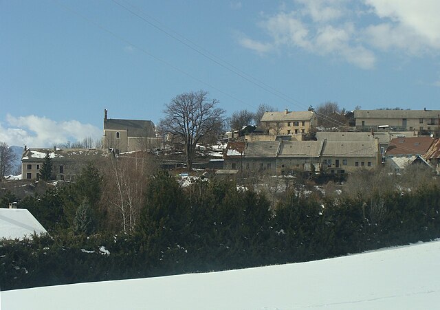
Champcella
- commune in Hautes-Alpes, France
Hiking in Champcella
Champcella is a lesser-known but beautiful hiking destination located in the French Alps, specifically in the Isère department. It's an excellent spot for nature lovers and those seeking adventure in mountain landscapes. Here are some key aspects to consider when hiking in Champcella:...
- Country:
- Postal Code: 05310
- Coordinates: 44° 43' 22" N, 6° 34' 17" E
- GPS tracks (wikiloc): [Link]
- AboveSeaLevel: 1150 м m
- Area: 30.25 sq km
- Population: 182
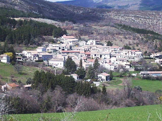
Crots
- commune in Hautes-Alpes, France
Hiking in Crots
Crots, located in the French Alps within the Hautes-Alpes department, is a beautiful destination for hiking enthusiasts. The area is known for its stunning landscapes, including mountains, valleys, and picturesque villages. If you're planning a hiking trip in Crots, here are some key points to consider:...
- Country:
- Postal Code: 05200
- Coordinates: 44° 32' 1" N, 6° 28' 16" E
- GPS tracks (wikiloc): [Link]
- AboveSeaLevel: 790 м m
- Area: 53.84 sq km
- Population: 1022
Ancelle
- commune in Hautes-Alpes, France
Hiking in Ancelle
Ancelle is a charming village located in the French Alps, specifically in the Hautes-Alpes department. It's a great destination for hiking enthusiasts looking for a mix of natural beauty, alpine scenery, and a variety of trails suitable for different skill levels. Here are some insights into hiking in Ancelle:...
- Country:
- Postal Code: 05260
- Coordinates: 44° 37' 24" N, 6° 12' 24" E
- GPS tracks (wikiloc): [Link]
- Area: 50.66 sq km
- Population: 905
Châteauneuf-d'Oze
- commune in Hautes-Alpes, France
Hiking in Châteauneuf-d'Oze
Châteauneuf-d'Oze is a charming village located in the Hautes-Alpes region of southeastern France. Nestled in the picturesque Oisans area, it's surrounded by stunning mountain scenery, making it an attractive destination for hikers. Here are some highlights and tips for hiking in and around Châteauneuf-d'Oze:...
- Country:
- Postal Code: 05400
- Coordinates: 44° 30' 42" N, 5° 51' 53" E
- GPS tracks (wikiloc): [Link]
- Area: 26.23 sq km
- Population: 27

Aspres-lès-Corps
- commune in Hautes-Alpes, France
Hiking in Aspres-lès-Corps
Aspres-lès-Corps is a charming village located in the Alpes-de-Haute-Provence region of France, surrounded by breathtaking natural landscapes that are perfect for hiking enthusiasts. The area offers a variety of trails that cater to different skill levels, from easy walks to more challenging hikes....
- Country:
- Postal Code: 05800
- Coordinates: 44° 48' 7" N, 5° 58' 54" E
- GPS tracks (wikiloc): [Link]
- Area: 16.73 sq km
- Population: 109

Le Bersac
- commune in Hautes-Alpes, France
Hiking in Le Bersac
Le Bersac is a picturesque destination for hiking enthusiasts, often celebrated for its beautiful landscapes and diverse flora and fauna. While you may not find extensive information specifically about Le Bersac, it’s common for areas with similar names to offer a mix of trails that cater to various skill levels, from easy walks to more challenging hikes....
- Country:
- Postal Code: 05700
- Coordinates: 44° 24' 42" N, 5° 44' 59" E
- GPS tracks (wikiloc): [Link]
- Area: 8.02 sq km
- Population: 152
Le Glaizil
- commune in Hautes-Alpes, France
Hiking in Le Glaizil
Le Glaizil is a picturesque commune located in the Hautes-Alpes department in southeastern France. The surrounding area is known for its stunning landscapes, including mountains, valleys, and diverse flora and fauna, which make it a great destination for hiking enthusiasts....
- Country:
- Postal Code: 05800
- Coordinates: 44° 45' 13" N, 5° 58' 59" E
- GPS tracks (wikiloc): [Link]
- Area: 21.93 sq km
- Population: 174

Esparron
- commune in Hautes-Alpes, France
Hiking in Esparron
Esparron, located in the Hautes-Alpes region of southeastern France, offers a fantastic setting for hiking enthusiasts. Nestled in a picturesque part of the French Alps, Esparron provides a variety of trails suitable for different skill levels, making it ideal for both novice hikers and experienced mountaineers....
- Country:
- Postal Code: 05110
- Coordinates: 44° 27' 13" N, 5° 54' 11" E
- GPS tracks (wikiloc): [Link]
- Area: 24.11 sq km
- Population: 40

Châteauvieux
- commune in Hautes-Alpes, France
Hiking in Châteauvieux
Châteauvieux, located in the Hautes-Alpes region of France, is a charming village surrounded by stunning natural landscapes, making it an excellent destination for hiking enthusiasts. The area features a variety of trails that cater to different skill levels, offering opportunities to explore both gentle walks and more challenging hikes....
- Country:
- Postal Code: 05000
- Coordinates: 44° 29' 2" N, 6° 3' 4" E
- GPS tracks (wikiloc): [Link]
- AboveSeaLevel: 783 м m
- Area: 7.07 sq km
- Population: 485

Barret-sur-Méouge
- commune in Hautes-Alpes, France
Hiking in Barret-sur-Méouge
Barret-sur-Méouge is a charming village located in the Drôme department in southeastern France, surrounded by stunning natural landscapes that make it a great destination for hiking enthusiasts. The area is characterized by its mountainous terrain, lush greenery, and the picturesque Méouge Valley, which offers numerous hiking opportunities suitable for various skill levels....
- Country:
- Postal Code: 05300
- Coordinates: 44° 15' 45" N, 5° 44' 1" E
- GPS tracks (wikiloc): [Link]
- Area: 26.72 sq km
- Population: 225

Châteauneuf-de-Chabre
- former commune in Hautes-Alpes, France
Hiking in Châteauneuf-de-Chabre
Châteauneuf-de-Chabre, located in the Hautes-Alpes region of France, is a hidden gem for outdoor enthusiasts and hikers. The area boasts stunning natural landscapes, including rugged mountains, lush valleys, and picturesque villages, making it an excellent location for both casual walkers and experienced hikers....
- Country:
- Postal Code: 05300
- Coordinates: 44° 16' 58" N, 5° 49' 10" E
- GPS tracks (wikiloc): [Link]
- Area: 23.9 sq km
- Population: 368

Chabottes
- commune in Hautes-Alpes, France
Hiking in Chabottes
Chabottes is a charming village located in the Hautes-Alpes region of France, nestled in the stunning French Alps. The area around Chabottes offers a variety of hiking trails suitable for different skill levels, making it a great destination for outdoor enthusiasts....
- Country:
- Postal Code: 05260
- Coordinates: 44° 38' 37" N, 6° 10' 15" E
- GPS tracks (wikiloc): [Link]
- Area: 9.96 sq km
- Population: 834
Buissard
- commune in Hautes-Alpes, France
Hiking in Buissard
Buissard is a well-known area for hiking, particularly in the context of the beautiful landscapes and outdoor opportunities it offers. Assuming you are referring to a location in the French Alps, here are some general highlights you might want to consider for hiking in this region:...
- Country:
- Postal Code: 05500
- Coordinates: 44° 39' 37" N, 6° 8' 22" E
- GPS tracks (wikiloc): [Link]
- Area: 2.92 sq km
- Population: 204

Chanousse
- commune in Hautes-Alpes, France
Hiking in Chanousse
It seems like you might be asking about hiking in the area around Chamois, which is in the Vanoise National Park in the French Alps, or maybe another specific location. However, since "Chanousse" doesn't exactly align with known hiking destinations, I'll provide general information about hiking in mountainous areas and the Vanoise National Park that can be applicable....
- Country:
- Postal Code: 05700
- Coordinates: 44° 21' 18" N, 5° 39' 20" E
- GPS tracks (wikiloc): [Link]
- Area: 20.32 sq km
- Population: 41

Château-Ville-Vieille
- commune in Hautes-Alpes, France
Hiking in Château-Ville-Vieille
Château-Ville-Vieille, located in the picturesque region of the Queyras in the French Alps, is an excellent destination for hiking enthusiasts. This charming village is situated at a high altitude and offers stunning views of the surrounding mountains, valleys, and the natural beauty of the Alps....
- Country:
- Postal Code: 05350
- Coordinates: 44° 45' 24" N, 6° 47' 28" E
- GPS tracks (wikiloc): [Link]
- Area: 66.9 sq km
- Population: 338
Antonaves
- former commune in Hautes-Alpes, France
Hiking in Antonaves
Antonaves is a small commune located in southeastern France, in the region of Auvergne-Rhône-Alpes. While it may not be as well-known as some larger hiking destinations, it offers access to beautiful natural landscapes typical of the French countryside....
- Country:
- Postal Code: 05300
- Coordinates: 44° 15' 59" N, 5° 48' 17" E
- GPS tracks (wikiloc): [Link]
- Area: 8.03 sq km
- Population: 170

Fouillouse
- commune in Hautes-Alpes, France
Hiking in Fouillouse
Fouillouse is a charming village located in the French Alps known for its stunning natural scenery and excellent hiking opportunities. Situated at a high altitude, it serves as a great base for exploring the surrounding mountains and trails. Here are some highlights of hiking in Fouillouse:...
- Country:
- Postal Code: 05130
- Coordinates: 44° 27' 27" N, 6° 0' 13" E
- GPS tracks (wikiloc): [Link]
- Area: 7.24 sq km
- Population: 236

La Bâtie-Vieille
- commune in Hautes-Alpes, France
Hiking in La Bâtie-Vieille
La Bâtie-Vieille, a small village located in the French Alps, offers beautiful hiking opportunities and stunning natural scenery. Here are some key points to consider if you're planning to hike in this region:...
- Country:
- Postal Code: 05000
- Coordinates: 44° 33' 14" N, 6° 9' 45" E
- GPS tracks (wikiloc): [Link]
- Area: 9.05 sq km
- Population: 346
- Web site: [Link]


Eyguians
- former commune in Hautes-Alpes, France
Hiking in Eyguians
Eyguians, a charming village located in the French Alps, offers a range of hiking opportunities for outdoor enthusiasts of various skill levels. Nestled in the Hautes-Alpes department, this region is characterized by stunning mountain scenery, lush forests, and diverse wildlife....
- Country:
- Postal Code: 05300
- Coordinates: 44° 20' 47" N, 5° 46' 21" E
- GPS tracks (wikiloc): [Link]
- Area: 9.37 sq km
- Population: 229

Arvieux
- commune in Hautes-Alpes, France
Hiking in Arvieux
Arvieux is a stunning destination situated in the Queyras Regional Natural Park in the French Alps, known for its beautiful landscapes, charming villages, and numerous hiking trails. Here are some highlights and tips for hiking in Arvieux:...
- Country:
- Postal Code: 05350
- Coordinates: 44° 46' 0" N, 6° 44' 20" E
- GPS tracks (wikiloc): [Link]
- Area: 72.62 sq km
- Population: 363
Sorbiers
- commune in Hautes-Alpes, France
Hiking in Sorbiers
Hiking in Sorbiers, located in the Hautes-Alpes region of France, offers a delightful experience for outdoor enthusiasts. This area is characterized by its stunning alpine scenery, diverse ecosystems, and a variety of trails suitable for hikers of all levels....
- Country:
- Postal Code: 05150
- Coordinates: 44° 22' 29" N, 5° 33' 47" E
- GPS tracks (wikiloc): [Link]
- Area: 13.93 sq km
- Population: 38

Théus
- commune in Hautes-Alpes, France
Hiking in Théus
Théus, a small village in the Hautes-Alpes region of France, offers a variety of hiking opportunities amidst beautiful Alpine scenery. Here’s what you need to know if you're planning to hike in or around Théus:...
- Country:
- Postal Code: 05190
- Coordinates: 44° 28' 34" N, 6° 11' 18" E
- GPS tracks (wikiloc): [Link]
- Area: 16.71 sq km
- Population: 202

Saint-Jacques-en-Valgodemard
- commune in Hautes-Alpes, France
Hiking in Saint-Jacques-en-Valgodemard
Saint-Jacques-en-Valgodemard is a charming commune located in the Hautes-Alpes region of France, known for its breathtaking landscapes and exceptional hiking opportunities. Nestled in the Écrins National Park, this area is a haven for outdoor enthusiasts, offering a range of trails that cater to different skill levels....
- Country:
- Postal Code: 05800
- Coordinates: 44° 46' 34" N, 6° 2' 38" E
- GPS tracks (wikiloc): [Link]
- Area: 15.65 sq km
- Population: 147

Rambaud
- commune in Hautes-Alpes, France
Hiking in Rambaud
Rambaud, located in the Hautes-Alpes region of southeastern France, is a beautiful destination for hiking enthusiasts. This area is known for its stunning alpine landscapes, diverse flora and fauna, and a variety of trails that cater to different skill levels. Here’s an overview of what you can expect when hiking in Rambaud:...
- Country:
- Postal Code: 05000
- Coordinates: 44° 32' 42" N, 6° 7' 56" E
- GPS tracks (wikiloc): [Link]
- Area: 10.71 sq km
- Population: 374
- Web site: [Link]

Saint-Genis
- former commune in Hautes-Alpes, France
Hiking in Saint-Genis
Saint-Genis in the Hautes-Alpes region of France is a picturesque village surrounded by stunning mountainous landscapes, making it an excellent location for hiking enthusiasts. The area features a variety of trails that cater to different skill levels, offering opportunities for both casual walkers and seasoned hikers....
- Country:
- Coordinates: 44° 22' 46" N, 5° 46' 7" E
- GPS tracks (wikiloc): [Link]
- Area: 18.32 sq km
- Population: 50
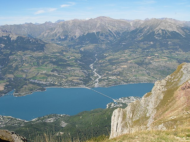
Savines-le-Lac
- commune in Hautes-Alpes, France
Hiking in Savines-le-Lac
Savines-le-Lac is a picturesque village located in the French Alps, near the Serre-Ponçon Lake in the Hautes-Alpes region. It's an excellent destination for hiking enthusiasts, offering a variety of trails that cater to different skill levels, with stunning views of the lake and surrounding mountains....
- Country:
- Postal Code: 05160
- Coordinates: 44° 31' 33" N, 6° 24' 18" E
- GPS tracks (wikiloc): [Link]
- AboveSeaLevel: 790 м m
- Area: 25.13 sq km
- Population: 1063
- Web site: [Link]

Rosans
- commune in Hautes-Alpes, France
Hiking in Rosans
Rosans is a charming village located in the Hautes-Alpes region of southeastern France, known for its picturesque landscapes, diverse flora, and a range of hiking opportunities. Here are some key points about hiking in and around Rosans:...
- Country:
- Postal Code: 05150
- Coordinates: 44° 23' 30" N, 5° 28' 12" E
- GPS tracks (wikiloc): [Link]
- Area: 30.39 sq km
- Population: 492
- Web site: [Link]

Saint-Bonnet-en-Champsaur
- former commune in Hautes-Alpes, France
Hiking in Saint-Bonnet-en-Champsaur
Saint-Bonnet-en-Champsaur, located in the Hautes-Alpes region of southeastern France, is a picturesque area that offers a variety of hiking opportunities. The region is known for its stunning alpine scenery, including mountains, rivers, and lush forests, making it a fantastic destination for outdoor enthusiasts....
- Country:
- Postal Code: 05500
- Coordinates: 44° 40' 55" N, 6° 4' 35" E
- GPS tracks (wikiloc): [Link]
- AboveSeaLevel: 1040 м m
- Area: 15.01 sq km
- Population: 2047
- Web site: [Link]

Orcières
- commune in Hautes-Alpes, France
Hiking in Orcières
Orcières is a stunning destination located in the French Alps, nestled within the Écrins National Park in the Haute-Alpes region. It offers a variety of hiking opportunities suitable for all levels of experience. Here are some key points to consider:...
- Country:
- Postal Code: 05170
- Coordinates: 44° 41' 4" N, 6° 19' 30" E
- GPS tracks (wikiloc): [Link]
- Area: 98.27 sq km
- Population: 715

Laragne-Montéglin
- commune in Hautes-Alpes, France
Hiking in Laragne-Montéglin
Laragne-Montéglin is a charming commune located in the Hautes-Alpes department of southeastern France. It's surrounded by stunning natural landscapes, making it a great destination for hiking enthusiasts. Here are some highlights and tips for hiking in this area:...
- Country:
- Postal Code: 05300
- Coordinates: 44° 18' 54" N, 5° 49' 18" E
- GPS tracks (wikiloc): [Link]
- Area: 23.51 sq km
- Population: 3455
- Web site: [Link]

Saint-Firmin
- commune in Hautes-Alpes, France
Hiking in Saint-Firmin
Saint-Firmin in the Hautes-Alpes region of France is a charming destination for hikers. Nestled in the Écrins National Park, this area is known for its stunning landscapes, rugged mountains, and rich biodiversity. Here are some key aspects to consider when hiking in and around Saint-Firmin:...
- Country:
- Postal Code: 05800
- Coordinates: 44° 46' 53" N, 6° 1' 45" E
- GPS tracks (wikiloc): [Link]
- AboveSeaLevel: 900 м m
- Area: 22.39 sq km
- Population: 468

Cervières
- commune in Hautes-Alpes, France
Hiking in Cervières
Cervières is a picturesque valley located in the Hautes-Alpes region of France, renowned for its stunning natural beauty, diverse landscapes, and rich cultural heritage. It offers a variety of hiking opportunities suited for all levels, from casual strolls to more challenging treks. Here are some highlights of hiking in this area:...
- Country:
- Postal Code: 05100
- Coordinates: 44° 52' 11" N, 6° 43' 19" E
- GPS tracks (wikiloc): [Link]
- Area: 109.68 sq km
- Population: 183

Saint-Crépin
- commune in Hautes-Alpes, France
Hiking in Saint-Crépin
Saint-Crépin is a charming village located in the Hautes-Alpes region of southeastern France. Nestled in the beautiful Southern Alps, it offers a range of hiking opportunities that take advantage of its stunning natural surroundings....
- Country:
- Postal Code: 05600
- Coordinates: 44° 42' 24" N, 6° 36' 26" E
- GPS tracks (wikiloc): [Link]
- Area: 46.3 sq km
- Population: 703
- Web site: [Link]

Villar-d'Arêne
- commune in Hautes-Alpes, France
Hiking in Villar-d'Arêne
Villar-d'Arêne is a charming village located in the Écrins National Park in the French Alps, known for its stunning natural beauty and a variety of hiking opportunities. Here are some key aspects of hiking in this area:...
- Country:
- Postal Code: 05480
- Coordinates: 45° 2' 34" N, 6° 20' 13" E
- GPS tracks (wikiloc): [Link]
- Area: 77.51 sq km
- Population: 330
- Web site: [Link]

Les Vigneaux
- commune in Hautes-Alpes, France
Hiking in Les Vigneaux
Les Vigneaux is a charming village located in the stunning Ecrins National Park in the French Alps. It is an excellent destination for hiking enthusiasts, featuring a variety of trails that cater to different skill levels. Here are some highlights about hiking in and around Les Vigneaux:...
- Country:
- Postal Code: 05120
- Coordinates: 44° 49' 26" N, 6° 32' 27" E
- GPS tracks (wikiloc): [Link]
- Area: 15.99 sq km
- Population: 521

Le Sauze-du-Lac
- commune in Hautes-Alpes, France
Hiking in Le Sauze-du-Lac
Le Sauze-du-Lac is a picturesque village located in the French Alps, known for its stunning natural beauty, pristine lakes, and accessibility to various hiking routes. Here’s what you should know about hiking in this delightful area:...
- Country:
- Postal Code: 05160
- Coordinates: 44° 28' 42" N, 6° 18' 50" E
- GPS tracks (wikiloc): [Link]
- AboveSeaLevel: 1052 м m
- Area: 8.49 sq km
- Population: 145
- Web site: [Link]

Sigottier
- commune in Hautes-Alpes, France
Hiking in Sigottier
Sigottier is a charming commune located in the French Alps, specifically in the Hautes-Alpes department. The area is renowned for its stunning natural landscapes, offering a variety of hiking opportunities for outdoor enthusiasts. Here are some highlights for hiking in and around Sigottier:...
- Country:
- Postal Code: 05700
- Coordinates: 44° 27' 18" N, 5° 41' 31" E
- GPS tracks (wikiloc): [Link]
- Area: 25.33 sq km
- Population: 87

Upaix
- commune in Hautes-Alpes, France
Hiking in Upaix
It seems there might be a typo or misunderstanding surrounding the location "Upaix." If you're referring to hiking in a specific area or region with a similar name, please clarify....
- Country:
- Postal Code: 05300
- Coordinates: 44° 18' 50" N, 5° 53' 26" E
- GPS tracks (wikiloc): [Link]
- Area: 23.26 sq km
- Population: 456

Villar-Loubière
- commune in Hautes-Alpes, France
Hiking in Villar-Loubière
Villar-Loubière is a picturesque village located in the Provence-Alpes-Côte d'Azur region of southeastern France. It’s surrounded by stunning natural landscapes, making it a great destination for hiking enthusiasts....
- Country:
- Postal Code: 05800
- Coordinates: 44° 49' 34" N, 6° 8' 44" E
- GPS tracks (wikiloc): [Link]
- Area: 22.63 sq km
- Population: 42

Saint-Sauveur
- commune in Hautes-Alpes, France
Hiking in Saint-Sauveur
Saint-Sauveur in the Hautes-Alpes region of France is a beautiful destination for hiking enthusiasts. Nestled in the French Alps, it offers stunning landscapes, diverse terrain, and a variety of trails suitable for different skill levels. Here are some key points about hiking in this area:...
- Country:
- Postal Code: 05200
- Coordinates: 44° 32' 27" N, 6° 31' 13" E
- GPS tracks (wikiloc): [Link]
- Area: 24.18 sq km
- Population: 454

Le Saix
- commune in Hautes-Alpes, France
Hiking in Le Saix
Le Saix is a charming commune located in the Hautes-Alpes region of southeastern France, known for its stunning alpine landscapes and outdoor recreational opportunities. Hiking in Le Saix offers a wonderful experience for nature lovers and adventure seekers alike, with trails that provide access to beautiful vistas, diverse flora and fauna, and the serene atmosphere of the mountains....
- Country:
- Postal Code: 05400
- Coordinates: 44° 28' 31" N, 5° 49' 25" E
- GPS tracks (wikiloc): [Link]
- Area: 22.15 sq km
- Population: 103
- Web site: [Link]

Salérans
- commune in Hautes-Alpes, France
Hiking in Salérans
Salérans is a small village located in the Hautes-Alpes region of southeastern France, known for its stunning natural scenery and outdoor activities, including hiking. It is situated near the Écrins National Park and offers access to beautiful landscapes, rugged mountains, and a sense of tranquility often found in rural areas....
- Country:
- Postal Code: 05300
- Coordinates: 44° 14' 35" N, 5° 42' 17" E
- GPS tracks (wikiloc): [Link]
- Area: 13.9 sq km
- Population: 94

Ventavon
- commune in Hautes-Alpes, France
Hiking in Ventavon
Ventavon is a charming village located in the southeastern part of France, within the Hautes-Alpes department in the Provence-Alpes-Côte d'Azur region. It's a relatively less-traveled area compared to more famous hiking destinations, making it an excellent choice for hikers who appreciate tranquility and stunning natural scenery....
- Country:
- Postal Code: 05300
- Coordinates: 44° 22' 15" N, 5° 54' 21" E
- GPS tracks (wikiloc): [Link]
- Area: 42.69 sq km
- Population: 520
- Web site: [Link]

Valserres
- commune in Hautes-Alpes, France
Hiking in Valserres
Valserres is a charming village located in the French Alps, near the more famous town of Gap in the Hautes-Alpes region. Hiking in and around Valserres offers a blend of picturesque landscapes, lush nature, and a variety of trails suitable for all levels of experience....
- Country:
- Postal Code: 05130
- Coordinates: 44° 29' 20" N, 6° 7' 39" E
- GPS tracks (wikiloc): [Link]
- Area: 11.92 sq km
- Population: 253
- Web site: [Link]

La Saulce
- commune in Hautes-Alpes, France
Hiking in La Saulce
La Saulce is a charming small municipality located in the Provence-Alpes-Côte d'Azur region of southeastern France, known for its picturesque landscapes and proximity to the mountains. Hiking in this area offers a mix of beautiful scenery, diverse trails, and a chance to experience the local flora and fauna....
- Country:
- Postal Code: 05110
- Coordinates: 44° 25' 31" N, 6° 0' 28" E
- GPS tracks (wikiloc): [Link]
- Area: 7.89 sq km
- Population: 1502

Savournon
- commune in Hautes-Alpes, France
Hiking in Savournon
Savournon is a picturesque village located in the southeastern part of France, nestled in the Haute-Alpes region. Hiking in Savournon offers breathtaking views, diverse landscapes, and a chance to explore the natural beauty of the area. Here are some key points about hiking in this region:...
- Country:
- Postal Code: 05700
- Coordinates: 44° 25' 20" N, 5° 47' 28" E
- GPS tracks (wikiloc): [Link]
- Area: 39.23 sq km
- Population: 253
- Web site: [Link]

Val-des-Prés
- commune in Hautes-Alpes, France
Hiking in Val-des-Prés
Val-des-Prés is a picturesque commune located in the Alpes-de-Haute-Provence region of France, known for its stunning landscapes and outdoor recreational opportunities, particularly hiking. Here are some key points to consider if you're planning to hike in Val-des-Prés:...
- Country:
- Postal Code: 05100
- Coordinates: 44° 56' 54" N, 6° 40' 42" E
- GPS tracks (wikiloc): [Link]
- Area: 44.77 sq km
- Population: 656
- Web site: [Link]

Vallouise
- former commune in Hautes-Alpes, France
Hiking in Vallouise
Vallouise, located in the French Alps within the Ecrins National Park, is a stunning destination for hiking enthusiasts. The area is renowned for its breathtaking mountain landscapes, diverse ecosystems, and a variety of trails suitable for all levels of hikers....
- Country:
- Postal Code: 05290
- Coordinates: 44° 50' 42" N, 6° 29' 13" E
- GPS tracks (wikiloc): [Link]
- Area: 68.58 sq km
- Population: 758

Saint-Michel-de-Chaillol
- commune in Hautes-Alpes, France
Hiking in Saint-Michel-de-Chaillol
Saint-Michel-de-Chaillol is a charming village located in the French Alps, specifically in the Hautes-Alpes department of southeastern France. The area is known for its breathtaking landscapes, making it a wonderful destination for hiking enthusiasts....
- Country:
- Postal Code: 05260
- Coordinates: 44° 40' 56" N, 6° 10' 3" E
- GPS tracks (wikiloc): [Link]
- Area: 16.78 sq km
- Population: 315

Saint-Étienne-le-Laus
- commune in Hautes-Alpes, France
Hiking in Saint-Étienne-le-Laus
Saint-Étienne-le-Laus is a charming village located in the Hautes-Alpes region of France, offering beautiful hiking opportunities amidst stunning natural landscapes. The area is characterized by picturesque mountains, lush valleys, and diverse flora and fauna, making it a great destination for outdoor enthusiasts....
- Country:
- Postal Code: 05130
- Coordinates: 44° 30' 8" N, 6° 9' 44" E
- GPS tracks (wikiloc): [Link]
- Area: 8.66 sq km
- Population: 294

Saint-Maurice-en-Valgodemard
- commune in Hautes-Alpes, France
Hiking in Saint-Maurice-en-Valgodemard
Saint-Maurice-en-Valgodemard is a beautiful village located in the French Alps, in the Hautes-Alpes department. Known for its stunning landscapes, it serves as an excellent base for various hiking adventures. Here are some key highlights for hiking in the area:...
- Country:
- Postal Code: 05800
- Coordinates: 44° 48' 14" N, 6° 5' 44" E
- GPS tracks (wikiloc): [Link]
- Area: 36.37 sq km
- Population: 133
Saint-Eusèbe-en-Champsaur
- former commune in Hautes-Alpes, France
Hiking in Saint-Eusèbe-en-Champsaur
Saint-Eusèbe-en-Champsaur is a picturesque village located in the French Alps, in the Champsaur valley. It offers a variety of hiking opportunities for both novice and experienced hikers. Here are some highlights of hiking in this area:...
- Country:
- Postal Code: 05500
- Coordinates: 44° 43' 33" N, 6° 1' 39" E
- GPS tracks (wikiloc): [Link]
- Area: 7.83 sq km
- Population: 150

Saint-Laurent-du-Cros
- commune in Hautes-Alpes, France
Hiking in Saint-Laurent-du-Cros
Saint-Laurent-du-Cros is a charming village located in the Hautes-Alpes region of France. It’s an excellent base for outdoor enthusiasts, especially hikers, given its proximity to the Écrins National Park and the stunning landscapes of the Southern Alps....
- Country:
- Postal Code: 05500
- Coordinates: 44° 38' 38" N, 6° 6' 39" E
- GPS tracks (wikiloc): [Link]
- Area: 12.69 sq km
- Population: 520

Sainte-Colombe
- commune in Hautes-Alpes, France
Hiking in Sainte-Colombe
Sainte-Colombe, situated in the Hautes-Alpes region of France, is known for its stunning natural landscapes and diverse hiking trails, making it a great destination for outdoor enthusiasts. Here are some highlights and tips for hiking in the area:...
- Country:
- Postal Code: 05700
- Coordinates: 44° 17' 5" N, 5° 40' 9" E
- GPS tracks (wikiloc): [Link]
- AboveSeaLevel: 920 м m
- Area: 17.18 sq km
- Population: 58

Sainte-Marie
- former commune in Hautes-Alpes, France
Hiking in Sainte-Marie
Sainte-Marie, located in the Hautes-Alpes department in southeastern France, is a beautiful area known for its stunning alpine landscapes, clear lakes, and diverse flora and fauna. Here are some highlights and tips for hiking in and around Sainte-Marie:...
- Country:
- Postal Code: 05150
- Coordinates: 44° 27' 56" N, 5° 28' 30" E
- GPS tracks (wikiloc): [Link]
- Area: 7.5 sq km
- Population: 40

La Roche-de-Rame
- commune in Hautes-Alpes, France
Hiking in La Roche-de-Rame
La Roche-de-Rame is a picturesque commune located in the Hautes-Alpes department in southeastern France. It is nestled in the stunning French Alps, providing a perfect backdrop for hiking enthusiasts. Here are some key points to consider if you're planning a hiking trip to La Roche-de-Rame:...
- Country:
- Postal Code: 05310
- Coordinates: 44° 45' 0" N, 6° 34' 50" E
- GPS tracks (wikiloc): [Link]
- Area: 40.53 sq km
- Population: 837

Saint-Chaffrey
- commune in Hautes-Alpes, France
Hiking in Saint-Chaffrey
Saint-Chaffrey is a charming commune located in the Hautes-Alpes region of France, and it's part of the broader area known for its stunning alpine scenery and outdoor activities, particularly hiking. Here are some key points about hiking in and around Saint-Chaffrey:...
- Country:
- Postal Code: 05330
- Coordinates: 44° 55' 34" N, 6° 36' 24" E
- GPS tracks (wikiloc): [Link]
- Area: 25.88 sq km
- Population: 1643
- Web site: [Link]

Ribeyret
- commune in Hautes-Alpes, France
Hiking in Ribeyret
Ribeyret is a picturesque village located in the Hautes-Alpes department of the Provence-Alpes-Côte d'Azur region in southeastern France. The area around Ribeyret is known for its stunning landscapes, diverse flora and fauna, and great opportunities for hiking and outdoor activities....
- Country:
- Postal Code: 05150
- Coordinates: 44° 24' 48" N, 5° 33' 17" E
- GPS tracks (wikiloc): [Link]
- Area: 17.87 sq km
- Population: 105

Saint-Auban-d'Oze
- commune in Hautes-Alpes, France
Hiking in Saint-Auban-d'Oze
Saint-Auban-d'Oze, located in the scenic region of the Drôme Provençale in southeastern France, offers a variety of hiking opportunities for outdoor enthusiasts. The area is known for its beautiful landscapes, lush vegetation, and diverse wildlife. Here are some key points to consider about hiking in and around Saint-Auban-d'Oze:...
- Country:
- Postal Code: 05400
- Coordinates: 44° 29' 45" N, 5° 50' 47" E
- GPS tracks (wikiloc): [Link]
- Area: 13.21 sq km
- Population: 84
- Web site: [Link]

Saint-Léger-les-Mélèzes
- commune in Hautes-Alpes, France
Hiking in Saint-Léger-les-Mélèzes
Saint-Léger-les-Mélèzes is a charming alpine village located in the Hautes-Alpes region of southeastern France. It's an excellent destination for hiking enthusiasts, offering a mix of scenic trails, beautiful landscapes, and a variety of outdoor activities....
- Country:
- Postal Code: 05260
- Coordinates: 44° 38' 38" N, 6° 11' 54" E
- GPS tracks (wikiloc): [Link]
- Area: 6.76 sq km
- Population: 345
- Web site: [Link]

Saint-André-de-Rosans
- commune in Hautes-Alpes, France
Hiking in Saint-André-de-Rosans
Saint-André-de-Rosans is a charming village located in the Hautes-Alpes region of southeastern France. It's a fantastic area for hikers, offering a variety of trails that cater to different skill levels and preferences. Here are some highlights about hiking in this picturesque location:...
- Country:
- Postal Code: 05150
- Coordinates: 44° 22' 38" N, 5° 30' 52" E
- GPS tracks (wikiloc): [Link]
- Area: 36.61 sq km
- Population: 145

Saint-Jean-Saint-Nicolas
- commune in Hautes-Alpes, France
Hiking in Saint-Jean-Saint-Nicolas
Saint-Jean-Saint-Nicolas is a charming village located in the Hautes-Alpes region of France, and it's an excellent destination for hiking enthusiasts. Nestled at the foot of the Écrins mountain range, the area is known for its stunning natural scenery, diverse landscapes, and a variety of hiking trails suitable for different skill levels....
- Country:
- Postal Code: 05260
- Coordinates: 44° 40' 3" N, 6° 13' 43" E
- GPS tracks (wikiloc): [Link]
- Area: 37.17 sq km
- Population: 997

Réotier
- commune in Hautes-Alpes, France
Hiking in Réotier
Réotier is a charming village located in the Hautes-Alpes region of France, near the border of Italy. It is nestled in the stunning natural landscape, characterized by mountains, rivers, and diverse flora and fauna, making it an excellent destination for hiking enthusiasts....
- Country:
- Postal Code: 05600
- Coordinates: 44° 39' 50" N, 6° 35' 24" E
- GPS tracks (wikiloc): [Link]
- Area: 22.33 sq km
- Population: 193
- Web site: [Link]
Montmorin
- former commune in Hautes-Alpes, France
Hiking in Montmorin
Montmorin, located in the Hautes-Alpes region of France, is a stunning area for outdoor enthusiasts, particularly hikers. The region offers a variety of trails suitable for all skill levels, ranging from easy walks to more challenging hikes that reward adventurers with breathtaking views of the mountains and surrounding landscapes....
- Country:
- Postal Code: 05150
- Coordinates: 44° 27' 5" N, 5° 32' 32" E
- GPS tracks (wikiloc): [Link]
- Area: 25.86 sq km
- Population: 90
Saint-André-d'Embrun
- commune in Hautes-Alpes, France
Hiking in Saint-André-d'Embrun
Saint-André-d'Embrun is a charming village located in the southeastern part of France, nestled in the Hautes-Alpes region. It offers a variety of hiking opportunities that cater to different experience levels, making it a great destination for outdoor enthusiasts....
- Country:
- Postal Code: 05200
- Coordinates: 44° 35' 10" N, 6° 32' 2" E
- GPS tracks (wikiloc): [Link]
- Area: 38.63 sq km
- Population: 644

La Motte-en-Champsaur
- commune in Hautes-Alpes, France
Hiking in La Motte-en-Champsaur
La Motte-en-Champsaur is a charming village located in the French Alps, known for its stunning natural scenery and a variety of hiking opportunities. The region offers a mix of landscapes, including alpine meadows, dense forests, and panoramic mountain views, making it an excellent destination for both novice and experienced hikers....
- Country:
- Postal Code: 05500
- Coordinates: 44° 43' 57" N, 6° 4' 5" E
- GPS tracks (wikiloc): [Link]
- Area: 52.8 sq km
- Population: 215
- Web site: [Link]

Saint-Julien-en-Champsaur
- commune in Hautes-Alpes, France
Hiking in Saint-Julien-en-Champsaur
Saint-Julien-en-Champsaur, located in the French Alps, is a beautiful destination for hiking enthusiasts. The area offers a variety of trails that cater to different skill levels, from easy walks to challenging hikes. The stunning landscapes, including mountains, valleys, and forests, provide a picturesque backdrop for outdoor activities....
- Country:
- Postal Code: 05500
- Coordinates: 44° 39' 33" N, 6° 7' 42" E
- GPS tracks (wikiloc): [Link]
- Area: 10.04 sq km
- Population: 357

Puy-Saint-Vincent
- commune in Hautes-Alpes, France
Hiking in Puy-Saint-Vincent
Puy-Saint-Vincent is a scenic destination in the French Alps, located in the Hautes-Alpes region. It's known for its beautiful landscapes and varied hiking trails. Here’s an overview of what you can expect when hiking in this area:...
- Country:
- Postal Code: 05290
- Coordinates: 44° 49' 48" N, 6° 29' 14" E
- GPS tracks (wikiloc): [Link]
- Area: 22.98 sq km
- Population: 283
- Web site: [Link]

Puy-Saint-André
- commune in Hautes-Alpes, France
Hiking in Puy-Saint-André
Puy-Saint-André is a charming village located in the Hautes-Alpes region of southeastern France, and it serves as a wonderful base for hiking enthusiasts. Nestled near the Écrins National Park, the area boasts stunning alpine scenery, diverse flora and fauna, and a range of trails suitable for various skill levels....
- Country:
- Postal Code: 05100
- Coordinates: 44° 52' 44" N, 6° 35' 55" E
- GPS tracks (wikiloc): [Link]
- Area: 15.37 sq km
- Population: 466
Montgardin
- commune in Hautes-Alpes, France
Hiking in Montgardin
Montgardin, located in the Hautes-Alpes region of France, offers beautiful hiking opportunities in the heart of the French Alps. The area is known for its stunning alpine landscapes, including mountains, valleys, and picturesque villages. Here are some highlights to consider when planning a hike in Montgardin:...
- Country:
- Postal Code: 05230
- Coordinates: 44° 33' 1" N, 6° 14' 23" E
- GPS tracks (wikiloc): [Link]
- Area: 15.32 sq km
- Population: 462
- Web site: [Link]
Réallon
- commune in Hautes-Alpes, France
Hiking in Réallon
Réallon is a picturesque village located in the French Alps, particularly in the Hautes-Alpes department. It’s a fantastic destination for hiking enthusiasts, offering a mix of stunning landscapes, diverse trails, and breathtaking views of the surrounding mountains and lakes. Here are some key details to consider when hiking in Réallon:...
- Country:
- Postal Code: 05160
- Coordinates: 44° 35' 44" N, 6° 21' 53" E
- GPS tracks (wikiloc): [Link]
- Area: 71.4 sq km
- Population: 260
- Web site: [Link]
Neffes
- commune in Hautes-Alpes, France
Hiking in Neffes
Neffes is not a widely recognized hiking destination, so it’s possible that you’re referring to a specific area or trail that's less known. If you’re referring to a particular region, here are a few general tips and considerations for hiking in lesser-known areas:...
- Country:
- Postal Code: 05000
- Coordinates: 44° 30' 16" N, 6° 1' 20" E
- GPS tracks (wikiloc): [Link]
- Area: 8.36 sq km
- Population: 744

Oze
- commune in Hautes-Alpes, France
Hiking in Oze
Oze National Park, located in central Japan, is a stunning destination for hiking enthusiasts. This park features a unique blend of diverse ecosystems, scenic landscapes, and rich wildlife. Here are some key points to know about hiking in Oze:...
- Country:
- Postal Code: 05400
- Coordinates: 44° 30' 18" N, 5° 48' 19" E
- GPS tracks (wikiloc): [Link]
- Area: 12.03 sq km
- Population: 109

Puy-Saint-Pierre
- commune in Hautes-Alpes, France
Hiking in Puy-Saint-Pierre
Puy-Saint-Pierre is a charming commune located in the Hautes-Alpes region of southeastern France. It's surrounded by stunning landscapes and offers a range of hiking opportunities, perfect for both beginner and experienced hikers. Here are some highlights about hiking in Puy-Saint-Pierre:...
- Country:
- Postal Code: 05100
- Coordinates: 44° 53' 27" N, 6° 37' 26" E
- GPS tracks (wikiloc): [Link]
- Area: 7.74 sq km
- Population: 529

Les Orres
- commune in Hautes-Alpes, France
Hiking in Les Orres
Les Orres, located in the French Alps, is a fantastic destination for hiking enthusiasts. This charming mountain resort offers a variety of trails suitable for all levels, from beginners to experienced hikers. Here’s an overview to help you plan your hiking experience in Les Orres:...
- Country:
- Postal Code: 05200
- Coordinates: 44° 30' 50" N, 6° 33' 3" E
- GPS tracks (wikiloc): [Link]
- AboveSeaLevel: 1460 м m
- Area: 74.79 sq km
- Population: 569
- Web site: [Link]
Nossage-et-Bénévent
- commune in Hautes-Alpes, France
Hiking in Nossage-et-Bénévent
Nossage-et-Bénévent is a charming commune located in the Vosges department of France. Surrounded by natural beauty, this area offers a variety of hiking opportunities for both beginners and experienced hikers alike. Here are some highlights for hiking in and around Nossage-et-Bénévent:...
- Country:
- Postal Code: 05700
- Coordinates: 44° 18' 55" N, 5° 44' 55" E
- GPS tracks (wikiloc): [Link]
- AboveSeaLevel: 690 м m
- Area: 4.31 sq km
- Population: 14

Prunières
- commune in Hautes-Alpes, France
Hiking in Prunières
Hiking in Prunières, located in the Hautes-Alpes region of France, offers stunning landscapes and a variety of trails suitable for all levels of hikers. This area is known for its beautiful mountains, alpine meadows, and pristine nature, making it an ideal destination for outdoor enthusiasts....
- Country:
- Postal Code: 05230
- Coordinates: 44° 32' 31" N, 6° 20' 0" E
- GPS tracks (wikiloc): [Link]
- Area: 13.2 sq km
- Population: 298
- Web site: [Link]
Le Poët
- commune in Hautes-Alpes, France
Hiking in Le Poët
Le Poët is a charming commune in the Drôme department of southeastern France, nestled in the foothills of the Vercors Mountains. It offers a variety of hiking opportunities that showcase its beautiful landscapes, historical sites, and the rich natural environment....
- Country:
- Postal Code: 05300
- Coordinates: 44° 17' 35" N, 5° 53' 49" E
- GPS tracks (wikiloc): [Link]
- Area: 15.51 sq km
- Population: 771
- Web site: [Link]

Pelvoux
- former commune in Hautes-Alpes, France
Hiking in Pelvoux
Pelvoux is a beautiful region located in the French Alps, specifically in the Ecrins National Park. It's known for its stunning mountain landscapes, varied hiking trails, and breathtaking views. Here are some key points to keep in mind when planning a hiking trip to Pelvoux:...
- Country:
- Postal Code: 05340
- Coordinates: 44° 52' 9" N, 6° 29' 12" E
- GPS tracks (wikiloc): [Link]
- Area: 76.23 sq km
- Population: 483

Puy-Sanières
- commune in Hautes-Alpes, France
Hiking in Puy-Sanières
Puy-Sanières is a charming village located in the Hautes-Alpes region of France and offers stunning hiking opportunities in the surrounding areas. The region is characterized by its beautiful landscapes, including mountains, plateaus, and valleys, making it a great destination for outdoor enthusiasts....
- Country:
- Postal Code: 05200
- Coordinates: 44° 33' 29" N, 6° 26' 3" E
- GPS tracks (wikiloc): [Link]
- Area: 11.38 sq km
- Population: 257

Le Noyer
- commune in Hautes-Alpes, France
Hiking in Le Noyer
Le Noyer, located in the Hautes-Alpes region of southeastern France, is an excellent destination for hiking enthusiasts. This charming alpine village is situated near the Écrins National Park, which offers a diverse range of trails suitable for different skill levels, from beginners to more experienced hikers....
- Country:
- Postal Code: 05500
- Coordinates: 44° 41' 55" N, 6° 0' 45" E
- GPS tracks (wikiloc): [Link]
- Area: 21.5 sq km
- Population: 289

Pelleautier
- commune in Hautes-Alpes, France
Hiking in Pelleautier
Pelleautier is a beautiful commune located in the Hautes-Alpes region of southeastern France. Nestled near the foot of the Écrins mountains and close to the city of Gap, it offers a range of hiking opportunities that cater to various skill levels....
- Country:
- Postal Code: 05000
- Coordinates: 44° 31' 1" N, 6° 1' 0" E
- GPS tracks (wikiloc): [Link]
- Area: 12.81 sq km
- Population: 684

Manteyer
- commune in Hautes-Alpes, France
Hiking in Manteyer
Manteyer is a charming village located in the Hautes-Alpes region of France, offering a variety of hiking opportunities that cater to different skill levels and interests. The area is characterized by its stunning natural landscapes, including rolling hills, forests, and panoramic views of the surrounding Alpine terrain....
- Country:
- Postal Code: 05400
- Coordinates: 44° 32' 16" N, 5° 57' 50" E
- GPS tracks (wikiloc): [Link]
- Area: 25.63 sq km
- Population: 424
- Web site: [Link]

Moydans
- commune in Hautes-Alpes, France
Hiking in Moydans
Moydans is not a widely recognized hiking destination, and it seems there might be a spelling error or it might refer to a specific, lesser-known location or a local site unfamiliar to broader audiences. If you meant a different location or if it's a local spot, let me know!...
- Country:
- Postal Code: 05150
- Coordinates: 44° 23' 59" N, 5° 30' 13" E
- GPS tracks (wikiloc): [Link]
- AboveSeaLevel: 633 м m
- Area: 10.51 sq km
- Population: 47

Remollon
- commune in Hautes-Alpes, France
Hiking in Remollon
Remollon is a charming village located in the French Alps, specifically in the Hautes-Alpes department. It provides a wonderful base for hiking enthusiasts looking to explore the stunning natural landscapes of the region. Here’s what you should know about hiking in Remollon:...
- Country:
- Postal Code: 05190
- Coordinates: 44° 28' 3" N, 6° 10' 3" E
- GPS tracks (wikiloc): [Link]
- Area: 6.45 sq km
- Population: 434
- Web site: [Link]

Monêtier-Allemont
- commune in Hautes-Alpes, France
Hiking in Monêtier-Allemont
Monêtier-Allemont, located in the French Alps, is a beautiful destination for hiking enthusiasts. The area offers a variety of trails that cater to different skill levels, making it accessible to both beginners and experienced hikers. Here are some highlights and tips for hiking in this region:...
- Country:
- Postal Code: 05110
- Coordinates: 44° 23' 9" N, 5° 56' 36" E
- GPS tracks (wikiloc): [Link]
- Area: 7.15 sq km
- Population: 293
Furmeyer
- commune in Hautes-Alpes, France
Hiking in Furmeyer
Furmeyer is a fantastic location for hiking enthusiasts, offering a range of trails suited for different skill levels amidst stunning natural scenery. Nestled within a mountainous region, hikers can enjoy diverse landscapes, from lush forests to rocky outcrops, and often breathtaking views....
- Country:
- Postal Code: 05400
- Coordinates: 44° 32' 11" N, 5° 51' 13" E
- GPS tracks (wikiloc): [Link]
- Area: 14.27 sq km
- Population: 143

La Fare-en-Champsaur
- commune in Hautes-Alpes, France
Hiking in La Fare-en-Champsaur
La Fare-en-Champsaur is a picturesque village located in the French Alps, within the Hautes-Alpes department of the Provence-Alpes-Côte d'Azur region. It is an excellent base for hiking enthusiasts, offering a variety of trails that cater to different skill levels and preferences....
- Country:
- Postal Code: 05500
- Coordinates: 44° 40' 32" N, 6° 4' 19" E
- GPS tracks (wikiloc): [Link]
- Area: 10.27 sq km
- Population: 453

Molines-en-Queyras
- commune in Hautes-Alpes, France
Hiking in Molines-en-Queyras
Molines-en-Queyras is a picturesque village located in the Queyras Regional Natural Park in the French Alps. It's an ideal destination for hiking enthusiasts, offering a variety of trails that cater to different skill levels. Here’s what you can expect when hiking in this beautiful region:...
- Country:
- Postal Code: 05350
- Coordinates: 44° 43' 51" N, 6° 50' 36" E
- GPS tracks (wikiloc): [Link]
- Area: 53.62 sq km
- Population: 305


L'Épine
- commune in Hautes-Alpes, France
Hiking in L'Épine
L'Épine, located in the Hautes-Alpes region of southeastern France, is known for its stunning natural beauty and a variety of hiking trails that cater to different skill levels. The area is characterized by picturesque landscapes, mountain ranges, valleys, and lakes. Here are some key points about hiking in L'Épine and its surroundings:...
- Country:
- Postal Code: 05700
- Coordinates: 44° 25' 1" N, 5° 37' 1" E
- GPS tracks (wikiloc): [Link]
- Area: 33.47 sq km
- Population: 192

Méreuil
- commune in Hautes-Alpes, France
Hiking in Méreuil
Méreuil, located in the picturesque Provence-Alpes-Côte d'Azur region of France, offers some delightful hiking opportunities. Here are some key points about hiking in this area:...
- Country:
- Postal Code: 05700
- Coordinates: 44° 23' 13" N, 5° 43' 50" E
- GPS tracks (wikiloc): [Link]
- Area: 10.61 sq km
- Population: 80

Les Costes
- former commune in Hautes-Alpes, France
Hiking in Les Costes
Les Costes is a beautiful area that offers a range of hiking opportunities, characterized by its stunning landscapes and diverse terrain. While the specifics can vary depending on the exact location you're referring to, here's a general overview of what you might expect when hiking in a region like Les Costes:...
- Country:
- Postal Code: 05500
- Coordinates: 44° 44' 46" N, 6° 2' 2" E
- GPS tracks (wikiloc): [Link]
- Area: 8.78 sq km
- Population: 178

Jarjayes
- commune in Hautes-Alpes, France
Hiking in Jarjayes
Jarjayes is a charming commune located in the Provence-Alpes-Côte d'Azur region of southeastern France, near the city of Gap, which sits at a lovely elevation and provides beautiful views of the surrounding countryside. The area is characterized by its diverse landscapes, including mountains, forests, and meadows, making it a fantastic destination for hiking enthusiasts....
- Country:
- Postal Code: 05130
- Coordinates: 44° 30' 19" N, 6° 6' 38" E
- GPS tracks (wikiloc): [Link]
- Area: 22.67 sq km
- Population: 421

Freissinières
- commune in Hautes-Alpes, France
Hiking in Freissinières
Freissinières is a picturesque village located in the Écrins National Park in the French Alps, renowned for its stunning landscapes, rich biodiversity, and a variety of hiking opportunities. Here's an overview to help you make the most of your hiking experience in Freissinières:...
- Country:
- Postal Code: 05310
- Coordinates: 44° 45' 15" N, 6° 32' 14" E
- GPS tracks (wikiloc): [Link]
- AboveSeaLevel: 1190 м m
- Area: 88.21 sq km
- Population: 208
- Web site: [Link]

Éourres
- commune in Hautes-Alpes, France
Hiking in Éourres
Éourres is a charming village located in the Hautes-Alpes region of France, near the stunning Dévoluy mountain range. It’s an ideal destination for hiking enthusiasts, offering various trails that cater to different skill levels and showcase the area’s natural beauty....
- Country:
- Postal Code: 26560
- Coordinates: 44° 12' 44" N, 5° 41' 57" E
- GPS tracks (wikiloc): [Link]
- Area: 26.47 sq km
- Population: 128
- Web site: [Link]

Saint-Martin-de-Queyrières
- commune in Hautes-Alpes, France
Hiking in Saint-Martin-de-Queyrières
Saint-Martin-de-Queyrières is a charming village located in the Hautes-Alpes region of France. It's a fantastic starting point for hiking enthusiasts as it offers access to stunning landscapes, diverse trails, and beautiful views of the Écrins National Park and surrounding mountains. Here are some highlights regarding hiking in this area:...
- Country:
- Postal Code: 05120
- Coordinates: 44° 50' 25" N, 6° 35' 7" E
- GPS tracks (wikiloc): [Link]
- AboveSeaLevel: 1200 м m
- Area: 55.52 sq km
- Population: 1131
Vars
- commune in Hautes-Alpes, France
Hiking in Vars
Vars, located in the Hautes-Alpes region of southeastern France, is a fantastic destination for hiking enthusiasts. Known primarily for its winter sports, Vars also offers stunning landscapes and a variety of hiking trails during the warmer months. Here's an overview of what to expect when hiking in this area:...
- Country:
- Postal Code: 05560
- Coordinates: 44° 35' 42" N, 6° 41' 23" E
- GPS tracks (wikiloc): [Link]
- Area: 92.2 sq km
- Population: 573
- Web site: [Link]
Montclus
- commune in Hautes-Alpes, France
Hiking in Montclus
Montclus, located in the Hautes-Alpes region of France, is a fantastic destination for hikers, offering stunning landscapes, diverse trails, and a generally peaceful atmosphere. Here are some key points to consider when hiking in this area:...
- Country:
- Postal Code: 05700
- Coordinates: 44° 24' 54" N, 5° 40' 57" E
- GPS tracks (wikiloc): [Link]
- Area: 21.25 sq km
- Population: 60
Poligny
- commune in Hautes-Alpes, France
Hiking in Poligny
Poligny, situated in the Hautes-Alpes region of southeastern France, is a fantastic destination for hikers, offering stunning landscapes, diverse trails, and a variety of outdoor activities....
- Country:
- Postal Code: 05500
- Coordinates: 44° 41' 30" N, 6° 2' 50" E
- GPS tracks (wikiloc): [Link]
- Area: 13.81 sq km
- Population: 302

Sigoyer
- commune in Hautes-Alpes, France
Hiking in Sigoyer
Sigoyer is a charming village located in the Hautes-Alpes region of southeastern France. It offers a picturesque setting and is an excellent base for outdoor enthusiasts looking to explore the scenic beauty of the surrounding area. Here are some highlights for hiking in and around Sigoyer:...
- Country:
- Postal Code: 05130
- Coordinates: 44° 28' 40" N, 5° 58' 33" E
- GPS tracks (wikiloc): [Link]
- Area: 24.38 sq km
- Population: 664
- Web site: [Link]

Rochebrune
- commune in Hautes-Alpes, France
Hiking in Rochebrune
Rochebrune is a beautiful area located in the Hautes-Alpes region of southeastern France, known for its stunning alpine scenery, diverse trails, and opportunities for outdoor activities. Here’s an overview of what you can expect when hiking in Rochebrune:...
- Country:
- Postal Code: 05190
- Coordinates: 44° 27' 22" N, 6° 10' 37" E
- GPS tracks (wikiloc): [Link]
- Area: 12.37 sq km
- Population: 170

Ribiers
- former commune in Hautes-Alpes, France
Hiking in Ribiers
Ribiers is a charming village located in the Hautes-Alpes department of southeastern France. It is situated near the beautiful mountains of the French Alps, making it an appealing destination for hikers of all levels. Here are some key points to consider if you're planning a hiking trip in and around Ribiers:...
- Country:
- Postal Code: 05300
- Coordinates: 44° 13' 52" N, 5° 51' 23" E
- GPS tracks (wikiloc): [Link]
- AboveSeaLevel: 972 м m
- Area: 36.55 sq km
- Population: 817
- Web site: [Link]

Avançon
- commune in Hautes-Alpes, France
Hiking in Avançon
Avançon is a picturesque commune in the Hautes-Alpes department of southeastern France, located in the southern Alps. This region is known for its stunning landscapes, including mountains, valleys, and clear rivers, which make it an excellent destination for hiking enthusiasts....
- Country:
- Postal Code: 05230
- Coordinates: 44° 31' 31" N, 6° 11' 7" E
- GPS tracks (wikiloc): [Link]
- Area: 22.57 sq km
- Population: 402

Saint-Apollinaire
- commune in Hautes-Alpes, France
Hiking in Saint-Apollinaire
Saint-Apollinaire is a charming commune in the Hautes-Alpes department of France, renowned for its stunning natural landscapes and proximity to the French Alps. Hiking in this region offers a variety of trails suitable for different skill levels, providing opportunities to explore diverse terrains, from lush valleys to rocky mountain paths....
- Country:
- Postal Code: 05160
- Coordinates: 44° 33' 22" N, 6° 21' 44" E
- GPS tracks (wikiloc): [Link]
- Area: 7.54 sq km
- Population: 138

La Roche-des-Arnauds
- commune in Hautes-Alpes, France
Hiking in La Roche-des-Arnauds
La Roche-des-Arnauds is a charming commune in the Hautes-Alpes department of southeastern France, known for its stunning natural landscapes and outdoor recreational opportunities, including hiking. Here are some key points to consider if you're planning to hike in this area:...
- Country:
- Postal Code: 05400
- Coordinates: 44° 33' 48" N, 5° 57' 23" E
- GPS tracks (wikiloc): [Link]
- Area: 53.75 sq km
- Population: 1498

Lazer
- commune in Hautes-Alpes, France
Hiking in Lazer
Lazer, located in the Hautes-Alpes department of France, is a wonderful destination for hiking enthusiasts. Nestled in the stunning landscape of the French Alps, it offers a variety of trails that cater to different skill levels, from beginners to experienced hikers....
- Country:
- Postal Code: 05300
- Coordinates: 44° 20' 54" N, 5° 50' 16" E
- GPS tracks (wikiloc): [Link]
- Area: 21.98 sq km
- Population: 361
- Web site: [Link]

Gap
- commune in Hautes-Alpes, France
Hiking in Gap
Gap, located in the Hautes-Alpes region of southeastern France, is a wonderful destination for hiking enthusiasts. Surrounded by majestic mountains and alpine landscapes, it offers a variety of trails that cater to all levels of hikers, from beginners to experienced trekkers....
- Country:
- Postal Code: 05000
- Coordinates: 44° 33' 31" N, 6° 4' 40" E
- GPS tracks (wikiloc): [Link]
- Area: 110.43 sq km
- Population: 40776
- Web site: [Link]

Saléon
- commune in Hautes-Alpes, France
Hiking in Saléon
Saléon, nestled in the picturesque countryside of France, offers a range of hiking opportunities for outdoor enthusiasts. The region is characterized by its stunning landscapes, including rolling hills, verdant forests, and scenic valleys. Here are some key highlights and tips for hiking in Saléon:...
- Country:
- Postal Code: 05300
- Coordinates: 44° 19' 55" N, 5° 46' 33" E
- GPS tracks (wikiloc): [Link]
- Area: 9.86 sq km
- Population: 91

La Chapelle-en-Valgaudémar
- commune in Hautes-Alpes, France
Hiking in La Chapelle-en-Valgaudémar
La Chapelle-en-Valgaudémar is a picturesque village located in the heart of the Écrins National Park in the French Alps. This area is renowned for its stunning natural beauty, rugged mountains, and a variety of hiking trails suitable for different skill levels....
- Country:
- Postal Code: 05800
- Coordinates: 44° 49' 1" N, 6° 11' 41" E
- GPS tracks (wikiloc): [Link]
- AboveSeaLevel: 1050 м m
- Area: 108.02 sq km
- Population: 101
Dévoluy
- commune in Hautes-Alpes, France
Hiking in Dévoluy
Le Dévoluy is a stunning mountain range located in the French Alps, known for its diverse landscapes, breathtaking scenery, and extensive hiking opportunities. Whether you're an experienced hiker or a beginner, there's something for everyone in this area....
- Country:
- Postal Code: 05250
- Coordinates: 44° 41' 33" N, 5° 56' 28" E
- GPS tracks (wikiloc): [Link]
- Area: 186.37 sq km
- Population: 1011
- Web site: [Link]
Chorges
- commune in Hautes-Alpes, France
Hiking in Chorges
Chorges, located in the Hautes-Alpes region of France, is a beautiful destination for hiking enthusiasts. Nestled in the stunning natural environment of the French Alps, it offers a range of trails suitable for all levels of hikers, from beginners to experienced trekkers. Here’s what you need to know about hiking in Chorges:...
- Country:
- Postal Code: 05230
- Coordinates: 44° 32' 44" N, 6° 16' 35" E
- GPS tracks (wikiloc): [Link]
- AboveSeaLevel: 835 м m
- Area: 53.34 sq km
- Population: 2810
- Web site: [Link]

Abriès
- commune in Hautes-Alpes, France
Hiking in Abriès
Abriès is a charming alpine village located in the Queyras Regional Natural Park in the French Alps. It is an excellent destination for hiking enthusiasts due to its stunning landscapes, diverse flora and fauna, and a variety of trails suitable for all levels of hikers. Here's an overview of what you can expect when hiking in Abriès:...
- Country:
- Postal Code: 05460
- Coordinates: 44° 47' 43" N, 6° 55' 38" E
- GPS tracks (wikiloc): [Link]
- Area: 77.13 sq km
- Population: 306
- Web site: [Link]

Chauffayer
- former commune in Hautes-Alpes, France
Hiking in Chauffayer
Chauffayer is a charming commune located in the Hautes-Alpes department of southeastern France. It is surrounded by stunning mountainous landscapes, making it an appealing destination for hiking enthusiasts. Here are some highlights about hiking in and around Chauffayer:...
- Country:
- Postal Code: 05800
- Coordinates: 44° 45' 15" N, 6° 0' 31" E
- GPS tracks (wikiloc): [Link]
- Area: 10.9 sq km
- Population: 383

Aspres-sur-Buëch
- commune in Hautes-Alpes, France
Hiking in Aspres-sur-Buëch
Aspres-sur-Buëch is a charming commune located in the Hautes-Alpes region of France, offering a range of hiking opportunities amidst stunning natural landscapes. The area is characterized by its picturesque valleys, rugged terrain, and beautiful views of the surrounding mountains. Here are some highlights for hiking around Aspres-sur-Buëch:...
- Country:
- Postal Code: 05140
- Coordinates: 44° 31' 25" N, 5° 44' 59" E
- GPS tracks (wikiloc): [Link]
- Area: 42.65 sq km
- Population: 832

L'Argentière-la-Bessée
- commune in Hautes-Alpes, France
Hiking in L'Argentière-la-Bessée
L'Argentière-la-Bessée, located in the Hautes-Alpes region of France, is a picturesque village surrounded by stunning mountain ranges, making it a fantastic destination for hiking enthusiasts. Here are some highlights and tips for hiking in this area:...
- Country:
- Postal Code: 05120
- Coordinates: 44° 47' 40" N, 6° 33' 33" E
- GPS tracks (wikiloc): [Link]
- Area: 64.55 sq km
- Population: 2307

Guillestre
- commune in Hautes-Alpes, France
Hiking in Guillestre
Guillestre is a charming village located in the southern Alps of France, within the Hautes-Alpes department. It serves as an excellent base for various hiking adventures, offering a range of trails catering to different skill levels and providing stunning alpine scenery....
- Country:
- Postal Code: 05600
- Coordinates: 44° 39' 37" N, 6° 38' 57" E
- GPS tracks (wikiloc): [Link]
- Area: 51.29 sq km
- Population: 2301
- Web site: [Link]

Barcillonnette
- commune in Hautes-Alpes, France
Hiking in Barcillonnette
Barcillonnette is a charming village situated in the French Alps, specifically in the Hautes-Alpes department. It's an ideal starting point for hiking enthusiasts looking to explore the stunning landscapes of the region....
- Country:
- Postal Code: 05110
- Coordinates: 44° 26' 7" N, 5° 55' 8" E
- GPS tracks (wikiloc): [Link]
- Area: 19.51 sq km
- Population: 151

Bruis
- former commune in Hautes-Alpes, France
Hiking in Bruis
Bruis, a charming village in France's Hautes-Alpes region, offers a range of beautiful hiking opportunities that take advantage of the stunning Alpine scenery. Here are some key points to consider when hiking in and around Bruis:...
- Country:
- Postal Code: 05150
- Coordinates: 44° 28' 5" N, 5° 30' 49" E
- GPS tracks (wikiloc): [Link]
- Area: 25.15 sq km
- Population: 77

Serres
- commune in Hautes-Alpes, France
Hiking in Serres
Hiking in Serres, located in the Hautes-Alpes region of France, offers a magnificent blend of natural beauty, cultural heritage, and outdoor adventure. The area is characterized by its stunning landscapes, including mountains, valleys, and rivers, making it a fantastic destination for hikers of all levels....
- Country:
- Postal Code: 05700
- Coordinates: 44° 25' 43" N, 5° 42' 54" E
- GPS tracks (wikiloc): [Link]
- AboveSeaLevel: 680 м m
- Area: 18.57 sq km
- Population: 1272

Veynes
- commune in Hautes-Alpes, France
Hiking in Veynes
Veynes, located in the Hautes-Alpes region of France, offers a beautiful setting for hiking enthusiasts. The area is characterized by stunning mountain scenery, varied terrain, and a network of trails suitable for different skill levels. Here are some highlights and tips for hiking in Veynes:...
- Country:
- Postal Code: 05400
- Coordinates: 44° 32' 3" N, 5° 49' 25" E
- GPS tracks (wikiloc): [Link]
- Area: 42.6 sq km
- Population: 3159
- Web site: [Link]

La Beaume
- commune in Hautes-Alpes, France
Hiking in La Beaume
La Beaume is a beautiful destination for hiking, typically known for its stunning landscapes, rich biodiversity, and scenic trails. Located in the region of Provence-Alpes-Côte d'Azur in France, it offers various trails suitable for different fitness levels and interests....
- Country:
- Postal Code: 05140
- Coordinates: 44° 33' 9" N, 5° 38' 12" E
- GPS tracks (wikiloc): [Link]
- Area: 29.64 sq km
- Population: 155
- Web site: [Link]

Aspremont
- commune in Hautes-Alpes, France
Hiking in Aspremont
Aspremont, located in the Hautes-Alpes region of southeastern France, offers a beautiful hiking experience amidst stunning alpine landscapes. Here are some key points to consider when hiking in Aspremont:...
- Country:
- Postal Code: 05140
- Coordinates: 44° 29' 33" N, 5° 43' 40" E
- GPS tracks (wikiloc): [Link]
- AboveSeaLevel: 715 м m
- Area: 18.52 sq km
- Population: 341

Saint-Véran
- commune in Hautes-Alpes, France
Hiking in Saint-Véran
Saint-Véran is one of the highest inhabited villages in Europe, located in the Queyras region of the French Southern Alps. It's known for its stunning landscapes, traditional architecture, and a variety of hiking trails that cater to all levels of hikers....
- Country:
- Postal Code: 05350
- Coordinates: 44° 42' 0" N, 6° 52' 6" E
- GPS tracks (wikiloc): [Link]
- AboveSeaLevel: 2042 м m
- Area: 44.75 sq km
- Population: 236

Orpierre
- commune in Hautes-Alpes, France
Hiking in Orpierre
Orpierre, located in the Hautes-Alpes region of southeastern France, is a charming village known for its stunning natural surroundings and outdoor activities, particularly hiking. The area is characterized by beautiful limestone cliffs, lush forests, and impressive views of the Provence landscape. Here are some key points to consider when hiking in Orpierre:...
- Country:
- Postal Code: 05700
- Coordinates: 44° 18' 47" N, 5° 41' 27" E
- GPS tracks (wikiloc): [Link]
- Area: 27.57 sq km
- Population: 341
- Web site: [Link]

Châteauroux-les-Alpes
- commune in Hautes-Alpes, France
Hiking in Châteauroux-les-Alpes
Châteauroux-les-Alpes is a charming village located in the Hautes-Alpes department in southeastern France. It is surrounded by beautiful mountainous landscapes, making it a great base for hiking enthusiasts. Here are some highlights of hiking in and around Châteauroux-les-Alpes:...
- Country:
- Postal Code: 05380
- Coordinates: 44° 36' 52" N, 6° 31' 19" E
- GPS tracks (wikiloc): [Link]
- Area: 92.84 sq km
- Population: 1146
Lagrand
- former commune in Hautes-Alpes, France
Hiking in Lagrand
Lagrand is not a widely known hiking location, so I assume you might be referring to an area such as Lagrande in the U.S. state of Oregon or possibly another place with a similar name....
- Country:
- Postal Code: 05300
- Coordinates: 44° 20' 29" N, 5° 45' 21" E
- GPS tracks (wikiloc): [Link]
- Area: 6.92 sq km
- Population: 267

Aiguilles
- commune in Hautes-Alpes, France
Hiking in Aiguilles
Aiguilles, located in the French Alps, is a breathtaking area known for its dramatic peaks, stunning landscapes, and diverse hiking opportunities. Here’s a guide to hiking in this beautiful region:...
- Country:
- Postal Code: 05470
- Coordinates: 44° 46' 54" N, 6° 52' 8" E
- GPS tracks (wikiloc): [Link]
- Area: 40.16 sq km
- Population: 425

Villar-Saint-Pancrace
- commune in Hautes-Alpes, France
Hiking in Villar-Saint-Pancrace
Villar-Saint-Pancrace is a charming alpine village located in the Provence-Alpes-Côte d'Azur region of France, near the town of Briançon. The area is known for its stunning landscapes, rich biodiversity, and a variety of hiking trails that cater to different skill levels. Here are some highlights for hiking in this region:...
- Country:
- Postal Code: 05100
- Coordinates: 44° 52' 23" N, 6° 37' 38" E
- GPS tracks (wikiloc): [Link]
- AboveSeaLevel: 1260 м m
- Area: 42.53 sq km
- Population: 1457

La Freissinouse
- commune in Hautes-Alpes, France
Hiking in La Freissinouse
La Freissinouse is a charming village located in the Hautes-Alpes department of southeastern France, nestled in the heart of the French Alps. The region is known for its stunning natural beauty, making it a great destination for hiking enthusiasts....
- Country:
- Postal Code: 05000
- Coordinates: 44° 32' 5" N, 6° 0' 35" E
- GPS tracks (wikiloc): [Link]
- Area: 8.32 sq km
- Population: 786

Saint-Clément-sur-Durance
- commune in Hautes-Alpes, France
Hiking in Saint-Clément-sur-Durance
Saint-Clément-sur-Durance, located in the Hautes-Alpes region of France, offers a variety of hiking opportunities amidst stunning natural scenery. The area is characterized by its picturesque landscapes, including mountains, rivers, and quaint villages. Here are some key points to consider for hiking in this area:...
- Country:
- Postal Code: 05600
- Coordinates: 44° 38' 56" N, 6° 34' 42" E
- GPS tracks (wikiloc): [Link]
- AboveSeaLevel: 872 м m
- Area: 25.06 sq km
- Population: 291
La Salle-les-Alpes
- commune in Hautes-Alpes, France
Hiking in La Salle-les-Alpes
La Salle-les-Alpes, located in the Hautes-Alpes region of southeastern France, is a fantastic destination for hiking enthusiasts. Nestled in the enchanting Écrins National Park, this charming village offers breathtaking mountain views, diverse landscapes, and a variety of trails suited for all skill levels....
- Country:
- Postal Code: 05240
- Coordinates: 44° 56' 41" N, 6° 34' 15" E
- GPS tracks (wikiloc): [Link]
- AboveSeaLevel: 1397 м m
- Area: 35.42 sq km
- Population: 1003

Névache
- commune in Hautes-Alpes, France
Hiking in Névache
Névache, located in the Hautes-Alpes region of France, is a beautiful destination for hiking enthusiasts. Nestled in the Écrins National Park, Névache is known for its stunning landscapes, including alpine meadows, rugged mountains, and crystal-clear rivers. Here are some highlights and tips for hiking in the area:...
- Country:
- Postal Code: 05100
- Coordinates: 45° 1' 7" N, 6° 36' 17" E
- GPS tracks (wikiloc): [Link]
- Area: 191.93 sq km
- Population: 359
- Web site: [Link]
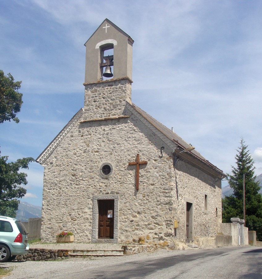

Forest-Saint-Julien
- commune in Hautes-Alpes, France
Hiking in Forest-Saint-Julien
Forest-Saint-Julien, located in the Rhône-Alpes region of France, is a picturesque area that offers a variety of hiking opportunities for outdoor enthusiasts. Known for its diverse landscapes, including lush forests, rolling hills, and scenic views of the surrounding mountains, it’s a great destination for nature lovers....
- Country:
- Postal Code: 05260
- Coordinates: 44° 38' 2" N, 6° 8' 8" E
- GPS tracks (wikiloc): [Link]
- Area: 6.95 sq km
- Population: 317

Montjay
- commune in Hautes-Alpes, France
Hiking in Montjay
Montjay, located in the Hautes-Alpes region of France, is a stunning area for hiking enthusiasts. Nestled in the French Alps, it offers a variety of trails that cater to different skill levels, from leisurely walks to more challenging hikes. Here are some highlights about hiking in this beautiful region:...
- Country:
- Postal Code: 05150
- Coordinates: 44° 21' 37" N, 5° 36' 14" E
- GPS tracks (wikiloc): [Link]
- Area: 27 sq km
- Population: 105

Champoléon
- commune in Hautes-Alpes, France
Hiking in Champoléon
Champoléon is a beautiful valley located in the Écrins National Park in the French Alps, known for its stunning landscapes, diverse flora and fauna, and a variety of hiking trails suitable for different skill levels. Here are some key points to consider when hiking in Champoléon:...
- Country:
- Postal Code: 05260
- Coordinates: 44° 43' 14" N, 6° 15' 40" E
- GPS tracks (wikiloc): [Link]
- Area: 98.54 sq km
- Population: 148

Ristolas
- commune in Hautes-Alpes, France
Hiking in Ristolas
Ristolas is a beautiful area located in the French Alps, specifically in the Queyras Regional Natural Park. It’s known for its stunning landscapes, diverse flora and fauna, and a variety of hiking trails that cater to different skill levels. Here are some key points to consider when planning a hike in Ristolas:...
- Country:
- Postal Code: 05460
- Coordinates: 44° 46' 25" N, 6° 57' 20" E
- GPS tracks (wikiloc): [Link]
- Area: 82.18 sq km
- Population: 73

La Grave
- commune in Hautes-Alpes, France
Hiking in La Grave
La Grave is a stunning area located in the French Alps, known for its breathtaking mountain scenery and varied hiking opportunities. Here are some key points to consider if you're planning a hiking trip in La Grave:...
- Country:
- Postal Code: 05320
- Coordinates: 45° 2' 46" N, 6° 18' 21" E
- GPS tracks (wikiloc): [Link]
- Area: 126.91 sq km
- Population: 487
- Web site: [Link]
Montbrand
- commune in Hautes-Alpes, France
Hiking in Montbrand
Montbrand is a charming area in the French Alps, known for its serene natural landscapes and opportunities for outdoor enthusiasts, particularly hikers. While specific trails and conditions may vary, here are some general insights into hiking in Montbrand:...
- Country:
- Postal Code: 05140
- Coordinates: 44° 35' 23" N, 5° 40' 57" E
- GPS tracks (wikiloc): [Link]
- Area: 25.03 sq km
- Population: 65


Saint-Pierre-d'Argençon
- commune in Hautes-Alpes, France
Hiking in Saint-Pierre-d'Argençon
Saint-Pierre-d'Argençon is a beautiful village located in the Hautes-Alpes region of southeastern France. It is surrounded by stunning natural scenery, making it a great destination for hiking enthusiasts. Here are some details about hiking in this area:...
- Country:
- Postal Code: 05140
- Coordinates: 44° 31' 12" N, 5° 41' 54" E
- GPS tracks (wikiloc): [Link]
- Area: 18.81 sq km
- Population: 157

Saint-Julien-en-Beauchêne
- commune in Hautes-Alpes, France
Hiking in Saint-Julien-en-Beauchêne
Saint-Julien-en-Beauchêne is a charming commune located in the Hautes-Alpes region of southeastern France. The area is known for its stunning natural landscapes, including mountains, forests, and picturesque valleys, making it an excellent destination for hikers of all levels....
- Country:
- Postal Code: 05140
- Coordinates: 44° 36' 58" N, 5° 42' 35" E
- GPS tracks (wikiloc): [Link]
- Area: 59.43 sq km
- Population: 124
- Web site: [Link]

La Bâtie-Montsaléon
- commune in Hautes-Alpes, France
Hiking in La Bâtie-Montsaléon
La Bâtie-Montsaléon is a beautiful destination for hiking enthusiasts located in the Drôme department of France. Nestled in the stunning landscapes of the Provence-Alpes-Côte d'Azur region, it offers numerous trails that showcase the area's natural beauty, rich flora, and panoramic views of the surrounding mountains....
- Country:
- Postal Code: 05700
- Coordinates: 44° 27' 22" N, 5° 44' 58" E
- GPS tracks (wikiloc): [Link]
- Area: 15.08 sq km
- Population: 234
- Web site: [Link]


La Faurie
- commune in Hautes-Alpes, France
Hiking in La Faurie
La Faurie is a picturesque village located in the Département of Hautes-Alpes in southeastern France, within the Provence-Alpes-Côte d'Azur region. The surrounding landscape offers stunning views and a variety of hiking opportunities suitable for different skill levels....
- Country:
- Postal Code: 05140
- Coordinates: 44° 34' 2" N, 5° 44' 24" E
- GPS tracks (wikiloc): [Link]
- Area: 31.44 sq km
- Population: 315
La Haute-Beaume
- commune in Hautes-Alpes, France
Hiking in La Haute-Beaume
La Haute-Beaume, located in the Auvergne region of France, offers a variety of hiking opportunities amid stunning natural landscapes. The area is characterized by rolling hills, lush forests, and picturesque valleys, making it a perfect destination for both novice and experienced hikers....
- Country:
- Postal Code: 05140
- Coordinates: 44° 33' 50" N, 5° 37' 40" E
- GPS tracks (wikiloc): [Link]
- AboveSeaLevel: 1100 м m
- Area: 7.13 sq km
- Population: 9

Rabou
- commune in Hautes-Alpes, France
Hiking in Rabou
Rabou is a charming village located in the French Alps, specifically within the Hautes-Alpes region. It is surrounded by stunning natural landscapes, making it an excellent destination for hiking enthusiasts. Here’s what you need to know about hiking in and around Rabou:...
- Country:
- Postal Code: 05400
- Coordinates: 44° 35' 28" N, 6° 0' 20" E
- GPS tracks (wikiloc): [Link]
- Area: 26.56 sq km
- Population: 77

Laye
- commune in Hautes-Alpes, France
Hiking in Laye
Laye, a charming commune in the Hautes-Alpes region of southeastern France, offers beautiful landscapes and a variety of hiking opportunities. Nestled in the French Alps, it boasts stunning mountain views, lush valleys, and diverse wildlife. Here are some key points to consider if you’re planning a hiking adventure in Laye:...
- Country:
- Postal Code: 05500
- Coordinates: 44° 39' 40" N, 6° 5' 3" E
- GPS tracks (wikiloc): [Link]
- Area: 10.55 sq km
- Population: 234

La Piarre
- commune in Hautes-Alpes, France
Hiking in La Piarre
La Piarre, located in the French Alps, is a beautiful region that offers various hiking opportunities. Here are some key highlights for those looking to explore hiking in La Piarre:...
- Country:
- Postal Code: 05700
- Coordinates: 44° 28' 31" N, 5° 39' 20" E
- GPS tracks (wikiloc): [Link]
- Area: 21.67 sq km
- Population: 90

Étoile-Saint-Cyrice
- commune in Hautes-Alpes, France
Hiking in Étoile-Saint-Cyrice
Étoile-Saint-Cyrice is a picturesque commune located in the Alpes-de-Haute-Provence region of southeastern France. The area is renowned for its stunning natural landscapes, making it an excellent destination for hiking enthusiasts. Here’s an overview of what you can expect when hiking in and around Étoile-Saint-Cyrice:...
- Country:
- Postal Code: 05700
- Coordinates: 44° 18' 55" N, 5° 37' 41" E
- GPS tracks (wikiloc): [Link]
- AboveSeaLevel: 880 м m
- Area: 14.41 sq km
- Population: 31
- Web site: [Link]
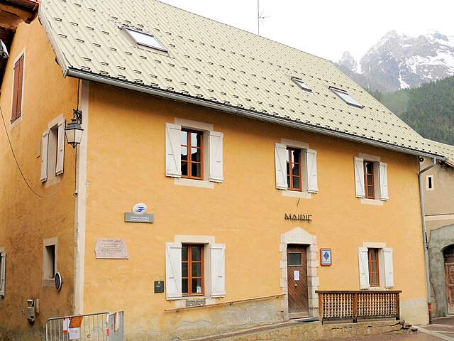
Ceillac
- commune in Hautes-Alpes, France
Hiking in Ceillac
Ceillac is a charming village located in the Queyras Regional Natural Park in the French Alps, known for its stunning landscapes and excellent hiking opportunities. The area is characterized by its beautiful valleys, high peaks, and a variety of ecosystems, making it a perfect destination for both novice and experienced hikers....
- Country:
- Postal Code: 05600
- Coordinates: 44° 40' 1" N, 6° 46' 36" E
- GPS tracks (wikiloc): [Link]
- Area: 96.05 sq km
- Population: 294
- Web site: [Link]

Montrond
- commune in Hautes-Alpes, France
Hiking in Montrond
Montrond, located in the Hautes-Alpes region of southeastern France, is known for its stunning natural landscapes and a variety of hiking opportunities. The area is part of the French Alps, which offers beautiful vistas, diverse flora and fauna, and well-marked hiking trails suitable for all skill levels....
- Country:
- Postal Code: 05700
- Coordinates: 44° 22' 54" N, 5° 44' 27" E
- GPS tracks (wikiloc): [Link]
- Area: 4.46 sq km
- Population: 63

Mont-Dauphin
- commune in Hautes-Alpes, France
Hiking in Mont-Dauphin
Mont-Dauphin, located in the Hautes-Alpes region of France, is a beautiful destination for hiking enthusiasts. The area offers stunning views of the surrounding mountains and has a rich history, with its star-shaped fortress built in the 17th century by Vauban, a prominent military engineer. Here are some highlights and tips for hiking in Mont-Dauphin:...
- Country:
- Postal Code: 05600
- Coordinates: 44° 40' 9" N, 6° 37' 26" E
- GPS tracks (wikiloc): [Link]
- Area: 0.58 sq km
- Population: 146
- Web site: [Link]

La Rochette
- commune in Hautes-Alpes, France
Hiking in La Rochette
La Rochette, located in the Hautes-Alpes region of southeastern France, offers a fantastic setting for hiking enthusiasts. The area is characterized by stunning alpine landscapes, diverse ecosystems, and a plethora of trails catering to various skill levels....
- Country:
- Postal Code: 05000
- Coordinates: 44° 35' 41" N, 6° 9' 22" E
- GPS tracks (wikiloc): [Link]
- Area: 10.34 sq km
- Population: 472


arrondissement of Briançon
- arrondissement of France
Hiking in arrondissement of Briançon
The Arrondissement of Briançon, located in the Hautes-Alpes department of the Provence-Alpes-Côte d'Azur region in France, is renowned for its stunning Alpine scenery and offers a plethora of hiking opportunities. Here are key highlights and information about hiking in this beautiful area:...
- Country:
- Capital: Briançon
- Coordinates: 44° 45' 0" N, 6° 40' 0" E
- GPS tracks (wikiloc): [Link]
- Area: 2138 sq km
- Population: 35673

arrondissement of Gap
- arrondissement of France
Hiking in arrondissement of Gap
The Arrondissement of Gap, located in the Hautes-Alpes department in southeastern France, is a great destination for hiking enthusiasts. This area is characterized by its stunning landscapes, which include rolling hills, majestic mountains, deep valleys, and pristine alpine lakes. Here are some highlights and tips for hiking in this region:...
- Country:
- Capital: Gap
- Coordinates: 44° 40' 0" N, 6° 0' 0" E
- GPS tracks (wikiloc): [Link]
- Area: 3411 sq km
- Population: 105243
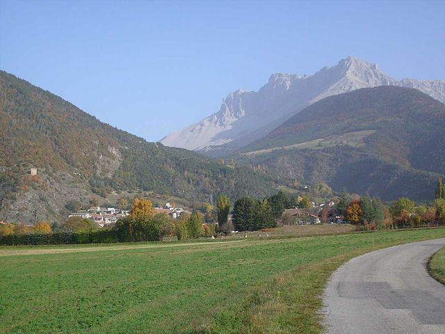
Montmaur
- commune in Hautes-Alpes, France
Hiking in Montmaur
Montmaur, located in the Hautes-Alpes department of France, offers a range of hiking opportunities for outdoor enthusiasts. Nestled in the picturesque French Alps, this area is characterized by stunning landscapes, diverse flora and fauna, and a variety of trails suitable for different skill levels....
- Country:
- Postal Code: 05400
- Coordinates: 44° 34' 16" N, 5° 52' 27" E
- GPS tracks (wikiloc): [Link]
- Area: 48.77 sq km
- Population: 515

Espinasses
- commune in Hautes-Alpes, France
Hiking in Espinasses
Espinasses is a charming village located in the French Alps, in the department of Hautes-Alpes. It offers a variety of hiking opportunities suitable for different skill levels, surrounded by stunning natural beauty....
- Country:
- Postal Code: 05190
- Coordinates: 44° 28' 0" N, 6° 13' 29" E
- GPS tracks (wikiloc): [Link]
- Area: 13.86 sq km
- Population: 728
- Web site: [Link]

Tallard
- commune in Hautes-Alpes, France
Hiking in Tallard
Tallard is a charming commune in the Hautes-Alpes department of southeastern France, known for its beautiful landscapes and outdoor activities. While the area is not as widely recognized as some of the more famous hiking destinations in the French Alps, it offers a unique experience for hikers looking to explore less crowded trails....
- Country:
- Postal Code: 05130
- Coordinates: 44° 27' 42" N, 6° 3' 16" E
- GPS tracks (wikiloc): [Link]
- Area: 15.02 sq km
- Population: 2151
- Web site: [Link]

La Bâtie-Neuve
- commune in Hautes-Alpes, France
Hiking in La Bâtie-Neuve
La Bâtie-Neuve is a picturesque village located in the Hautes-Alpes region of southeastern France. It's an excellent destination for hiking enthusiasts due to its stunning natural surroundings, including the nearby Écrins National Park and the breathtaking landscapes of the Alps....
- Country:
- Postal Code: 05230
- Coordinates: 44° 34' 0" N, 6° 11' 45" E
- GPS tracks (wikiloc): [Link]
- Area: 27.99 sq km
- Population: 2487
- Web site: [Link]

Baratier
- commune in Hautes-Alpes, France
Hiking in Baratier
Baratier, a small commune located in the French Alps near the Écrins National Park, offers stunning landscapes and a variety of hiking opportunities. Here are some key points to consider when exploring this beautiful area:...
- Country:
- Postal Code: 05200
- Coordinates: 44° 32' 16" N, 6° 29' 43" E
- GPS tracks (wikiloc): [Link]
- Area: 15.99 sq km
- Population: 559
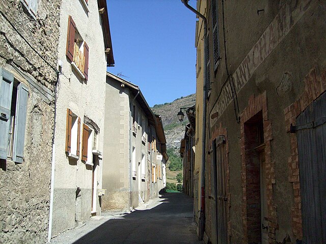
Bréziers
- commune in Hautes-Alpes, France
Hiking in Bréziers
Bréziers is a charming town in the Occitanie region of southern France. While it is not as widely known for hiking as some other areas in France, it is surrounded by beautiful landscapes that can offer some great hiking opportunities....
- Country:
- Postal Code: 05190
- Coordinates: 44° 25' 35" N, 6° 11' 58" E
- GPS tracks (wikiloc): [Link]
- Area: 30.35 sq km
- Population: 210

Risoul
- commune in Hautes-Alpes, France
Hiking in Risoul
Risoul is a charming alpine village located in the French Alps, known primarily for its ski resort, but it also offers fantastic hiking opportunities during the warmer months. Here are some key points to consider if you're looking to hike in Risoul:...
- Country:
- Postal Code: 05600
- Coordinates: 44° 38' 55" N, 6° 38' 24" E
- GPS tracks (wikiloc): [Link]
- Area: 30.34 sq km
- Population: 638

Trescléoux
- commune in Hautes-Alpes, France
Hiking in Trescléoux
Trescléoux, located in the Hautes-Alpes department of France, offers a unique hiking experience with stunning landscapes and diverse trails. Nestled in the foothills of the Alps, it provides hikers with access to beautiful natural features, including rolling hills, rocky outcrops, and alpine meadows....
- Country:
- Postal Code: 05700
- Coordinates: 44° 21' 15" N, 5° 42' 31" E
- GPS tracks (wikiloc): [Link]
- Area: 18.68 sq km
- Population: 318
- Web site: [Link]

Puy-Saint-Eusèbe
- commune in Hautes-Alpes, France
Hiking in Puy-Saint-Eusèbe
Puy-Saint-Eusèbe is a charming destination for hiking enthusiasts, nestled in the region of Auvergne-Rhône-Alpes in southeastern France. The area is known for its stunning landscapes, characterized by rolling hills, deep valleys, and picturesque views of the surrounding mountains....
- Country:
- Postal Code: 05200
- Coordinates: 44° 34' 4" N, 6° 24' 4" E
- GPS tracks (wikiloc): [Link]
- Area: 11.31 sq km
- Population: 137

Montgenèvre
- commune in Hautes-Alpes, France
Hiking in Montgenèvre
Montgenèvre is a charming village located in the French Alps, right near the Italian border, and it's an excellent destination for hiking enthusiasts. The landscape is characterized by breathtaking mountain views, lush valleys, and a range of trails suitable for various skill levels. Here are some key points about hiking in Montgenèvre:...
- Country:
- Postal Code: 05100
- Coordinates: 44° 55' 51" N, 6° 43' 16" E
- GPS tracks (wikiloc): [Link]
- AboveSeaLevel: 1860 м m
- Area: 40.07 sq km
- Population: 510
- Web site: [Link]

Lettret
- commune in Hautes-Alpes, France
Hiking in Lettret
Lettret, located in the French Alps, is a beautiful area known for its stunning natural landscapes, making it a fantastic destination for hiking enthusiasts. Here’s what you should know about hiking in Lettret:...
- Country:
- Postal Code: 05130
- Coordinates: 44° 28' 6" N, 6° 3' 40" E
- GPS tracks (wikiloc): [Link]
- Area: 4.2 sq km
- Population: 171
- Web site: [Link]

Rousset
- commune in Hautes-Alpes, France
Hiking in Rousset
Rousset, located in the Hautes-Alpes region of France, is a fantastic destination for hiking enthusiasts. This picturesque village is surrounded by stunning natural landscapes, ranging from mountainous terrain to lush valleys, making it an ideal spot for hikers of all skill levels....
- Country:
- Postal Code: 05190
- Coordinates: 44° 27' 59" N, 6° 14' 3" E
- GPS tracks (wikiloc): [Link]
- AboveSeaLevel: 1040 м m
- Area: 14.38 sq km
- Population: 171
- Web site: [Link]

Crévoux
- commune in Hautes-Alpes, France
Hiking in Crévoux
Crévoux is a picturesque village located in the French Alps, part of the Hautes-Alpes department, and is often celebrated for its stunning natural beauty and outdoor recreational opportunities, including fantastic hiking trails. Here are some highlights to help you prepare for a hiking adventure in Crévoux:...
- Country:
- Postal Code: 05200
- Coordinates: 44° 32' 53" N, 6° 36' 26" E
- GPS tracks (wikiloc): [Link]
- Area: 56.26 sq km
- Population: 140

Eygliers
- commune in Hautes-Alpes, France
Hiking in Eygliers
Eygliers is a charming village located in the southern French Alps, near the Queyras Regional Natural Park. It’s a fantastic destination for hiking enthusiasts, offering stunning landscapes, diverse trails, and opportunities to explore both nature and local culture....
- Country:
- Postal Code: 05600
- Coordinates: 44° 40' 33" N, 6° 38' 2" E
- GPS tracks (wikiloc): [Link]
- AboveSeaLevel: 1029 м m
- Area: 30.04 sq km
- Population: 761


Vitrolles
- commune in Hautes-Alpes, France
Hiking in Vitrolles
Vitrolles, located in the Hautes-Alpes region of France, offers a fantastic environment for hiking enthusiasts. Surrounded by stunning landscapes, including mountains, valleys, and rivers, the area provides a range of trails suitable for various skill levels....
- Country:
- Postal Code: 05110
- Coordinates: 44° 24' 44" N, 5° 57' 15" E
- GPS tracks (wikiloc): [Link]
- AboveSeaLevel: 1000.0 м m
- Area: 14.62 sq km
- Population: 206


Saint-Pierre-Avez
- commune in Hautes-Alpes, France
Hiking in Saint-Pierre-Avez
Saint-Pierre-Avez is a charming village in the Auvergne region of France, nestled in the heart of nature and surrounded by stunning landscapes. Hiking in this area offers a unique experience for outdoor enthusiasts, with various trails that cater to different skill levels....
- Country:
- Postal Code: 05300
- Coordinates: 44° 15' 26" N, 5° 45' 40" E
- GPS tracks (wikiloc): [Link]
- Area: 11.37 sq km
- Population: 30

Lardier-et-Valença
- commune in Hautes-Alpes, France
Hiking in Lardier-et-Valença
Lardier-et-Valença is a charming commune located in the Hautes-Alpes department in southeastern France. The region's natural beauty and varied terrain make it an excellent destination for hiking enthusiasts....
- Country:
- Postal Code: 05110
- Coordinates: 44° 26' 5" N, 5° 58' 51" E
- GPS tracks (wikiloc): [Link]
- AboveSeaLevel: 1015.0 м m
- Area: 14.86 sq km
- Population: 329

Chabestan
- commune in Hautes-Alpes, France
Hiking in Chabestan
Chabestan, known for its breathtaking landscapes and diverse terrain, offers numerous hiking opportunities for outdoor enthusiasts of all levels. Although there may not be extensive information readily available about Chabestan, I can provide you with general tips that are applicable to hiking in areas with similar landscapes and characteristics....
- Country:
- Postal Code: 05400
- Coordinates: 44° 28' 41" N, 5° 46' 59" E
- GPS tracks (wikiloc): [Link]
- Area: 12.2 sq km
- Population: 136
- Web site: [Link]
Shares border with regions:

Piedmont
- region in North-West Italy
Hiking in Piedmont
Hiking in the Piedmont region offers a wonderful blend of natural beauty, diverse landscapes, and rich cultural heritage. This area, which generally encompasses the foothills of the Appalachian Mountains and stretches across parts of Virginia, North Carolina, South Carolina, and more, features rolling hills, lush forests, and scenic views. Here are some highlights and tips for hiking in Piedmont:...
- Country:

- Capital: Turin
- Coordinates: 45° 15' 0" N, 7° 55' 0" E
- GPS tracks (wikiloc): [Link]
- AboveSeaLevel: 421 м m
- Area: 25402 sq km
- Population: 4367559
- Web site: [Link]


Isère
- French department
Hiking in Isère
Isère, located in the Auvergne-Rhône-Alpes region of France, offers some of the most beautiful and diverse hiking opportunities in the French Alps. Known for its stunning mountain scenery, charming villages, and rich cultural heritage, Isère is a fantastic destination for hikers of all levels. Here are some highlights of hiking in Isère:...
- Country:
- Capital: Grenoble
- Coordinates: 45° 20' 0" N, 5° 30' 0" E
- GPS tracks (wikiloc): [Link]
- AboveSeaLevel: 846 м m
- Area: 7431 sq km
- Population: 1251060
- Web site: [Link]

Savoie
- French department in the Auvergne-Rhône-Alpes region of the French Alps
Hiking in Savoie
Savoie, located in the Auvergne-Rhône-Alpes region of France, is a stunning area known for its dramatic landscapes, alpine scenery, and rich cultural heritage. Hiking in Savoie offers a diverse range of trails suitable for all skill levels, from leisurely walks to challenging mountain treks....
- Country:
- Capital: Chambéry
- Coordinates: 45° 35' 0" N, 6° 20' 0" E
- GPS tracks (wikiloc): [Link]
- AboveSeaLevel: 1595 м m
- Area: 6028 sq km
- Population: 428204
- Web site: [Link]


Province of Cuneo
- province in Italy
Hiking in Province of Cuneo
The Province of Cuneo, located in the Piedmont region of northwestern Italy, is a fantastic destination for hiking enthusiasts. This area is known for its stunning alpine landscapes, diverse ecosystems, and charming villages, making it an ideal spot for outdoor activities. Here are some highlights and key information about hiking in the Province of Cuneo:...
- Country:
- Capital: Cuneo
- Postal Code: 12100
- Licence Plate Code: CN
- Coordinates: 44° 23' 0" N, 7° 33' 0" E
- GPS tracks (wikiloc): [Link]
- Area: 6902.65 sq km
- Web site: [Link]

Province of Turin
- former province of Italy (1847 to 2014), now Metropolitan City of Turin (Q18288162)
Hiking in Province of Turin
The Province of Turin, located in the Piedmont region of northwest Italy, offers a diverse range of hiking opportunities set against stunning mountainous backdrops, particularly in the Susa Valley and the nearby areas of the Alps....
- Country:
- Capital: Turin
- Postal Code: 10010–10099; 10121–10156
- Local Dialing Code: 0161; 0125; 0124; 0123; 0122; 0121; 011
- Licence Plate Code: TO
- Coordinates: 45° 4' 0" N, 7° 42' 0" E
- GPS tracks (wikiloc): [Link]
- Area: 6821 sq km
- Web site: [Link]
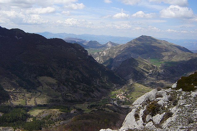
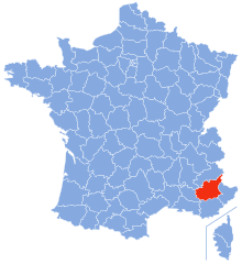
Alpes-de-Haute-Provence
- French department
Hiking in Alpes-de-Haute-Provence
Hiking in the Alpes-de-Haute-Provence region of southeastern France offers a unique blend of stunning landscapes, diverse ecosystems, and charming villages. Here are some key points to consider if you’re planning a hiking trip in this area:...
- Country:
- Capital: Digne-les-Bains
- Coordinates: 44° 5' 43" N, 6° 14' 24" E
- GPS tracks (wikiloc): [Link]
- Area: 6925 sq km
- Population: 161799
- Web site: [Link]


Drôme
- French department
Hiking in Drôme
Hiking in the Drôme department in southeastern France is a fantastic experience, known for its diverse landscapes, charming villages, and rich natural heritage. The area offers a variety of trails suitable for all levels of hikers, from beginners to advanced....
- Country:
- Capital: Valence
- Coordinates: 44° 45' 0" N, 5° 10' 0" E
- GPS tracks (wikiloc): [Link]
- Area: 6530 sq km
- Population: 504637
- Web site: [Link]