Vatilieu (Vatilieu)

- commune in Isère, France
 Hiking in Vatilieu
Vatilieu is a charming commune located in the Isère department in the Auvergne-Rhône-Alpes region of southeastern France. Although it may not be as widely known as other hiking destinations, the surrounding area offers beautiful landscapes and opportunities for outdoor activities like hiking.
Hiking Trails
While specific trails in Vatilieu might not be extensively documented, a few general guidelines can help you find great hiking options in the region:
-
Local Paths: Look for local paths and trails that connect to nearby mountains and forests. The rolling hills and countryside in this area provide a wonderful backdrop for a walk or hike.
-
Nearby Parks: Consider exploring nearby natural parks or reserves, such as the Chartreuse Regional Natural Park or the Vercors Regional Natural Park. These parks are home to well-marked hiking trails with varying difficulty levels, stunning views, and diverse flora and fauna.
-
Graded Trails: You may find graded hiking trails suited for different fitness levels, ranging from easy walks to more challenging climbs. Always check local resources or maps for updates on trail conditions and lengths.
Tips for Hiking in Vatilieu
- Preparation: Make sure to wear suitable footwear and dress in layers to adapt to changing weather conditions.
- Navigation: Carry a map or GPS device, as some trails may not be well-marked.
- Local Guides: Consider hiring a local guide if you want an enriched experience of the region, as they can provide information on the flora, fauna, and history of the area.
- Safety: Always let someone know your planned route and expected return time, especially if you’re hiking alone.
Best Time to Visit
The ideal time for hiking in Vatilieu and the surrounding regions is during spring (April to June) and early autumn (September to October) when the weather is mild and the scenery is lush.
Conclusion
Whether exploring the lovely countryside around Vatilieu or venturing into the larger natural parks nearby, there's plenty to enjoy for hiking enthusiasts. Just remember to plan ahead and prioritize safety, and you'll have a wonderful experience exploring the beauty of this region!
- Country:

- Postal Code: 38470
- Coordinates: 45° 15' 22" N, 5° 24' 38" E


- GPS tracks (wikiloc): [Link]
- Area: 9.22 sq km
- Population: 370
- Web site: http://vatilieu.sud-gresivaudan.org
- Wikipedia en: wiki(en)
- Wikipedia: wiki(fr)
- Wikidata storage: Wikidata: Q1067448
- Wikipedia Commons Category: [Link]
- Freebase ID: [/m/03nvk2c]
- GeoNames ID: Alt: [6433441]
- SIREN number: [213805260]
- BnF ID: [15258326p]
- INSEE municipality code: 38526
Shares border with regions:


Cras
- commune in Isère, France
Hiking in Cras
Cras, located in the Isère department of the Auvergne-Rhône-Alpes region in southeastern France, provides an excellent backdrop for hiking enthusiasts. The area is known for its stunning mountain landscapes, diverse flora and fauna, and well-marked trails. Here are some key points to consider when hiking in Cras:...
- Country:
- Postal Code: 38210
- Coordinates: 45° 16' 8" N, 5° 27' 0" E
- GPS tracks (wikiloc): [Link]
- Area: 5.43 sq km
- Population: 448
- Web site: [Link]

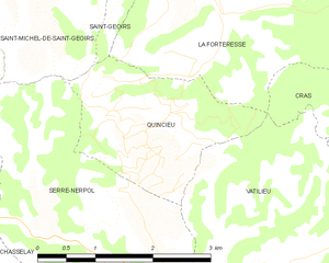
Quincieu
- commune in Isère, France
Hiking in Quincieu
Quincieu is not a widely recognized hiking destination in the usual lists of outdoor places, which might imply that you meant a specific region or perhaps there was a typo in the name. If you're referring to a specific area or local trail in a less popular region, I would recommend checking local hiking forums or resources for detailed information....
- Country:
- Postal Code: 38470
- Coordinates: 45° 16' 32" N, 5° 23' 7" E
- GPS tracks (wikiloc): [Link]
- Area: 4.75 sq km
- Population: 103
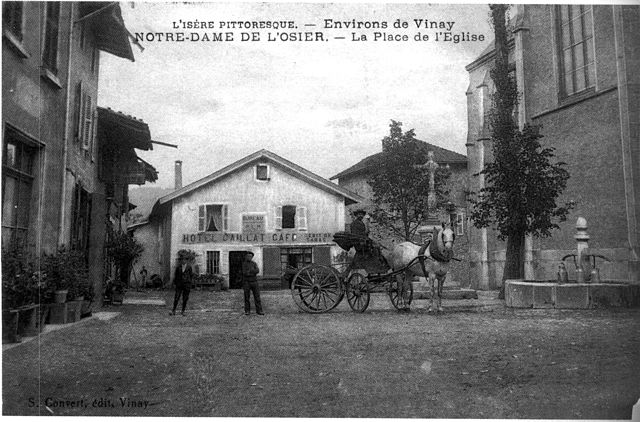
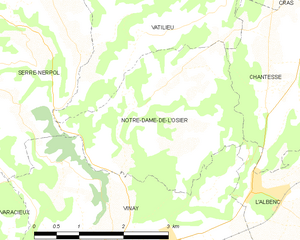
Notre-Dame-de-l'Osier
- commune in Isère, France
Hiking in Notre-Dame-de-l'Osier
Notre-Dame-de-l'Osier, located in the Isère department of France, is a charming village surrounded by stunning natural landscapes, making it an excellent destination for hiking enthusiasts. Here are some highlights:...
- Country:
- Postal Code: 38470
- Coordinates: 45° 14' 18" N, 5° 24' 19" E
- GPS tracks (wikiloc): [Link]
- Area: 8.38 sq km
- Population: 478
- Web site: [Link]

Chantesse
- commune in Isère, France
Hiking in Chantesse
Chantesse, located in the picturesque region of France, offers a variety of hiking opportunities for both beginners and seasoned trekkers. It's nestled in the Vercors massif, which is known for its stunning landscapes, limestone cliffs, and diverse flora and fauna....
- Country:
- Postal Code: 38470
- Coordinates: 45° 14' 34" N, 5° 26' 40" E
- GPS tracks (wikiloc): [Link]
- Area: 5.83 sq km
- Population: 320
- Web site: [Link]

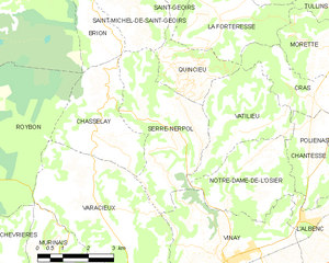
Serre-Nerpol
- commune in Isère, France
Hiking in Serre-Nerpol
Serre-Nerpol, located in the French Alps, offers a range of hiking opportunities for enthusiasts of all skill levels. Here are some key highlights and tips for hiking in this beautiful region:...
- Country:
- Postal Code: 38470
- Coordinates: 45° 15' 29" N, 5° 22' 30" E
- GPS tracks (wikiloc): [Link]
- AboveSeaLevel: 400 м m
- Area: 13.16 sq km
- Population: 293
- Web site: [Link]