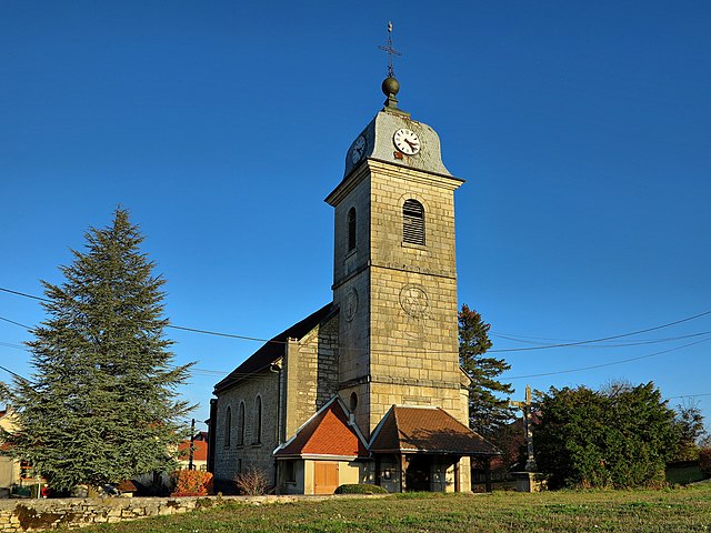
Vaucluse (Vaucluse)

- commune in Doubs, France
 Hiking in Vaucluse
Vaucluse, located in the Doubs department of France, is a region known for its picturesque landscapes, rolling hills, and diverse natural beauty, making it an excellent destination for hiking enthusiasts. Here are some highlights and tips for hiking in Vaucluse:
Scenic Trails
- Regional Natural Parks: Vaucluse is home to beautiful natural parks, such as the Parc naturel régional du Haut-Jura, where you can find a variety of trails that cater to different skill levels.
- Forests and Lakes: The region features lush forests and tranquil lakes, providing opportunities for both short and long hikes that showcase the stunning scenery.
Recommended Trails
- Sentier des Vignes: This is a relatively easy trail that winds through vineyards and offers breathtaking views of the surrounding countryside.
- Les Crêtes du Jura: For more experienced hikers, this trail offers higher elevation and stunning vistas. It can also lead you to various peaks where you can enjoy panoramic views of the Jura Mountains.
Best Time to Hike
- The best time to explore the trails is during spring (April to June) and fall (September to October). During these months, the weather is generally mild, and the landscapes are vibrant with colors.
Hiking Tips
- Prepare for Varied Weather: The weather can change quickly, so it's important to dress in layers and bring rain gear if necessary.
- Stay Hydrated: Always carry enough water, especially on longer hikes.
- Trail Maps: Make sure to have a map or a hiking app downloaded to keep track of trails, as some may not be well-marked.
- Respect Nature: Follow Leave No Trace principles to preserve the natural beauty of the area.
Local Culture and Attractions
After a day of hiking, consider exploring local villages for a taste of regional cuisine, including specialties like Comté cheese or traditional baked goods. Vaucluse is steeped in history, so visiting castles and local markets can enrich your hiking experience.
Overall, Vaucluse in Doubs offers a perfect blend of outdoor activity and cultural exploration, making it a fantastic destination for hikers of all levels.
- Country:

- Postal Code: 25380
- Coordinates: 47° 15' 30" N, 6° 41' 14" E


- GPS tracks (wikiloc): [Link]
- Area: 5.01 sq km
- Population: 119
- Wikipedia en: wiki(en)
- Wikipedia: wiki(fr)
- Wikidata storage: Wikidata: Q907338
- Wikipedia Commons Category: [Link]
- Freebase ID: [/m/03mhdyf]
- GeoNames ID: Alt: [2970555]
- SIREN number: [212505887]
- BnF ID: [15252814m]
- VIAF ID: Alt: [157073240]
- Library of Congress authority ID: Alt: [n50021204]
- INSEE municipality code: 25588
Shares border with regions:


Belleherbe
- commune in Doubs, France
Hiking in Belleherbe
Belleherbe is a charming village located in the Doubs department of the Bourgogne-Franche-Comté region in eastern France. It’s surrounded by beautiful landscapes, making it a great spot for hiking enthusiasts. Here are some key details about hiking in and around Belleherbe:...
- Country:
- Postal Code: 25380
- Coordinates: 47° 15' 43" N, 6° 39' 30" E
- GPS tracks (wikiloc): [Link]
- Area: 16.13 sq km
- Population: 604


Battenans-Varin
- commune in Doubs, France
Hiking in Battenans-Varin
Battenans-Varin, a charming commune in the Bourgogne-Franche-Comté region of France, offers a picturesque setting for hiking enthusiasts. The area is characterized by its natural beauty, with rolling hills, lush forests, and scenic trails that vary in difficulty....
- Country:
- Postal Code: 25380
- Coordinates: 47° 14' 56" N, 6° 42' 43" E
- GPS tracks (wikiloc): [Link]
- AboveSeaLevel: 550 м m
- Area: 6.38 sq km
- Population: 79

Charmoille
- commune in Doubs, France
Hiking in Charmoille
Charmoille, located in the Doubs department of France, is a charming village nestled in the Jura Mountains. The region offers a variety of hiking opportunities that cater to different skill levels and preferences. Here are some aspects to consider when hiking in this area:...
- Country:
- Postal Code: 25380
- Coordinates: 47° 14' 45" N, 6° 40' 15" E
- GPS tracks (wikiloc): [Link]
- Area: 10.14 sq km
- Population: 335


Cour-Saint-Maurice
- commune in Doubs, France
Hiking in Cour-Saint-Maurice
Cour-Saint-Maurice is a picturesque village in the French Alps, known for its stunning natural beauty and excellent hiking opportunities. Nestled in the Auvergne-Rhône-Alpes region, it offers a variety of trails that cater to all skill levels, from leisurely walks through charming valleys to more challenging treks that lead to breathtaking mountain vistas....
- Country:
- Postal Code: 25380
- Coordinates: 47° 15' 22" N, 6° 42' 3" E
- GPS tracks (wikiloc): [Link]
- Area: 4.47 sq km
- Population: 161


Rosureux
- commune in Doubs, France
Hiking in Rosureux
Rosureux is a beautiful destination for hiking enthusiasts, featuring a mix of scenic trails, diverse landscapes, and varying levels of difficulty. While the information may be slightly limited due to its lesser-known status, here are some general highlights you might expect when hiking in the Rosureux area:...
- Country:
- Postal Code: 25380
- Coordinates: 47° 13' 6" N, 6° 41' 14" E
- GPS tracks (wikiloc): [Link]
- Area: 6.14 sq km
- Population: 78