Verderonne (Verderonne)

- commune in Oise, France
- Country:

- Postal Code: 60140
- Coordinates: 49° 19' 46" N, 2° 29' 54" E


- GPS tracks (wikiloc): [Link]
- Area: 3.33 sq km
- Population: 494
- Wikipedia en: wiki(en)
- Wikipedia: wiki(fr)
- Wikidata storage: Wikidata: Q818038
- Wikipedia Commons Category: [Link]
- Freebase ID: [/m/03qg95n]
- GeoNames ID: Alt: [2969985]
- SIREN number: [216006601]
- BnF ID: [152679029]
- INSEE municipality code: 60669
Shares border with regions:


Rosoy
- commune in Oise, France
- Country:
- Postal Code: 60140
- Coordinates: 49° 20' 25" N, 2° 30' 4" E
- GPS tracks (wikiloc): [Link]
- Area: 4.95 sq km
- Population: 631
- Web site: [Link]


Angicourt
- commune in Oise, France
- Country:
- Postal Code: 60940
- Coordinates: 49° 18' 43" N, 2° 30' 13" E
- GPS tracks (wikiloc): [Link]
- Area: 4.96 sq km
- Population: 1441
- Web site: [Link]

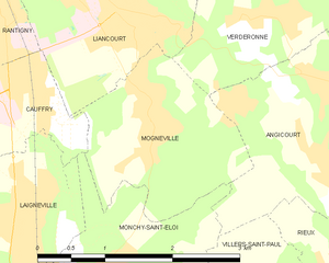
Mogneville
- commune in Oise, France
- Country:
- Postal Code: 60140
- Coordinates: 49° 18' 52" N, 2° 28' 18" E
- GPS tracks (wikiloc): [Link]
- Area: 3.91 sq km
- Population: 1550
- Web site: [Link]


Liancourt
- commune in Oise, France
- Country:
- Postal Code: 60140
- Coordinates: 49° 19' 51" N, 2° 27' 55" E
- GPS tracks (wikiloc): [Link]
- Area: 4.75 sq km
- Population: 7093