Verdille (Verdille)

- commune in Charente, France
- Country:

- Postal Code: 16140
- Coordinates: 45° 52' 52" N, 0° 6' 18" E


- GPS tracks (wikiloc): [Link]
- Area: 14.48 sq km
- Population: 321
- Wikipedia en: wiki(en)
- Wikipedia: wiki(fr)
- Wikidata storage: Wikidata: Q1440499
- Wikipedia Commons Category: [Link]
- Freebase ID: [/m/03mcf6s]
- GeoNames ID: Alt: [2969976]
- SIREN number: [211603972]
- BnF ID: [15248834g]
- INSEE municipality code: 16397
Shares border with regions:


Barbezières
- commune in Charente, France
- Country:
- Postal Code: 16140
- Coordinates: 45° 54' 41" N, 0° 5' 31" E
- GPS tracks (wikiloc): [Link]
- Area: 9.29 sq km
- Population: 125


Bresdon
- commune in Charente-Maritime, France
- Country:
- Postal Code: 17490
- Coordinates: 45° 51' 49" N, 0° 8' 50" E
- GPS tracks (wikiloc): [Link]
- Area: 16.67 sq km
- Population: 233

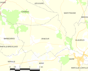
Oradour
- commune in Charente, France
- Country:
- Postal Code: 16140
- Coordinates: 45° 54' 24" N, 0° 1' 54" E
- GPS tracks (wikiloc): [Link]
- Area: 14.4 sq km
- Population: 182

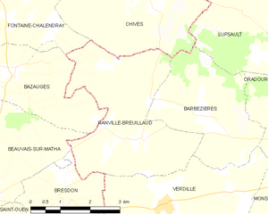
Ranville-Breuillaud
- commune in Charente, France
- Country:
- Postal Code: 16140
- Coordinates: 45° 54' 8" N, 0° 7' 3" E
- GPS tracks (wikiloc): [Link]
- Area: 12.84 sq km
- Population: 186
- Web site: [Link]


Mons
- commune in Charente, France
- Country:
- Postal Code: 16140
- Coordinates: 45° 52' 6" N, 0° 0' 53" E
- GPS tracks (wikiloc): [Link]
- AboveSeaLevel: 85 м m
- Area: 20.11 sq km
- Population: 253


Auge-Saint-Médard
- commune in Charente, France
- Country:
- Postal Code: 16170
- Coordinates: 45° 50' 50" N, 0° 5' 9" E
- GPS tracks (wikiloc): [Link]
- AboveSeaLevel: 92 м m
- Area: 17.37 sq km
- Population: 302