Verneuil-sur-Seine (Verneuil-sur-Seine)

- commune in Yvelines, France
- Country:

- Postal Code: 78480
- Coordinates: 48° 58' 47" N, 1° 58' 26" E


- GPS tracks (wikiloc): [Link]
- Area: 9.43 sq km
- Population: 15366
- Web site: http://www.ville-verneuil-sur-seine.fr/
- Wikipedia en: wiki(en)
- Wikipedia: wiki(fr)
- Wikidata storage: Wikidata: Q642326
- Wikipedia Commons Category: [Link]
- Freebase ID: [/m/03qgf7w]
- Freebase ID: [/m/03qgf7w]
- GeoNames ID: Alt: [2969796]
- GeoNames ID: Alt: [2969796]
- SIREN number: [217806421]
- SIREN number: [217806421]
- BnF ID: [15276121b]
- BnF ID: [15276121b]
- VIAF ID: Alt: [168747145]
- VIAF ID: Alt: [168747145]
- GND ID: Alt: [4440227-2]
- GND ID: Alt: [4440227-2]
- Library of Congress authority ID: Alt: [nr95043881]
- Library of Congress authority ID: Alt: [nr95043881]
- PACTOLS thesaurus ID: [pcrt05PUv5JmYK]
- PACTOLS thesaurus ID: [pcrt05PUv5JmYK]
- MusicBrainz area ID: [ff57ab21-19bc-48c9-8400-0c16d2eea3b6]
- MusicBrainz area ID: [ff57ab21-19bc-48c9-8400-0c16d2eea3b6]
- TGN ID: [1036067]
- TGN ID: [1036067]
- Twitter username: Alt: [VilledeVerneuil]
- Twitter username: Alt: [VilledeVerneuil]
- INSEE municipality code: 78642
- INSEE municipality code: 78642
Shares border with regions:

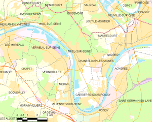
Triel-sur-Seine
- commune in Yvelines, France
- Country:
- Postal Code: 78510
- Coordinates: 48° 58' 51" N, 2° 0' 22" E
- GPS tracks (wikiloc): [Link]
- Area: 13.58 sq km
- Population: 11922


Vaux-sur-Seine
- commune in Yvelines, France
- Country:
- Postal Code: 78740
- Coordinates: 49° 0' 28" N, 1° 57' 47" E
- GPS tracks (wikiloc): [Link]
- Area: 8.45 sq km
- Population: 4788

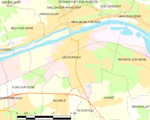
Les Mureaux
- commune in Yvelines, France
- Country:
- Postal Code: 78130
- Coordinates: 48° 59' 35" N, 1° 54' 30" E
- GPS tracks (wikiloc): [Link]
- Area: 11.99 sq km
- Population: 32048
- Web site: [Link]


Chapet
- commune in Yvelines, France
- Country:
- Postal Code: 78130
- Coordinates: 48° 57' 59" N, 1° 56' 1" E
- GPS tracks (wikiloc): [Link]
- Area: 5.1 sq km
- Population: 1263

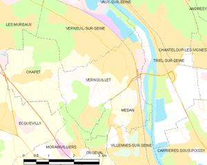
Vernouillet
- commune in Yvelines, France
- Country:
- Postal Code: 78540
- Coordinates: 48° 58' 20" N, 1° 59' 0" E
- GPS tracks (wikiloc): [Link]
- Area: 6.48 sq km
- Population: 9963
- Web site: [Link]