Vernois-lès-Belvoir (Vernois-lès-Belvoir)

- commune in Doubs, France
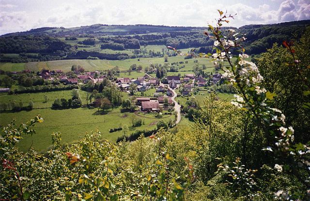
 Hiking in Vernois-lès-Belvoir
Vernois-lès-Belvoir is a charming village located in the Doubs department in the Bourgogne-Franche-Comté region of France. While it may not be as widely known as some other hiking destinations, it offers beautiful landscapes and opportunities for outdoor activities, including hiking.
Hiking in Vernois-lès-Belvoir
-
Scenic Trails: The area around Vernois-lès-Belvoir features picturesque rural landscapes, with rolling hills, forests, and agricultural fields. You can find several trails that take you through these serene environments, providing a great opportunity to enjoy nature and wildlife.
-
Difficulty Levels: The trails around Vernois-lès-Belvoir vary in difficulty. Whether you're a seasoned hiker or a beginner, you can find suitable paths. Some trails may lead to higher elevations, offering stunning views of the surrounding region.
-
Nearby Nature Reserves: The proximity to natural reserves can enhance your hiking experience. Consider exploring nearby parks or protected areas that offer a variety of trails. These areas often have well-marked paths and informative signage regarding local flora and fauna.
-
Local Highlights: Along your hike, you might encounter historical sites or local landmarks, such as old stone buildings or churches, adding cultural depth to your outdoor adventure.
-
Best Time to Hike: The best times for hiking in the Vernois-lès-Belvoir area are typically in spring and early autumn when the weather is mild, and the landscapes are particularly beautiful. Summer can be warm, and winter may bring challenging conditions if there's snow and ice.
-
Preparation and Gear: As with any hiking trip, ensure you're adequately prepared. Wear suitable hiking boots, bring enough water, snacks, and first-aid supplies, and consider a map or GPS device as some trails may not be well-marked.
-
Local Advice: Don't hesitate to ask locals or visit a nearby tourist information center for advice on trails and safety tips. They can provide insights into current trail conditions and any specific recommendations.
Overall, hiking in Vernois-lès-Belvoir can offer a peaceful and picturesque outdoor experience, perfect for those looking to enjoy nature away from the busier tourist spots.
- Country:

- Postal Code: 25430
- Coordinates: 47° 19' 40" N, 6° 38' 24" E


- GPS tracks (wikiloc): [Link]
- Area: 4.68 sq km
- Population: 59
- Wikipedia en: wiki(en)
- Wikipedia: wiki(fr)
- Wikidata storage: Wikidata: Q605003
- Wikipedia Commons Category: [Link]
- Freebase ID: [/m/03mhf3z]
- GeoNames ID: Alt: [6430045]
- SIREN number: [212506075]
- INSEE municipality code: 25607
Shares border with regions:

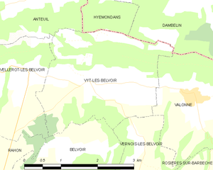
Vyt-lès-Belvoir
- commune in Doubs, France
Hiking in Vyt-lès-Belvoir
Vyt-lès-Belvoir is a small commune located in the Doubs department in the Bourgogne-Franche-Comté region of eastern France. The area is known for its picturesque landscapes, dense forests, and charming countryside, making it a great place for hiking enthusiasts....
- Country:
- Postal Code: 25430
- Coordinates: 47° 20' 54" N, 6° 37' 18" E
- GPS tracks (wikiloc): [Link]
- Area: 7.54 sq km
- Population: 187


Provenchère
- commune in Doubs, France
Hiking in Provenchère
Provenchère, located in the Doubs region of France, is a charming destination for hiking enthusiasts. Nestled in the picturesque Jura mountains, the area is known for its stunning landscapes, diverse ecosystems, and rich flora and fauna. Here are some key features about hiking in this region:...
- Country:
- Postal Code: 25380
- Coordinates: 47° 17' 21" N, 6° 38' 37" E
- GPS tracks (wikiloc): [Link]
- Area: 6.97 sq km
- Population: 134


Belvoir
- commune in Doubs, France
Hiking in Belvoir
Belvoir, located in the Doubs department of France, offers some stunning hiking opportunities amidst picturesque landscapes. The area is characterized by rolling hills, dense forests, and beautiful viewpoints over the surrounding countryside....
- Country:
- Postal Code: 25430
- Coordinates: 47° 19' 3" N, 6° 36' 12" E
- GPS tracks (wikiloc): [Link]
- Area: 9.31 sq km
- Population: 105

Valonne
- commune in Doubs, France
Hiking in Valonne
Valonne is not widely recognized as a specific hiking destination, but if you meant the Valles de Valonne in France, or perhaps a similar area, there are certainly some beautiful hiking opportunities in the surrounding regions. Here are some general points to consider while hiking in scenic areas like Valonne or any mountainous area:...
- Country:
- Postal Code: 25190
- Coordinates: 47° 20' 36" N, 6° 39' 31" E
- GPS tracks (wikiloc): [Link]
- Area: 8.33 sq km
- Population: 248

Rosières-sur-Barbèche
- commune in Doubs, France
Hiking in Rosières-sur-Barbèche
Rosières-sur-Barbèche is a picturesque village located in the Auvergne-Rhône-Alpes region of France. Hiking in this area offers a blend of beautiful landscapes, diverse wildlife, and a variety of trails suitable for different skill levels. Here are some highlights and tips for hiking in Rosières-sur-Barbèche:...
- Country:
- Postal Code: 25190
- Coordinates: 47° 18' 56" N, 6° 39' 33" E
- GPS tracks (wikiloc): [Link]
- Area: 5.31 sq km
- Population: 121