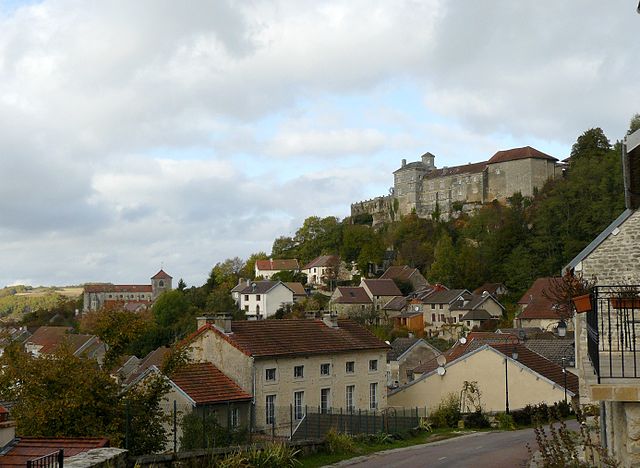
Verrey-sous-Salmaise (Verrey-sous-Salmaise)

- commune in Côte-d'Or, France
- Country:

- Postal Code: 21690
- Coordinates: 47° 26' 19" N, 4° 40' 3" E


- GPS tracks (wikiloc): [Link]
- Area: 8.21 sq km
- Population: 299
- Web site: http://www.verrey-sous-salmaise.fr
- Wikipedia en: wiki(en)
- Wikipedia: wiki(fr)
- Wikidata storage: Wikidata: Q860780
- Wikipedia Commons Category: [Link]
- Freebase ID: [/m/03mfxkm]
- GeoNames ID: Alt: [6428947]
- SIREN number: [212106702]
- BnF ID: [15250957p]
- PACTOLS thesaurus ID: [pcrtgff1PUWHrW]
- TGN ID: [1036072]
- INSEE municipality code: 21670
Shares border with regions:
Charencey
- commune in Côte-d'Or, France
- Country:
- Postal Code: 21690
- Coordinates: 47° 25' 19" N, 4° 40' 18" E
- GPS tracks (wikiloc): [Link]
- Area: 4.84 sq km
- Population: 27

Salmaise
- commune in Côte-d'Or, France
- Country:
- Postal Code: 21690
- Coordinates: 47° 27' 22" N, 4° 39' 47" E
- GPS tracks (wikiloc): [Link]
- Area: 13.12 sq km
- Population: 135
- Web site: [Link]

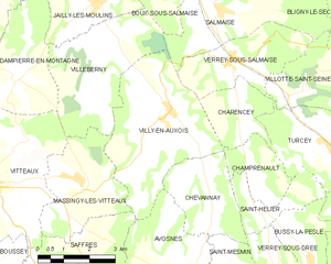
Villy-en-Auxois
- commune in Côte-d'Or, France
- Country:
- Postal Code: 21350
- Coordinates: 47° 25' 13" N, 4° 38' 6" E
- GPS tracks (wikiloc): [Link]
- Area: 16.17 sq km
- Population: 217
- Web site: [Link]


Turcey
- commune in Côte-d'Or, France
- Country:
- Postal Code: 21540
- Coordinates: 47° 24' 22" N, 4° 43' 2" E
- GPS tracks (wikiloc): [Link]
- Area: 12.45 sq km
- Population: 192


Villotte-Saint-Seine
- commune in Côte-d'Or, France
- Country:
- Postal Code: 21690
- Coordinates: 47° 25' 44" N, 4° 42' 21" E
- GPS tracks (wikiloc): [Link]
- Area: 7.59 sq km
- Population: 68