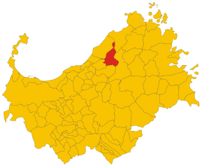
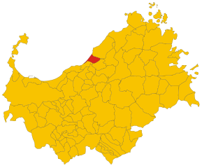
Viddalba (Viddalba)
%20-%202016.svg)
- Italian comune
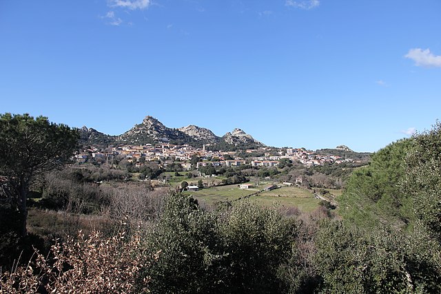
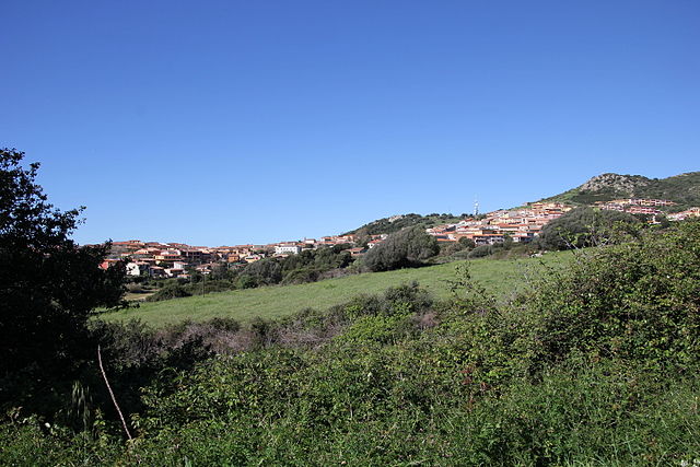
 Hiking in Viddalba
Viddalba, a charming village in the northern part of Sardinia, Italy, is surrounded by beautiful natural landscapes that offer great opportunities for hiking and outdoor activities. The area is characterized by its Mediterranean flora and fauna, along with stunning views of the surrounding mountains and coastline.
Hiking Opportunities in Viddalba:
-
Natural Park of Monti Ferru: This park is not very far from Viddalba and offers several well-marked trails. Hiking here allows you to explore rocky landscapes, verdant forests, and possibly even spot local wildlife.
-
Coastal Trails: The nearby coastline features several scenic trails that provide breathtaking views of the Tyrrhenian Sea. You can enjoy cliffs, sandy beaches, and unique rock formations along the way.
-
Historical Routes: Some trails may lead you to historical landmarks, including ancient ruins and old farmhouses, providing a cultural aspect to your hiking experience.
-
Waterfalls and Rivers: Depending on the trail you choose, you may encounter picturesque waterfalls and clear streams which can be a refreshing sight during your hike.
Tips for Hiking in Viddalba:
- Trail Maps: Ensure you have up-to-date maps or a hiking app to navigate the trails effectively.
- Weather Conditions: Check the weather forecast before your hike, as conditions can change quickly in mountainous areas.
- Stay Hydrated and Nourished: Carry enough water and snacks, especially on longer hikes.
- Footwear: Wear appropriate hiking boots to ensure comfort and safety on uneven terrain.
- Local Guidance: If you’re unfamiliar with the area, consider hiring a local guide or joining a guided group hike to discover hidden gems and learn more about the region.
Access and Accommodation:
Viddalba is accessible by car, and you can find local accommodations ranging from hotels to guesthouses. It can serve as a great base for exploring the surrounding hiking trails.
With its beautiful landscapes, rich biodiversity, and mild Mediterranean climate, hiking in Viddalba can be an unforgettable experience for outdoor enthusiasts. Remember to leave no trace and respect the natural environment during your hikes. Enjoy your adventure!
- Country:

- Postal Code: 07030
- Local Dialing Code: 079
- Licence Plate Code: SS
- Coordinates: 40° 54' 58" N, 8° 53' 41" E


- GPS tracks (wikiloc): [Link]
- AboveSeaLevel: 22 м m
- Area: 50.41 sq km
- Population: 1687
- Web site: http://www.viddalba.gov.it
- Wikipedia en: wiki(en)
- Wikipedia: wiki(it)
- Wikidata storage: Wikidata: Q391735
- Wikipedia Commons Category: [Link]
- Freebase ID: [/m/0gqtx6]
- GeoNames ID: Alt: [6543648]
- OSM relation ID: [40898]
- ISTAT ID: 090082
- Italian cadastre code: M259
Shares border with regions:
Aggius
- Italian comune
Hiking in Aggius
Aggius is a charming town located in the Gallura region of northern Sardinia, Italy. It is known for its beautiful landscapes, ancient culture, and traditional architecture, which makes it an excellent destination for hiking enthusiasts....
- Country:
- Postal Code: 07020
- Local Dialing Code: 079
- Licence Plate Code: SS
- Coordinates: 40° 55' 46" N, 9° 3' 52" E
- GPS tracks (wikiloc): [Link]
- AboveSeaLevel: 514 м m
- Area: 86.31 sq km
- Population: 1482
- Web site: [Link]

Badesi
- Italian comune
Hiking in Badesi
Badesi is a charming village located in the northern part of Sardinia, Italy. It's known for its stunning landscapes, beautiful coastline, and picturesque views of the Mediterranean Sea. Hiking in this region offers a unique opportunity to explore diverse terrains, including coastal paths, hills, and natural reserves....
- Country:
- Postal Code: 07030
- Local Dialing Code: 079
- Licence Plate Code: SS
- Coordinates: 40° 57' 56" N, 8° 53' 1" E
- GPS tracks (wikiloc): [Link]
- AboveSeaLevel: 102 м m
- Area: 31.3 sq km
- Population: 1873
- Web site: [Link]


Bortigiadas
- Italian comune
Hiking in Bortigiadas
Bortigiadas is a small town located in the northern part of Sardinia, Italy. It's surrounded by stunning natural landscapes, including mountains, forests, and the beautiful countryside, making it an excellent destination for hiking enthusiasts. Here are some highlights and tips for hiking in this area:...
- Country:
- Postal Code: 07030
- Local Dialing Code: 079
- Licence Plate Code: SS
- Coordinates: 40° 53' 30" N, 9° 2' 34" E
- GPS tracks (wikiloc): [Link]
- AboveSeaLevel: 476 м m
- Area: 75.9 sq km
- Population: 759
- Web site: [Link]

Trinità d'Agultu e Vignola
- Italian comune
Hiking in Trinità d'Agultu e Vignola
Trinità d'Agultu e Vignola is a charming municipality located in the province of Sassari, in the northern part of Sardinia, Italy. It offers stunning landscapes, diverse terrain, and a variety of hiking opportunities suited for different skill levels. Here are some highlights of hiking in the area:...
- Country:
- Postal Code: 07038
- Local Dialing Code: 079
- Licence Plate Code: SS
- Coordinates: 40° 59' 9" N, 8° 54' 51" E
- GPS tracks (wikiloc): [Link]
- AboveSeaLevel: 365 м m
- Area: 134 sq km
- Population: 2227
- Web site: [Link]


Santa Maria Coghinas
- Italian comune
Hiking in Santa Maria Coghinas
Santa Maria Coghinas is a charming village located in the region of Sardinia, Italy. It’s surrounded by beautiful landscapes, including rolling hills, natural springs, and the Coghinas River, which offer excellent opportunities for hiking and outdoor activities....
- Country:
- Postal Code: 07030
- Local Dialing Code: 079
- Licence Plate Code: SS
- Coordinates: 40° 54' 14" N, 8° 52' 6" E
- GPS tracks (wikiloc): [Link]
- AboveSeaLevel: 21 м m
- Area: 22.97 sq km
- Population: 1391
- Web site: [Link]


Valledoria
- Italian comune
Hiking in Valledoria
Valledoria, located in the northwestern part of Sardinia, Italy, is a hidden gem for hikers and nature enthusiasts. Nestled between the beautiful coastline of the Gulf of Asinara and the rolling hills of the surrounding countryside, it offers a variety of hiking opportunities suitable for different skill levels. Here are some highlights of hiking in Valledoria:...
- Country:
- Postal Code: 07039
- Local Dialing Code: 079
- Licence Plate Code: SS
- Coordinates: 40° 55' 41" N, 8° 49' 29" E
- GPS tracks (wikiloc): [Link]
- AboveSeaLevel: 16 м m
- Area: 25.95 sq km
- Population: 4316
- Web site: [Link]