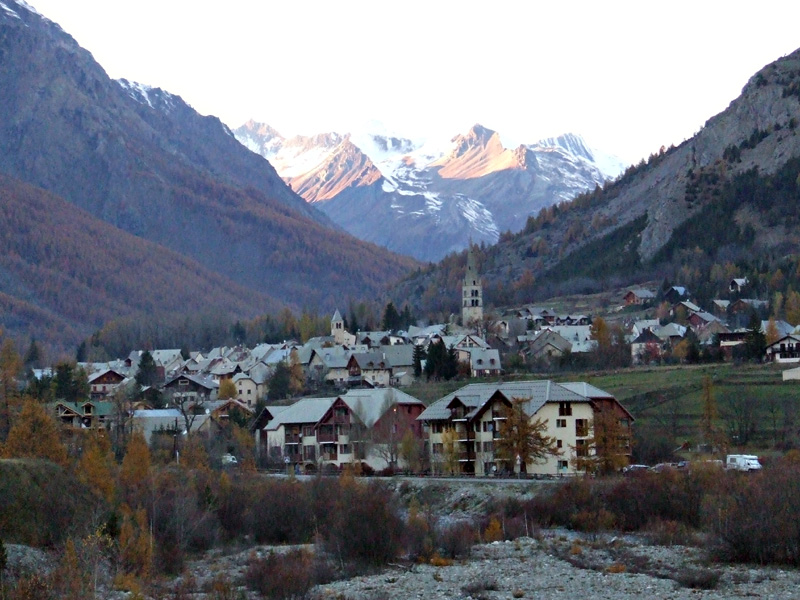
Villar-d'Arêne (Villar-d'Arêne)
- commune in Hautes-Alpes, France
 Hiking in Villar-d'Arêne
Villar-d'Arêne is a charming village located in the Écrins National Park in the French Alps, known for its stunning natural beauty and a variety of hiking opportunities. Here are some key aspects of hiking in this area:
Stunning Scenery
The region boasts dramatic mountain landscapes, including towering peaks, glacial valleys, and picturesque alpine meadows. The scenery is particularly breathtaking in the summer when wildflowers are in full bloom.
Hiking Trails
-
Le Lac de la Muzelle: This hike takes you to the beautiful Lake Muzelle, surrounded by stunning mountain views. The trail is moderate in difficulty and offers a rewarding view at the end.
-
Dôme de la Lauze: A more challenging hike, this trail leads you to the summit of Dôme de la Lauze, where you'll be rewarded with panoramic views of the surrounding peaks and valleys.
-
Col de la Buffe: This hike offers breathtaking views and is relatively accessible. It’s a great option for those who want to experience high-altitude hiking without an extremely strenuous climb.
-
Valley of the Séveraisse: Explore the serene valley dotted with traditional alpine chalets and enjoy the peaceful atmosphere. This area is less crowded and perfect for a more tranquil hiking experience.
Practical Considerations
- Difficulty Levels: Hikes range from easy to challenging, so it’s essential to choose trails that match your fitness level and experience.
- Weather: The weather in the Alps can change rapidly, so always check forecasts and be prepared for varying conditions.
- Equipment: Ensure you have proper hiking gear, including sturdy boots, weather-appropriate clothing, water, and snacks.
- Guided Tours: If you are unfamiliar with the area, consider joining a guided hiking tour for a safe and informative experience.
Wildlife and Flora
While hiking, keep an eye out for the diverse flora and fauna of the region, including ibex, chamois, and various bird species. The lush meadows and pristine forests are also home to a variety of wildflowers and plants.
Conclusion
Hiking in Villar-d'Arêne offers an incredible opportunity to explore the majestic Alps, enjoy the tranquility of nature, and engage in a variety of outdoor activities. Whether you're an experienced hiker or just starting out, the region has something to offer everyone. Remember to respect nature and follow local guidelines to ensure a safe and enjoyable experience. Happy hiking!
- Country:

- Postal Code: 05480
- Coordinates: 45° 2' 34" N, 6° 20' 13" E


- GPS tracks (wikiloc): [Link]
- Area: 77.51 sq km
- Population: 330
- Web site: http://villardarene.free.fr
- Wikipedia en: wiki(en)
- Wikipedia: wiki(fr)
- Wikidata storage: Wikidata: Q1085526
- Wikipedia Commons Category: [Link]
- Freebase ID: [/m/03mfnd9]
- Freebase ID: [/m/03mfnd9]
- GeoNames ID: Alt: [6618128]
- GeoNames ID: Alt: [6618128]
- SIREN number: [210501813]
- SIREN number: [210501813]
- VIAF ID: Alt: [235177115]
- VIAF ID: Alt: [235177115]
- PACTOLS thesaurus ID: [pcrtropPTP1Jlx]
- PACTOLS thesaurus ID: [pcrtropPTP1Jlx]
- WOEID: [22757612]
- WOEID: [22757612]
- INSEE municipality code: 05181
- INSEE municipality code: 05181
Shares border with regions:
Le Monêtier-les-Bains
- commune in Hautes-Alpes, France
Hiking in Le Monêtier-les-Bains
Le Monêtier-les-Bains, located in the Hautes-Alpes region of France, is a stunning destination for hiking enthusiasts. Nestled in the Serre Chevalier Valley, this alpine village offers a variety of trails that cater to all levels of hikers, from beginners to experienced adventurers. Here are some highlights and tips for hiking in Le Monêtier-les-Bains:...
- Country:
- Postal Code: 05220
- Coordinates: 44° 58' 34" N, 6° 30' 31" E
- GPS tracks (wikiloc): [Link]
- Area: 97.87 sq km
- Population: 1024
- Web site: [Link]

Pelvoux
- former commune in Hautes-Alpes, France
Hiking in Pelvoux
Pelvoux is a beautiful region located in the French Alps, specifically in the Ecrins National Park. It's known for its stunning mountain landscapes, varied hiking trails, and breathtaking views. Here are some key points to keep in mind when planning a hiking trip to Pelvoux:...
- Country:
- Postal Code: 05340
- Coordinates: 44° 52' 9" N, 6° 29' 12" E
- GPS tracks (wikiloc): [Link]
- Area: 76.23 sq km
- Population: 483

La Grave
- commune in Hautes-Alpes, France
Hiking in La Grave
La Grave is a stunning area located in the French Alps, known for its breathtaking mountain scenery and varied hiking opportunities. Here are some key points to consider if you're planning a hiking trip in La Grave:...
- Country:
- Postal Code: 05320
- Coordinates: 45° 2' 46" N, 6° 18' 21" E
- GPS tracks (wikiloc): [Link]
- Area: 126.91 sq km
- Population: 487
- Web site: [Link]

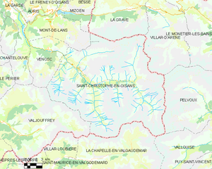
Saint-Christophe-en-Oisans
- commune in Isère, France
Hiking in Saint-Christophe-en-Oisans
Saint-Christophe-en-Oisans is a charming village located in the French Alps, nestled within the Oisans valley. It serves as a gateway to some stunning hiking opportunities in the surrounding terrain, known for its breathtaking scenery, diverse ecosystems, and the proximity to the Écrins National Park....
- Country:
- Postal Code: 38520
- Coordinates: 44° 57' 26" N, 6° 10' 37" E
- GPS tracks (wikiloc): [Link]
- Area: 123.5 sq km
- Population: 105
- Web site: [Link]