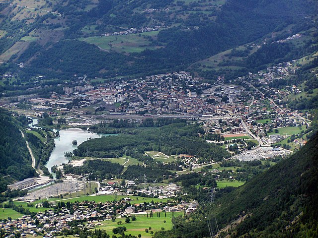
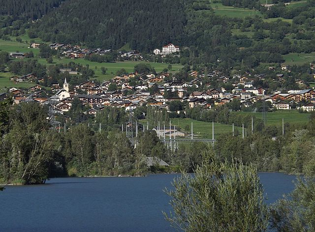
Villaroger (Villaroger)

- commune in Savoie, France
 Hiking in Villaroger
Villaroger is a charming village located in the French Alps, within the Tarentaise Valley in the Savoie region. It offers a range of hiking opportunities, making it an attractive destination for outdoor enthusiasts. Here are some key points to consider when hiking in Villaroger:
1.
- The area boasts a variety of hiking trails suitable for all levels, from gentle walks to more challenging treks. The routes often feature stunning views of the surrounding mountains, valleys, and forests.
- Popular trails include those leading towards the nearby Vanoise National Park, which offers breathtaking alpine scenery and diverse flora and fauna.
2.
- Hiking in Villaroger provides a chance to encounter diverse wildlife, including chamois, ibex, and various bird species. The region is also known for its beautiful alpine flowers, especially during the summer months.
3.
- Many trails can be accessed directly from the village or can be reached by a short drive to trailheads. Well-marked paths are common, but it's essential to have a good map or GPS device.
- Some routes may lead to elevated areas, so be prepared for changes in altitude and conditions.
4.
- The best time for hiking in Villaroger is typically from late spring to early autumn (May to October). In winter, the area is popular for skiing, but snow can impede access to hiking trails.
- Always check trail conditions before heading out, as some paths may close due to weather or maintenance.
5.
- Carry enough water, snacks, and appropriate gear for the conditions. Layered clothing is advisable as mountain weather can change rapidly.
- Inform someone of your plans and estimated return time, especially when hiking alone.
6.
- Villaroger has facilities for hikers, including accommodations, cafes, and information centers where you can gather more information about local trails and conditions.
Whether you're looking for a peaceful day hike or a more strenuous adventure, Villaroger and its surroundings offer great opportunities for exploration in the beautiful French Alps. Enjoy your hike!
- Country:

- Postal Code: 73640
- Coordinates: 45° 35' 28" N, 6° 52' 28" E


- GPS tracks (wikiloc): [Link]
- Area: 28.15 sq km
- Population: 387
- Wikipedia en: wiki(en)
- Wikipedia: wiki(fr)
- Wikidata storage: Wikidata: Q1231171
- Wikipedia Commons Category: [Link]
- Freebase ID: [/m/03qlmrj]
- GeoNames ID: Alt: [6442932]
- SIREN number: [217303239]
- BnF ID: [15274253r]
- INSEE municipality code: 73323
Shares border with regions:

Bourg-Saint-Maurice
- commune in Savoie, France
Hiking in Bourg-Saint-Maurice
Bourg-Saint-Maurice, located in the Savoie region of the French Alps, is a fantastic destination for hikers. It offers stunning alpine scenery, a variety of trails suitable for different skill levels, and access to some of the most beautiful landscapes in the region, including the Vanoise National Park....
- Country:
- Postal Code: 73700
- Coordinates: 45° 37' 0" N, 6° 46' 7" E
- GPS tracks (wikiloc): [Link]
- AboveSeaLevel: 744 м m
- Area: 179.07 sq km
- Population: 7228
- Web site: [Link]


Tignes
- commune in Savoie, France
Hiking in Tignes
Tignes is a beautiful alpine resort located in the French Alps, renowned for both its skiing and summer hiking opportunities. Here are some insights into hiking in Tignes:...
- Country:
- Postal Code: 73320
- Coordinates: 45° 28' 11" N, 6° 54' 34" E
- GPS tracks (wikiloc): [Link]
- Area: 81.63 sq km
- Population: 2569
- Web site: [Link]


Montvalezan
- commune in Savoie, France
Hiking in Montvalezan
Montvalezan, nestled in the Savoie region of the French Alps, offers a stunning backdrop for hiking enthusiasts. This area is particularly known for its proximity to the vast Ski Paradiski area, which includes Les Arcs and La Plagne, but it also boasts fantastic summer hiking opportunities....
- Country:
- Postal Code: 73700
- Coordinates: 45° 36' 43" N, 6° 50' 48" E
- GPS tracks (wikiloc): [Link]
- Area: 25.9 sq km
- Population: 695


Peisey-Nancroix
- commune in Savoie, France
Hiking in Peisey-Nancroix
Peisey-Nancroix is a beautiful alpine village located in the Tarentaise Valley in the Savoie region of the French Alps. It serves as a gateway to some stunning hiking trails, particularly within the Vanoise National Park, which is famous for its diverse landscapes, wildlife, and breathtaking views. Here are some highlights and tips for hiking in the Peisey-Nancroix area:...
- Country:
- Postal Code: 73210
- Coordinates: 45° 32' 47" N, 6° 45' 23" E
- GPS tracks (wikiloc): [Link]
- Area: 70.64 sq km
- Population: 640

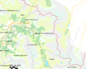
Sainte-Foy-Tarentaise
- commune in Savoie, France
Hiking in Sainte-Foy-Tarentaise
Sainte-Foy-Tarentaise, located in the French Alps, is a fantastic destination for hiking enthusiasts. This region boasts stunning landscapes, diverse trails, and a variety of experiences for hikers of all levels. Here's what you can expect when hiking in Sainte-Foy-Tarentaise:...
- Country:
- Postal Code: 73640
- Coordinates: 45° 35' 21" N, 6° 53' 2" E
- GPS tracks (wikiloc): [Link]
- Area: 100.15 sq km
- Population: 737
- Web site: [Link]

Séez
- commune in Savoie, France
Hiking in Séez
Séez, located in the Auvergne-Rhône-Alpes region of France near the Italian border, is a gateway to some beautiful hiking experiences in the the French Alps. Here’s what you need to know about hiking in and around Séez:...
- Country:
- Postal Code: 73700
- Coordinates: 45° 37' 22" N, 6° 48' 3" E
- GPS tracks (wikiloc): [Link]
- Area: 42.55 sq km
- Population: 2398
- Web site: [Link]