Villastellone (Villastellone)

- Italian comune
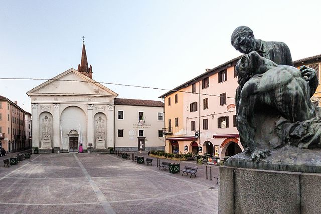
 Hiking in Villastellone
Villastellone is a charming town located in the Piedmont region of Italy, not far from Turin. While it may not be as widely known as other hiking destinations in Italy, the area around Villastellone offers some lovely opportunities for outdoor enthusiasts who enjoy hiking and exploring nature.
Hiking Trails
-
Countryside Paths: The countryside surrounding Villastellone features numerous smaller trails that take you through lush fields, vineyards, and rustic rural scenery. These trails are perfect for leisurely walks and are generally suitable for all fitness levels.
-
Nearby Nature Reserves: A short drive from Villastellone, you can find larger nature reserves and parks, such as the nearby Po River Park (Parco del Po). This park features various trails along the river and through diverse wetland ecosystems, providing great opportunities for bird watching and enjoying the local flora.
-
Mounts and Hills: If you're looking for a more challenging hike, consider exploring the nearby hills and lower mountains of the Monferrato area. These trails can provide stunning views of the valleys and are often dotted with charming villages.
Hiking Tips
-
Best Time to Hike: Spring (April to June) and fall (September to October) are ideal for hiking in this region, as the weather is generally mild and pleasant. Summer can be hot, and winters can have snow in higher elevations.
-
Navigation: While some trails are well-marked, it’s always a good idea to have a reliable map or GPS device. Familiarize yourself with the area before heading out.
-
Local Resources: Check with local tourism offices for maps and information on guided hikes or organized events, as they can be a great way to explore the area.
-
Stay Hydrated: Always bring plenty of water, especially if you're planning a longer hike.
Conclusion
Hiking around Villastellone offers a wonderful way to experience the natural beauty and tranquility of the Piedmont region. Whether you prefer easy strolls through the countryside or more demanding hikes in the hills, you'll find plenty of options to enjoy your outdoor adventure. Always ensure to respect local wildlife and the environment while on your hikes!
- Country:

- Postal Code: 10029
- Local Dialing Code: 011
- Licence Plate Code: TO
- Coordinates: 44° 55' 0" N, 7° 45' 0" E


- GPS tracks (wikiloc): [Link]
- AboveSeaLevel: 234 м m
- Area: 19.88 sq km
- Population: 4688
- Web site: http://www.comune.villastellone.to.it
- Wikipedia en: wiki(en)
- Wikipedia: wiki(it)
- Wikidata storage: Wikidata: Q10360
- Wikipedia Commons Category: [Link]
- Freebase ID: [/m/0g8nfc]
- GeoNames ID: Alt: [6538095]
- VIAF ID: Alt: [147020723]
- OSM relation ID: [43799]
- UN/LOCODE: [ITVSI]
- ISTAT ID: 001308
- Italian cadastre code: M027
Shares border with regions:

Poirino
- Italian comune
Hiking in Poirino
Poirino, located in the Piedmont region of Italy, is surrounded by rolling hills, vineyards, and beautiful landscapes that make it a great destination for hiking. While Poirino itself may not have an extensive network of hiking trails, its proximity to the surrounding areas offers plenty of options for outdoor enthusiasts....
- Country:
- Postal Code: 10046
- Local Dialing Code: 011
- Licence Plate Code: TO
- Coordinates: 44° 55' 0" N, 7° 51' 0" E
- GPS tracks (wikiloc): [Link]
- AboveSeaLevel: 249 м m
- Area: 75.62 sq km
- Population: 10576
- Web site: [Link]


Santena
- Italian comune
Hiking in Santena
Santena is a small town located in the Piedmont region of Italy, near Turin. While it may not be as well-known for hiking as some of the surrounding areas, it is situated near various beautiful landscapes and trails that are ideal for outdoor enthusiasts....
- Country:
- Postal Code: 10026
- Local Dialing Code: 011
- Licence Plate Code: TO
- Coordinates: 44° 57' 0" N, 7° 47' 0" E
- GPS tracks (wikiloc): [Link]
- AboveSeaLevel: 237 м m
- Area: 16.2 sq km
- Population: 10764
- Web site: [Link]


Cambiano
- Italian comune
Hiking in Cambiano
Cambiano is a charming village located in the Piedmont region of Italy, close to the bigger city of Turin. While it may not be as well-known for hiking as some other areas in the region, it offers access to beautiful trails and scenic landscapes, especially with its proximity to the hills surrounding the Po Valley and the nearby mountains....
- Country:
- Postal Code: 10020
- Local Dialing Code: 011
- Licence Plate Code: TO
- Coordinates: 44° 58' 16" N, 7° 46' 28" E
- GPS tracks (wikiloc): [Link]
- Area: 14.13 sq km
- Population: 6027
- Web site: [Link]

Carignano
- Italian comune
Hiking in Carignano
Carignano, a charming town located in the Piedmont region of Italy, offers a variety of hiking opportunities that showcase its beautiful landscapes and rich history. Here are some highlights for hiking enthusiasts looking to explore the area:...
- Country:
- Postal Code: 10041
- Local Dialing Code: 011
- Licence Plate Code: TO
- Coordinates: 44° 54' 21" N, 7° 40' 21" E
- GPS tracks (wikiloc): [Link]
- Area: 50.68 sq km
- Population: 9334
- Web site: [Link]

Carmagnola
- Italian comune
Hiking in Carmagnola
Carmagnola is a charming town located in the Piedmont region of Italy, known for its agricultural background and beautiful landscapes. Although it may not be the first destination that comes to mind for hiking, there are several outdoor opportunities in and around the area....
- Country:
- Postal Code: 10022
- Local Dialing Code: 011
- Licence Plate Code: TO
- Coordinates: 44° 51' 0" N, 7° 43' 0" E
- GPS tracks (wikiloc): [Link]
- AboveSeaLevel: 240 м m
- Area: 95.72 sq km
- Population: 28976
- Web site: [Link]


Moncalieri
- Italian comune
Hiking in Moncalieri
Moncalieri, located just south of Turin in the Piedmont region of Italy, offers a variety of hiking opportunities that cater to different skill levels and interests. Here are some highlights about hiking in and around Moncalieri:...
- Country:
- Postal Code: 10024
- Local Dialing Code: 011
- Licence Plate Code: TO
- Coordinates: 45° 0' 0" N, 7° 41' 0" E
- GPS tracks (wikiloc): [Link]
- AboveSeaLevel: 260 м m
- Area: 47.53 sq km
- Population: 57530
- Web site: [Link]