Ville-sous-la-Ferté (Ville-sous-la-Ferté)

- commune in Aube, France
- Country:

- Postal Code: 10310
- Coordinates: 48° 7' 16" N, 4° 47' 24" E


- GPS tracks (wikiloc): [Link]
- Area: 19.77 sq km
- Population: 1077
- Web site: http://www.ville-sous-la-ferte.barsuraube.org
- Wikipedia en: wiki(en)
- Wikipedia: wiki(fr)
- Wikidata storage: Wikidata: Q1438807
- Wikipedia Commons Category: [Link]
- Freebase ID: [/m/02qyh5h]
- GeoNames ID: Alt: [6426620]
- SIREN number: [211003983]
- BnF ID: [15246518x]
- PACTOLS thesaurus ID: [pcrtNl274bPYd4]
- INSEE municipality code: 10426
Shares border with regions:


Arconville
- commune in Aube, France
- Country:
- Postal Code: 10200
- Coordinates: 48° 9' 46" N, 4° 43' 21" E
- GPS tracks (wikiloc): [Link]
- Area: 15 sq km
- Population: 109


Juvancourt
- commune in Aube, France
- Country:
- Postal Code: 10310
- Coordinates: 48° 6' 53" N, 4° 47' 56" E
- GPS tracks (wikiloc): [Link]
- Area: 8.29 sq km
- Population: 120

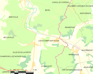
Longchamp-sur-Aujon
- commune in Aube, France
- Country:
- Postal Code: 10310
- Coordinates: 48° 9' 0" N, 4° 49' 52" E
- GPS tracks (wikiloc): [Link]
- Area: 16.39 sq km
- Population: 426


Baroville
- commune in Aube, France
- Country:
- Postal Code: 10200
- Coordinates: 48° 11' 32" N, 4° 43' 16" E
- GPS tracks (wikiloc): [Link]
- AboveSeaLevel: 219 м m
- Area: 17.32 sq km
- Population: 320

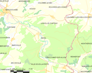
Bayel
- commune in Aube, France
- Country:
- Postal Code: 10310
- Coordinates: 48° 11' 56" N, 4° 46' 31" E
- GPS tracks (wikiloc): [Link]
- Area: 23 sq km
- Population: 772


Laferté-sur-Aube
- commune in Haute-Marne, France
- Country:
- Postal Code: 52120
- Coordinates: 48° 5' 51" N, 4° 46' 57" E
- GPS tracks (wikiloc): [Link]
- Area: 32.54 sq km
- Population: 341


Champignol-lez-Mondeville
- commune in Aube, France
- Country:
- Postal Code: 10200
- Coordinates: 48° 8' 18" N, 4° 40' 29" E
- GPS tracks (wikiloc): [Link]
- Area: 44.17 sq km
- Population: 306