Villecien (Villecien)

- commune in Yonne, France
- Country:

- Postal Code: 89300
- Coordinates: 48° 0' 26" N, 3° 19' 46" E


- GPS tracks (wikiloc): [Link]
- Area: 7.6 sq km
- Population: 390
- Wikipedia en: wiki(en)
- Wikipedia: wiki(fr)
- Wikidata storage: Wikidata: Q223198
- Wikipedia Commons Category: [Link]
- Freebase ID: [/m/03qfl6l]
- Freebase ID: [/m/03qfl6l]
- GeoNames ID: Alt: [6446072]
- GeoNames ID: Alt: [6446072]
- SIREN number: [218904522]
- SIREN number: [218904522]
- BnF ID: [152799082]
- BnF ID: [152799082]
- VIAF ID: Alt: [235629799]
- VIAF ID: Alt: [235629799]
- INSEE municipality code: 89452
- INSEE municipality code: 89452
Shares border with regions:


Cézy
- commune in Yonne, France
- Country:
- Postal Code: 89410
- Coordinates: 47° 59' 32" N, 3° 20' 26" E
- GPS tracks (wikiloc): [Link]
- Area: 16.02 sq km
- Population: 1118

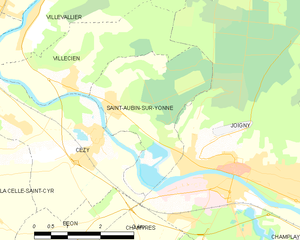
Saint-Aubin-sur-Yonne
- commune in Yonne, France
- Country:
- Postal Code: 89300
- Coordinates: 48° 0' 4" N, 3° 20' 45" E
- GPS tracks (wikiloc): [Link]
- Area: 8.87 sq km
- Population: 419


Villevallier
- commune in Yonne, France
- Country:
- Postal Code: 89330
- Coordinates: 48° 1' 29" N, 3° 18' 50" E
- GPS tracks (wikiloc): [Link]
- Area: 8.37 sq km
- Population: 423
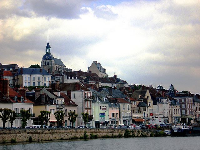
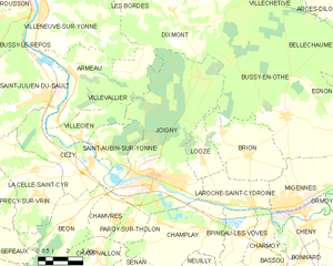
Joigny
- commune in Yonne, France
- Country:
- Postal Code: 89300
- Coordinates: 47° 58' 56" N, 3° 23' 50" E
- GPS tracks (wikiloc): [Link]
- AboveSeaLevel: 96 м m
- Area: 46.67 sq km
- Population: 9580
- Web site: [Link]