Villeneuve-lès-Béziers (Villeneuve-lès-Béziers)

- commune in Hérault, France
- Country:

- Postal Code: 34420
- Coordinates: 43° 18' 53" N, 3° 16' 49" E


- GPS tracks (wikiloc): [Link]
- Area: 17.31 sq km
- Population: 4266
- Web site: http://www.villeneuve-les-beziers.fr/
- Wikipedia en: wiki(en)
- Wikipedia: wiki(fr)
- Wikidata storage: Wikidata: Q1322772
- Wikipedia Commons Gallery: [Link]
- Wikipedia Commons Category: [Link]
- Freebase ID: [/m/03nv800]
- Freebase ID: [/m/03nv800]
- GeoNames ID: Alt: [6432687]
- GeoNames ID: Alt: [6432687]
- SIREN number: [213403363]
- SIREN number: [213403363]
- BnF ID: [152569365]
- BnF ID: [152569365]
- VIAF ID: Alt: [136196033]
- VIAF ID: Alt: [136196033]
- Library of Congress authority ID: Alt: [n94019988]
- Library of Congress authority ID: Alt: [n94019988]
- PACTOLS thesaurus ID: [pcrtnoHsS0GJY8]
- PACTOLS thesaurus ID: [pcrtnoHsS0GJY8]
- INSEE municipality code: 34336
- INSEE municipality code: 34336
Shares border with regions:


Sauvian
- commune in Hérault, France
- Country:
- Postal Code: 34410
- Coordinates: 43° 17' 31" N, 3° 15' 38" E
- GPS tracks (wikiloc): [Link]
- Area: 13.07 sq km
- Population: 5156
- Web site: [Link]
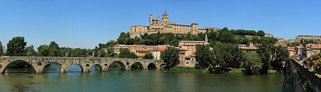

Béziers
- commune in Hérault, France
- Country:
- Postal Code: 34500
- Coordinates: 43° 20' 36" N, 3° 12' 58" E
- GPS tracks (wikiloc): [Link]
- AboveSeaLevel: 17 м m
- Area: 95.48 sq km
- Population: 77393
- Web site: [Link]


Sérignan
- commune in Hérault, France
- Country:
- Postal Code: 34410
- Coordinates: 43° 16' 48" N, 3° 16' 39" E
- GPS tracks (wikiloc): [Link]
- Area: 27.45 sq km
- Population: 6974
- Web site: [Link]


Portiragnes
- commune in Hérault, France
- Country:
- Postal Code: 34420
- Coordinates: 43° 18' 16" N, 3° 20' 9" E
- GPS tracks (wikiloc): [Link]
- Area: 20.16 sq km
- Population: 3185


Cers
- commune in Hérault, France
- Country:
- Postal Code: 34420
- Coordinates: 43° 19' 23" N, 3° 18' 17" E
- GPS tracks (wikiloc): [Link]
- Area: 7.85 sq km
- Population: 2357
- Web site: [Link]