Villeneuve-sur-Lot (Villeneuve-sur-Lot)

- commune in Lot-et-Garonne, France
- Country:

- Postal Code: 47300
- Coordinates: 44° 24' 25" N, 0° 42' 15" E


- GPS tracks (wikiloc): [Link]
- AboveSeaLevel: 55 м m
- Area: 81.32 sq km
- Population: 22686
- Web site: http://www.ville-villeneuve-sur-lot.fr
- Wikipedia en: wiki(en)
- Wikipedia: wiki(fr)
- Wikidata storage: Wikidata: Q205638
- Wikipedia Commons Category: [Link]
- Freebase ID: [/m/08sg99]
- Freebase ID: [/m/08sg99]
- Freebase ID: [/m/08sg99]
- GeoNames ID: Alt: [2968515]
- GeoNames ID: Alt: [2968515]
- GeoNames ID: Alt: [2968515]
- SIREN number: [214703233]
- SIREN number: [214703233]
- SIREN number: [214703233]
- BnF ID: [15261402g]
- BnF ID: [15261402g]
- BnF ID: [15261402g]
- VIAF ID: Alt: [152508085]
- VIAF ID: Alt: [152508085]
- VIAF ID: Alt: [152508085]
- GND ID: Alt: [4362671-3]
- GND ID: Alt: [4362671-3]
- GND ID: Alt: [4362671-3]
- Library of Congress authority ID: Alt: [n85117767]
- Library of Congress authority ID: Alt: [n85117767]
- Library of Congress authority ID: Alt: [n85117767]
- PACTOLS thesaurus ID: [pcrtF3W6iDaJve]
- PACTOLS thesaurus ID: [pcrtF3W6iDaJve]
- PACTOLS thesaurus ID: [pcrtF3W6iDaJve]
- MusicBrainz area ID: [29eb56af-6c9f-4e33-9ae8-7191b67eae6e]
- MusicBrainz area ID: [29eb56af-6c9f-4e33-9ae8-7191b67eae6e]
- MusicBrainz area ID: [29eb56af-6c9f-4e33-9ae8-7191b67eae6e]
- WOEID: [12649326]
- WOEID: [12649326]
- WOEID: [12649326]
- Quora topic ID: [Villeneuve-sur-Lot]
- Quora topic ID: [Villeneuve-sur-Lot]
- Quora topic ID: [Villeneuve-sur-Lot]
- SUDOC authorities ID: [026597012]
- SUDOC authorities ID: [026597012]
- SUDOC authorities ID: [026597012]
- INSEE municipality code: 47323
- INSEE municipality code: 47323
- INSEE municipality code: 47323
Shares border with regions:


Trentels
- commune in Lot-et-Garonne, France
- Country:
- Postal Code: 47140
- Coordinates: 44° 26' 8" N, 0° 51' 46" E
- GPS tracks (wikiloc): [Link]
- Area: 19.47 sq km
- Population: 832
Lédat
- commune in Lot-et-Garonne, France
- Country:
- Postal Code: 47300
- Coordinates: 44° 27' 15" N, 0° 40' 4" E
- GPS tracks (wikiloc): [Link]
- AboveSeaLevel: 86 м m
- Area: 12.43 sq km
- Population: 1383

Savignac-sur-Leyze
- commune in Lot-et-Garonne, France
- Country:
- Postal Code: 47150
- Coordinates: 44° 28' 49" N, 0° 47' 26" E
- GPS tracks (wikiloc): [Link]
- Area: 11.38 sq km
- Population: 318


Penne-d'Agenais
- commune in Lot-et-Garonne, France
- Country:
- Postal Code: 47140
- Coordinates: 44° 23' 19" N, 0° 49' 8" E
- GPS tracks (wikiloc): [Link]
- Area: 46.71 sq km
- Population: 2347
- Web site: [Link]


Hautefage-la-Tour
- commune in Lot-et-Garonne, France
- Country:
- Postal Code: 47340
- Coordinates: 44° 19' 19" N, 0° 47' 4" E
- GPS tracks (wikiloc): [Link]
- Area: 20.75 sq km
- Population: 928
- Web site: [Link]


La Sauvetat-sur-Lède
- commune in Lot-et-Garonne, France
- Country:
- Postal Code: 47150
- Coordinates: 44° 28' 9" N, 0° 43' 48" E
- GPS tracks (wikiloc): [Link]
- Area: 14.14 sq km
- Population: 665

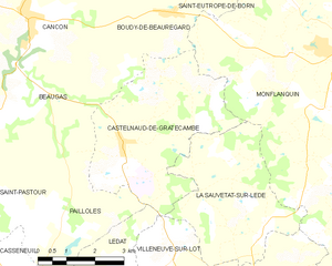
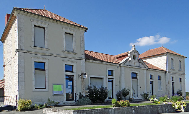
Castelnaud-de-Gratecambe
- commune in Lot-et-Garonne, France
- Country:
- Postal Code: 47290
- Coordinates: 44° 29' 50" N, 0° 40' 6" E
- GPS tracks (wikiloc): [Link]
- Area: 17.23 sq km
- Population: 489

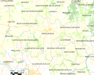
Monflanquin
- commune in Lot-et-Garonne, France
- Country:
- Postal Code: 47150
- Coordinates: 44° 31' 55" N, 0° 46' 4" E
- GPS tracks (wikiloc): [Link]
- Area: 62.21 sq km
- Population: 2315
- Web site: [Link]

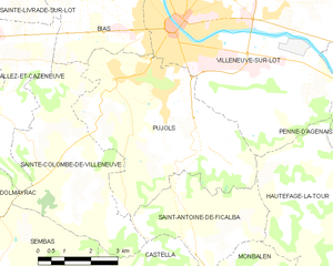
Pujols
- commune in Lot-et-Garonne, France
- Country:
- Postal Code: 47300
- Coordinates: 44° 23' 8" N, 0° 41' 18" E
- GPS tracks (wikiloc): [Link]
- Area: 24.98 sq km
- Population: 3623
- Web site: [Link]


Saint-Sylvestre-sur-Lot
- commune in Lot-et-Garonne, France
- Country:
- Postal Code: 47140
- Coordinates: 44° 23' 55" N, 0° 48' 22" E
- GPS tracks (wikiloc): [Link]
- Area: 21.27 sq km
- Population: 2286
- Web site: [Link]

Saint-Aubin
- commune in Lot-et-Garonne, France
- Country:
- Postal Code: 47150
- Coordinates: 44° 28' 34" N, 0° 51' 9" E
- GPS tracks (wikiloc): [Link]
- AboveSeaLevel: 144 м m
- Area: 18.51 sq km
- Population: 441

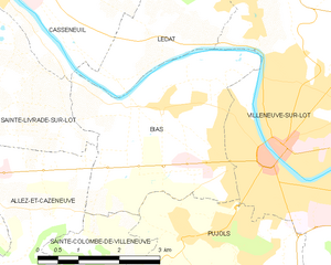
Bias
- commune in Lot-et-Garonne, France
- Country:
- Postal Code: 47300
- Coordinates: 44° 24' 58" N, 0° 40' 9" E
- GPS tracks (wikiloc): [Link]
- Area: 12.29 sq km
- Population: 3062
- Web site: [Link]