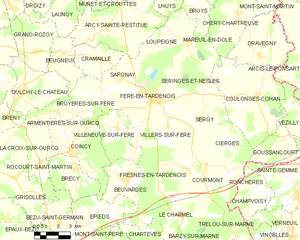
Villers-sur-Fère (Villers-sur-Fère)
- commune in Aisne, France
- Country:

- Postal Code: 02130
- Coordinates: 49° 10' 54" N, 3° 32' 1" E


- GPS tracks (wikiloc): [Link]
- Area: 10.79 sq km
- Population: 521
- Wikipedia en: wiki(en)
- Wikipedia: wiki(fr)
- Wikidata storage: Wikidata: Q868168
- Wikipedia Commons Category: [Link]
- Freebase ID: [/m/03m7rm5]
- Freebase ID: [/m/03m7rm5]
- GeoNames ID: Alt: [6425326]
- GeoNames ID: Alt: [6425326]
- SIREN number: [210207890]
- SIREN number: [210207890]
- INSEE municipality code: 02816
- INSEE municipality code: 02816
Shares border with regions:

Fère-en-Tardenois
- commune in Aisne, France
- Country:
- Coordinates: 49° 11' 58" N, 3° 31' 3" E
- GPS tracks (wikiloc): [Link]
- Area: 20.4 sq km
- Population: 3143
- Web site: [Link]

Seringes-et-Nesles
- commune in Aisne, France
- Country:
- Postal Code: 02130
- Coordinates: 49° 12' 19" N, 3° 32' 27" E
- GPS tracks (wikiloc): [Link]
- Area: 13.49 sq km
- Population: 283

Sergy
- commune in Aisne, France
- Country:
- Postal Code: 02130
- Coordinates: 49° 10' 57" N, 3° 34' 12" E
- GPS tracks (wikiloc): [Link]
- Area: 13.32 sq km
- Population: 157

Fresnes-en-Tardenois
- commune in Aisne, France
- Country:
- Postal Code: 02130
- Coordinates: 49° 8' 45" N, 3° 33' 21" E
- GPS tracks (wikiloc): [Link]
- Area: 8.84 sq km
- Population: 267